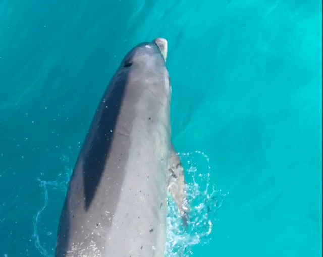
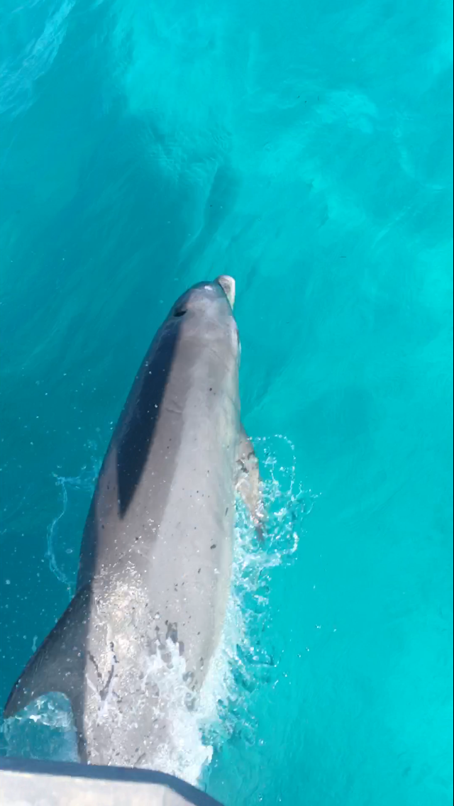
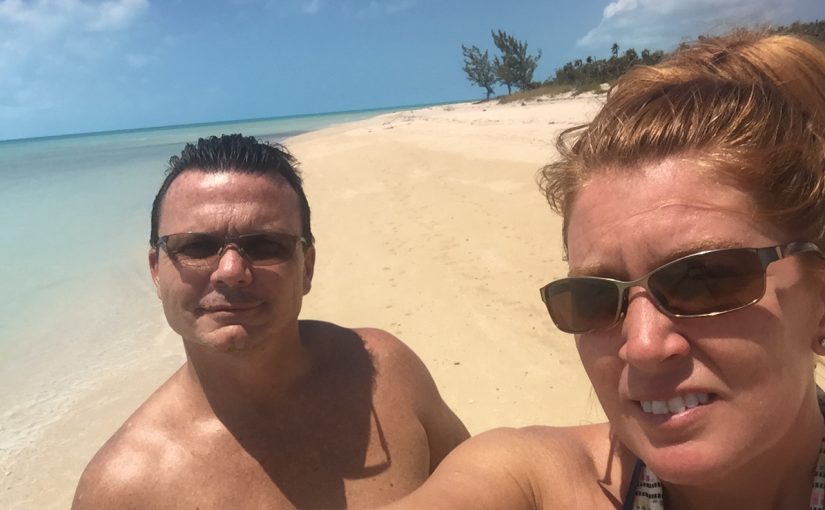
I started this post in the Bahamas and just realized I never finished it……I had intended to make a folder of dolphin pics but this seems to be the only one I saved…..
Here’s a Dolphin in our bow wake as we were leaving Bimini……he’s so close that the shadow of our anchor in on his back…..
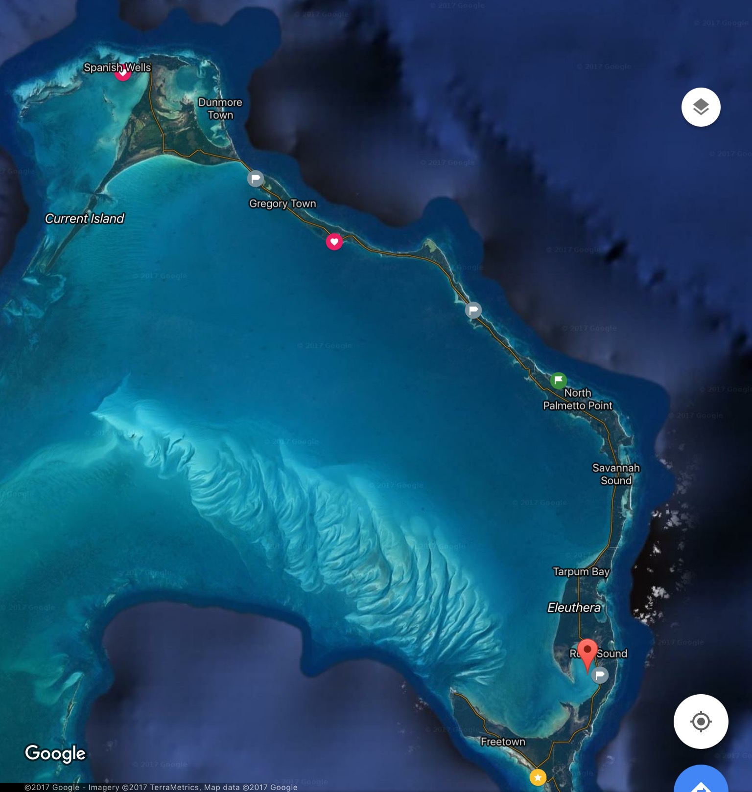
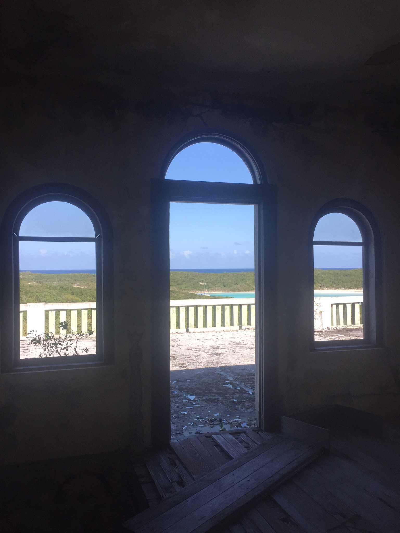
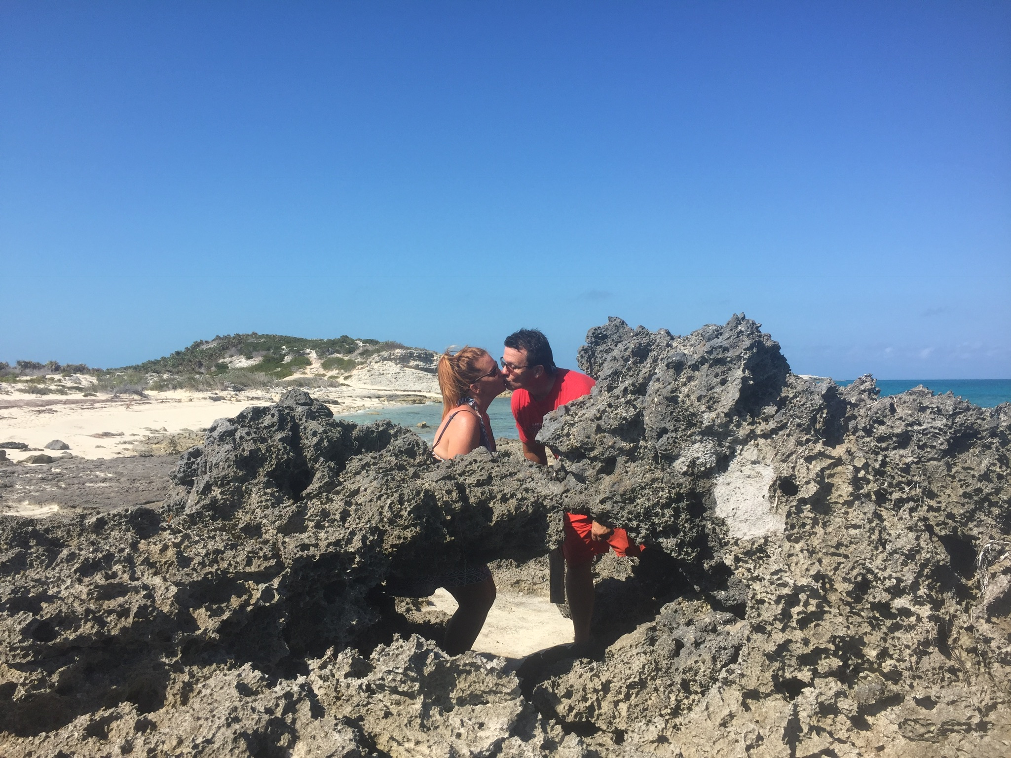
After our harrowing experience at Little San Salvador we made our way to Rock Sound, Eleuthera later that day and anchored for a few weeks….it ended up being longer then anticipated due to some clumsiness on my part.
I had decided that we were due for an oil change. We were way under on engine hours but over on the time frame for an oil change, so I decided to change the oil and filter while we were here. Well, long story short, I pumped out the used oil, without spilling a drop (which I should have known was a bad sign) but couldn’t find my slimline strap wrench to remove the filter. So, I went to the local NAPA and bought a slightly larger wrench that I hoped would work. Unfortunately, the width of the new wrench snagged the oil cooler line and ruptured it….uh-oh…..bad weather was forecast for the upcoming weekend and after the Little San Salvador incident this was almost too much to deal with….essentially we were going to be without an engine until we received a new line….which in the Bahamas could take weeks……and it did…..we spent about three and a half weeks total and it turned out to be a good thing because we had time to see things and visit our favorite spots again and again.
Part of the moral to this story is ….take plenty of spare parts when you venture away from the U.S. We have a cruiser’s kit onboard but it doesn’t include oil cooler lines. I won’t make that mistake again……
here’s a satellite image of Eleuthera. The pin is Rock Sound. The Glass Window Bridge is in the skinny part of the island just north of Gregory Town.
Image courtesy of Google Maps
We considered renting a car, but ran into the insurance issue again, so we hired a driver (Lyle) to give us a tour of the island. He was a super nice guy and was full of knowledge about spots on the island. The price wasn’t bad, eight hours for $125 plus he knew a great place for lunch.
The Glass Window bridge is in northern Eleuthera and is one of the few places you can see the Atlantic and the banks side of the ocean at the same time. It’s more impressive when the weather is unsettled but still pretty cool.
The east side of the “glass window bridge” on the east side of Eleuthera see the video on my Facebook page….
the west side of the Glass Window….
Me at the cliffs….east side of northern Eleuthera
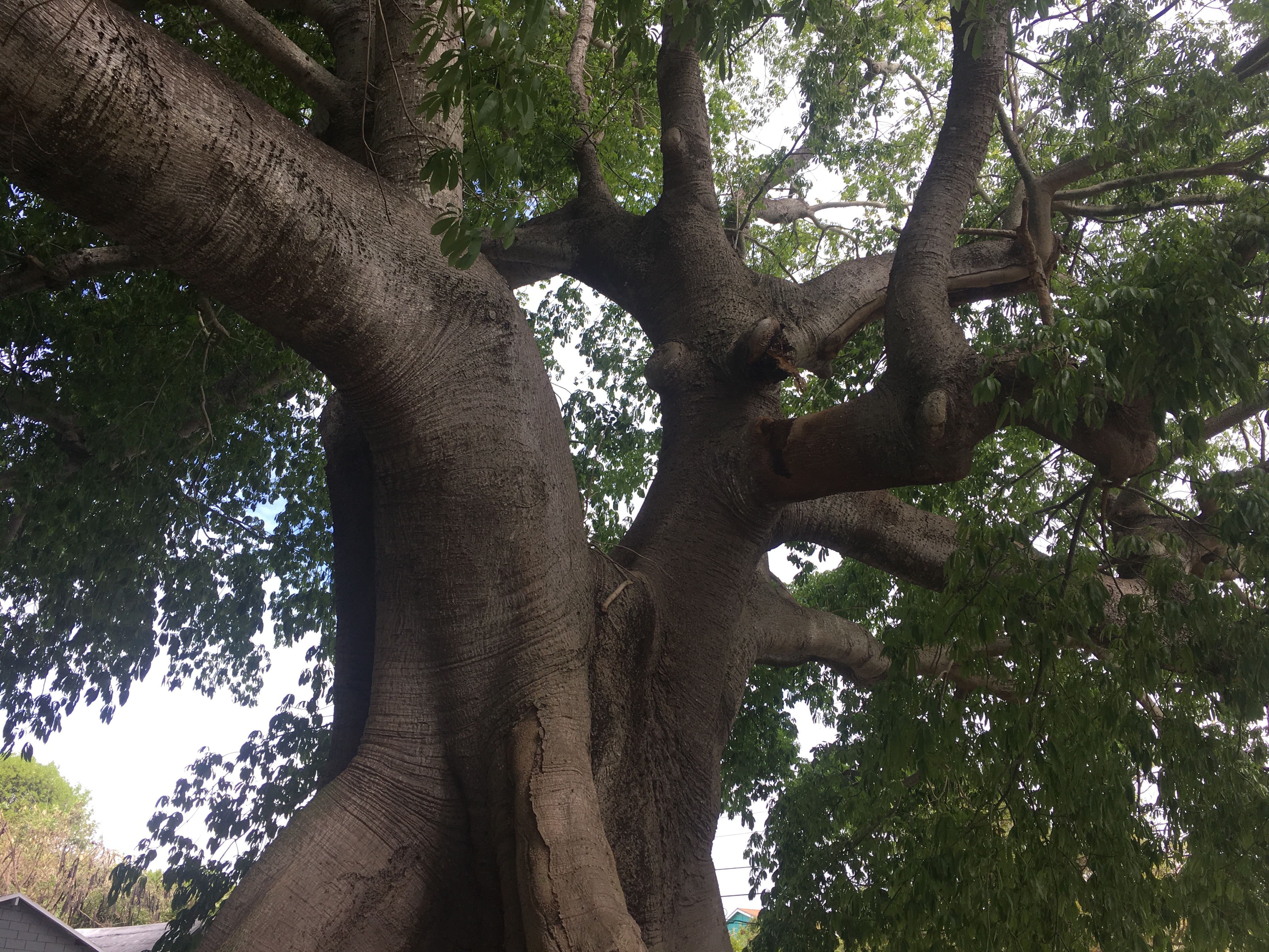
Long view of the Cotton(Ceiba) Silk Tree
A Cotton Silk or Ceiba tree
Cotton Silk Tree…upview
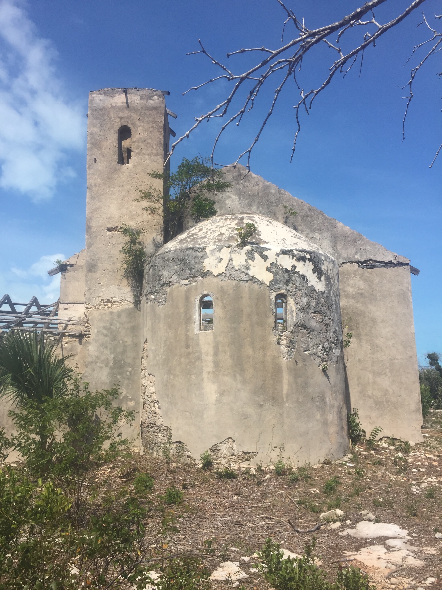
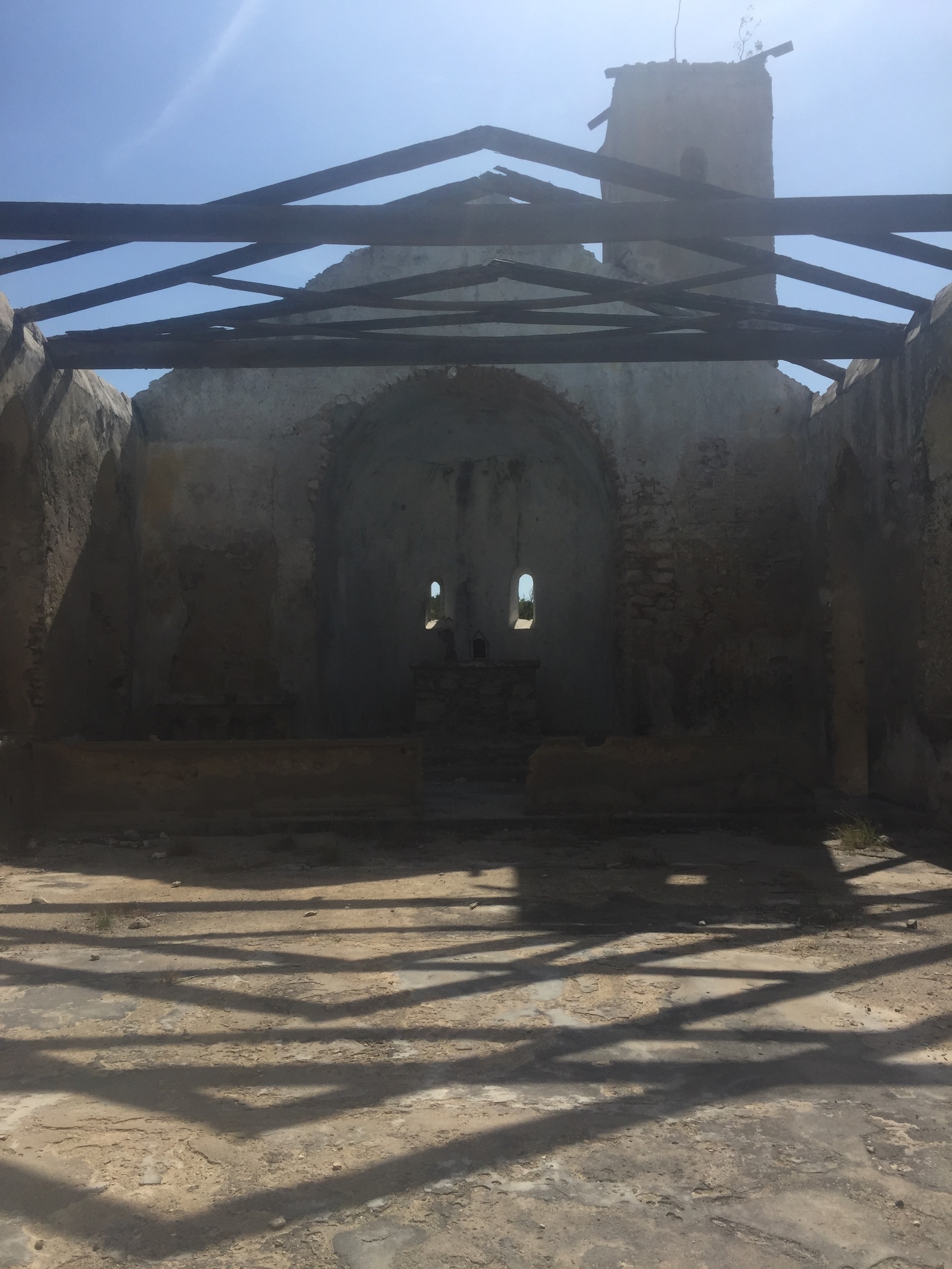
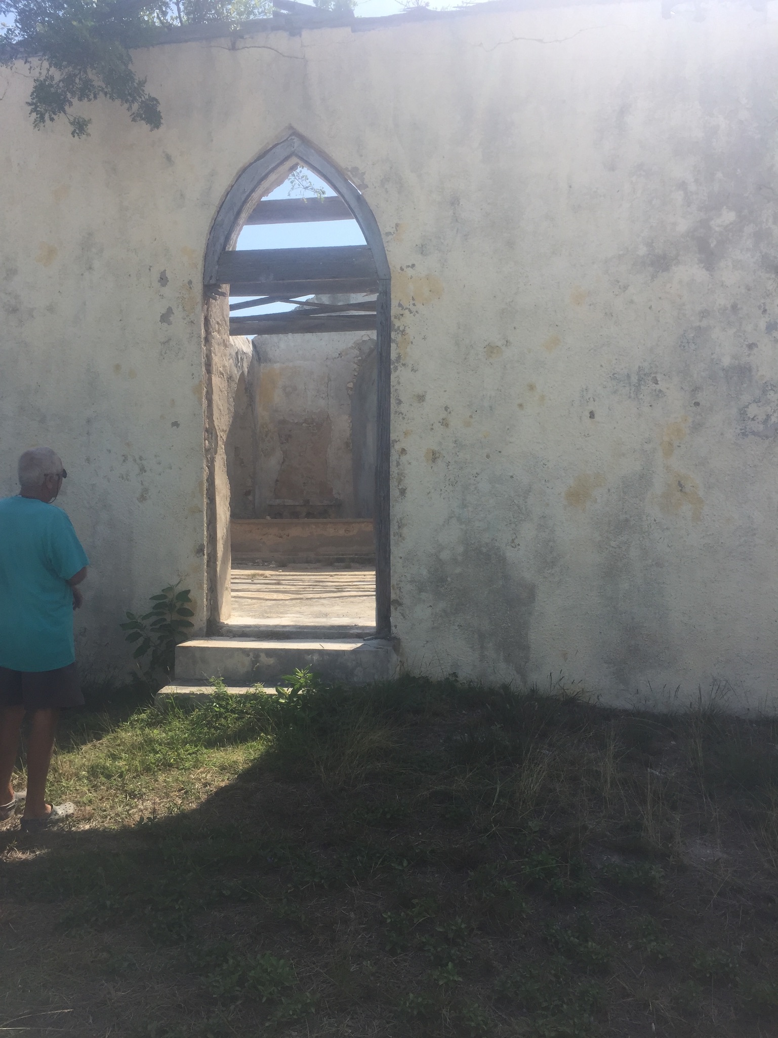
Beautiful beachfront church in Rock Sound
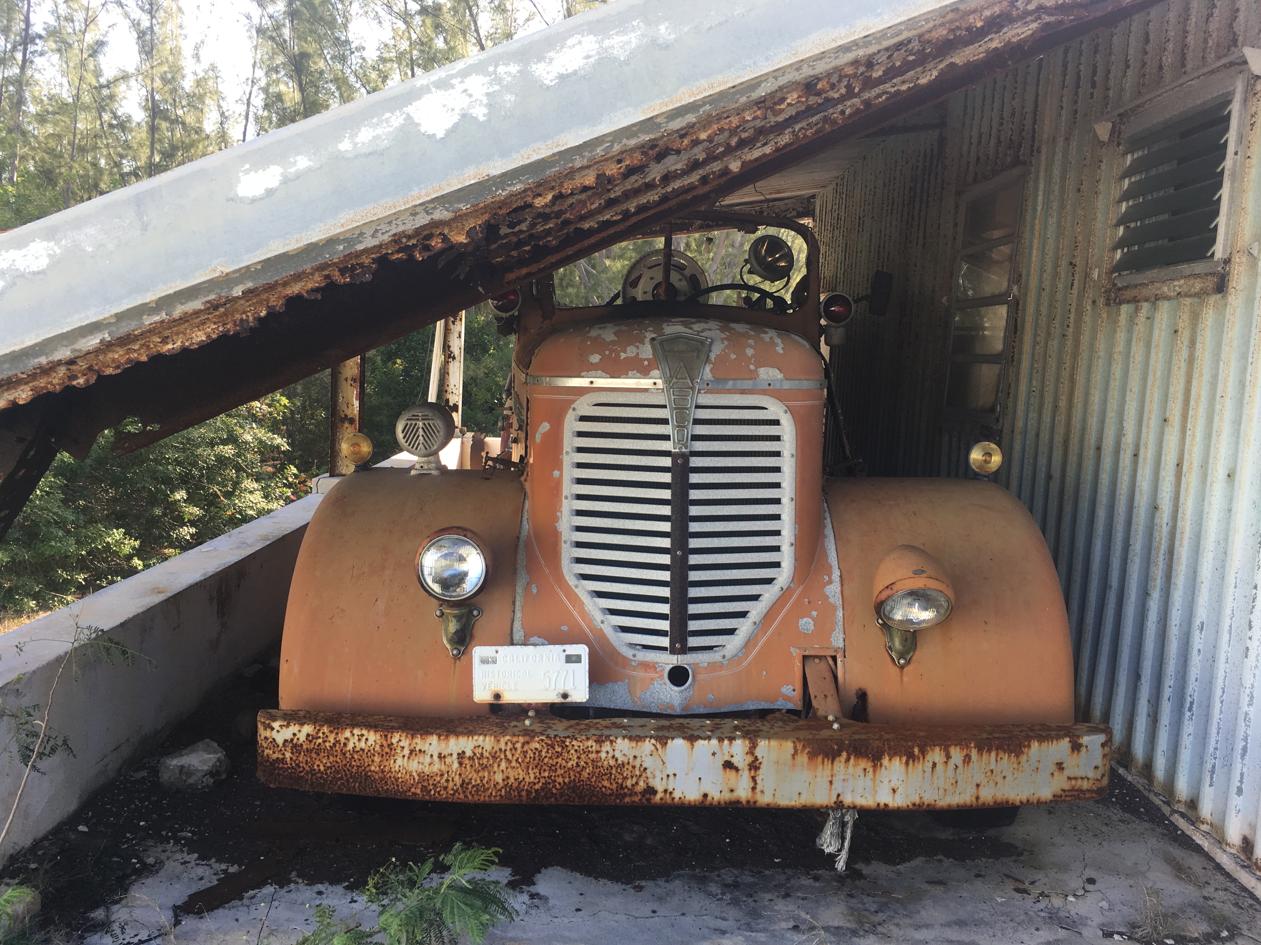
An abandoned 1950’s fire truck stored behind a Kalik beer warehouse….
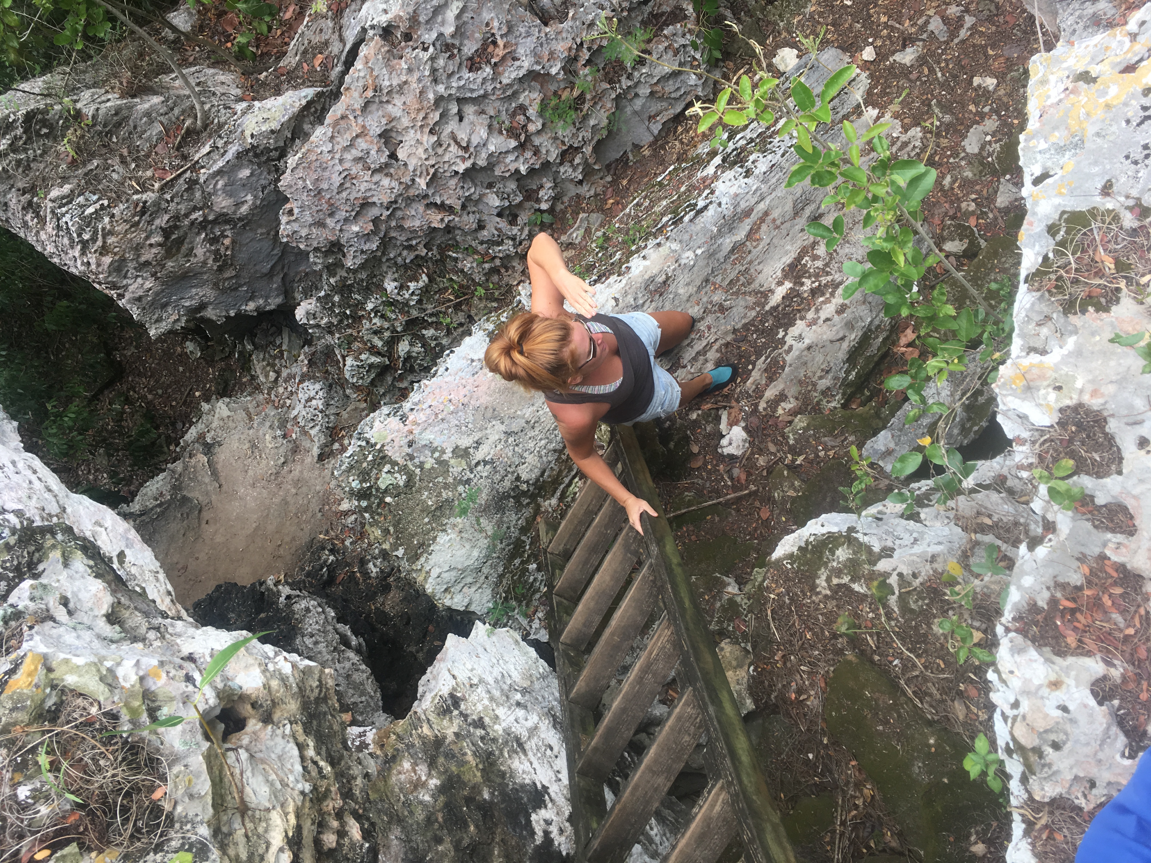
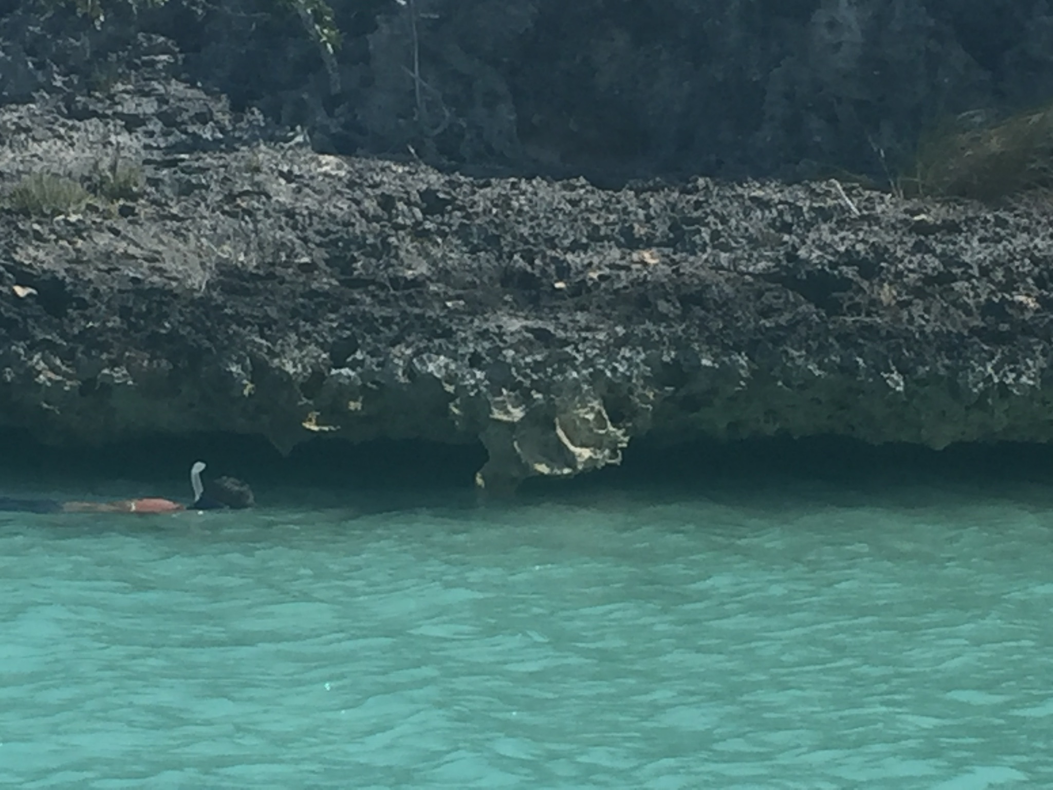
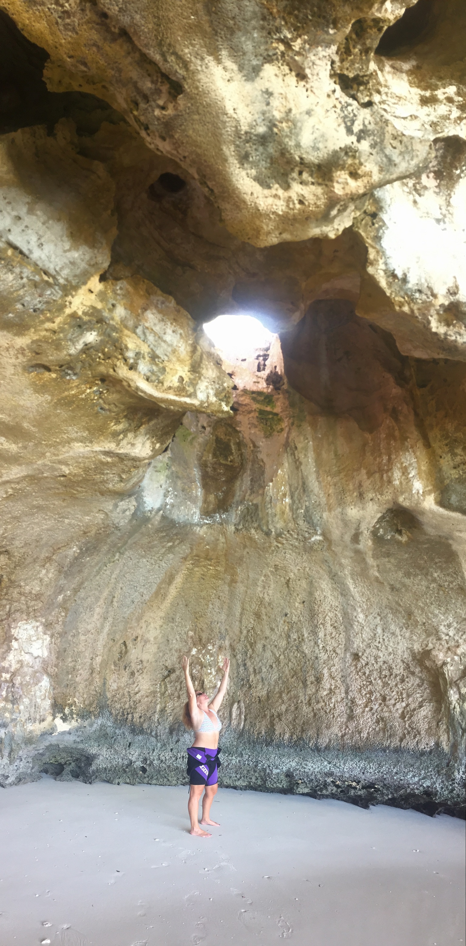
In the spider cave….Kim doesn’t look worried at all….
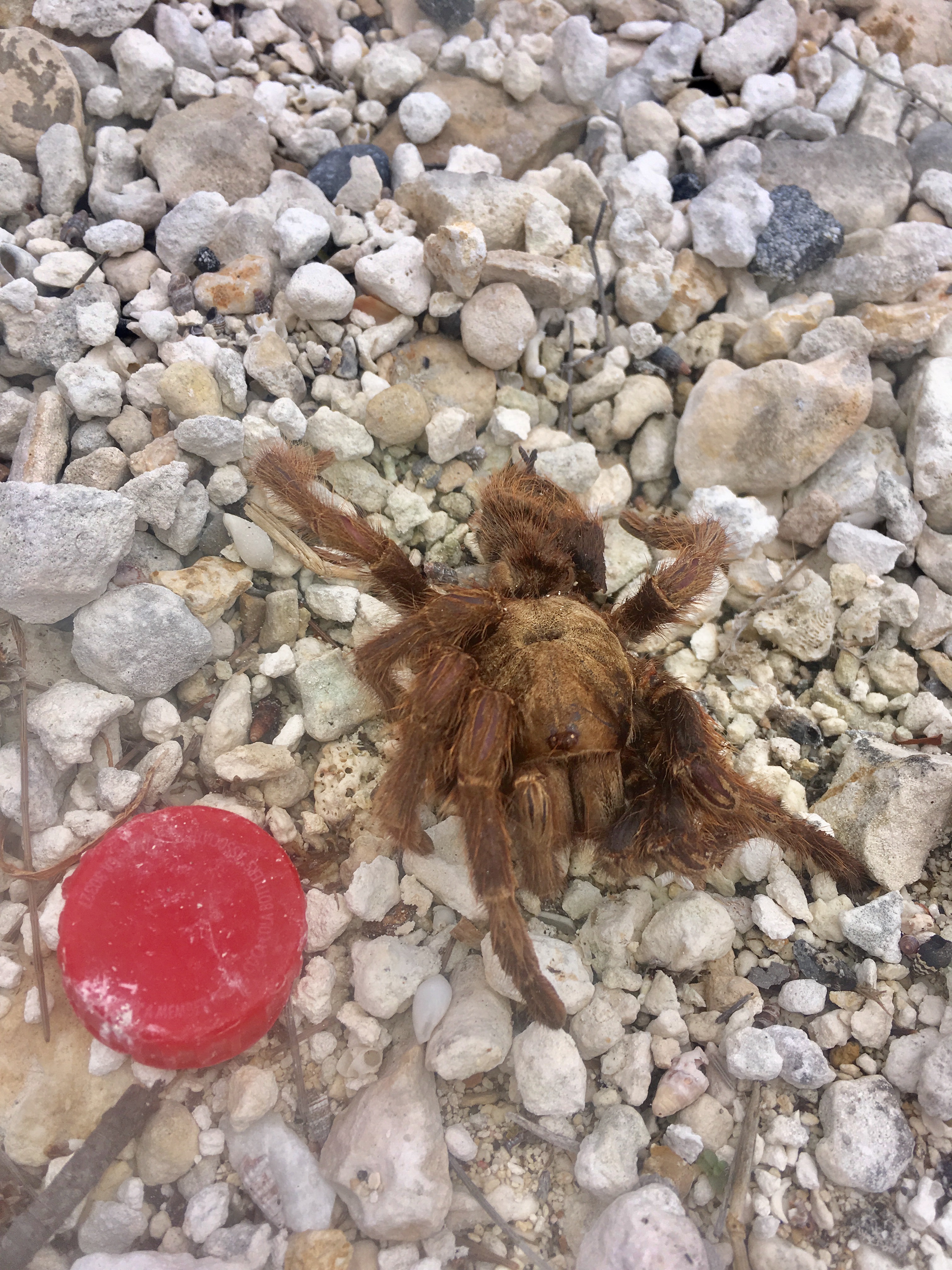
We found this little guy dead on the side of the road….that’s about a 2″ Gatorade lid for scale…..maybe he was hit by a car…..I wonder how badly the car was damaged?
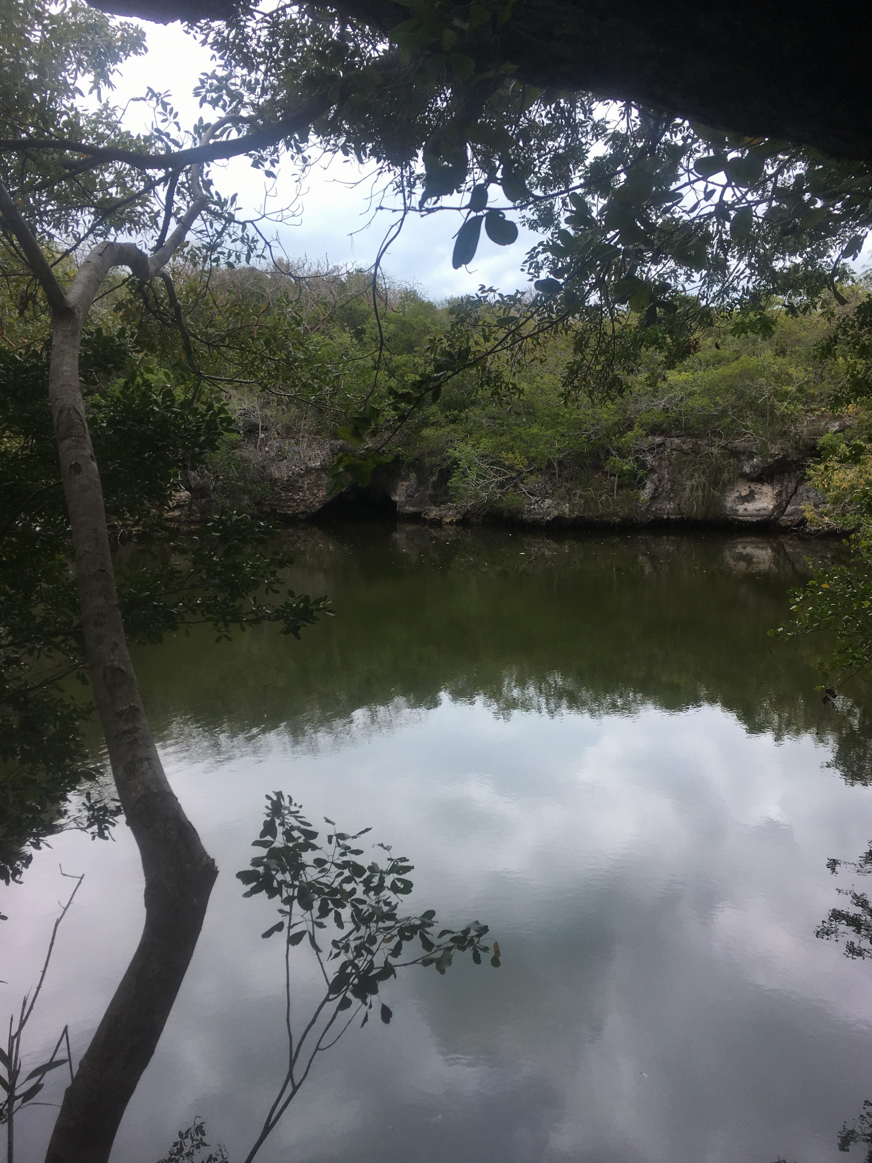
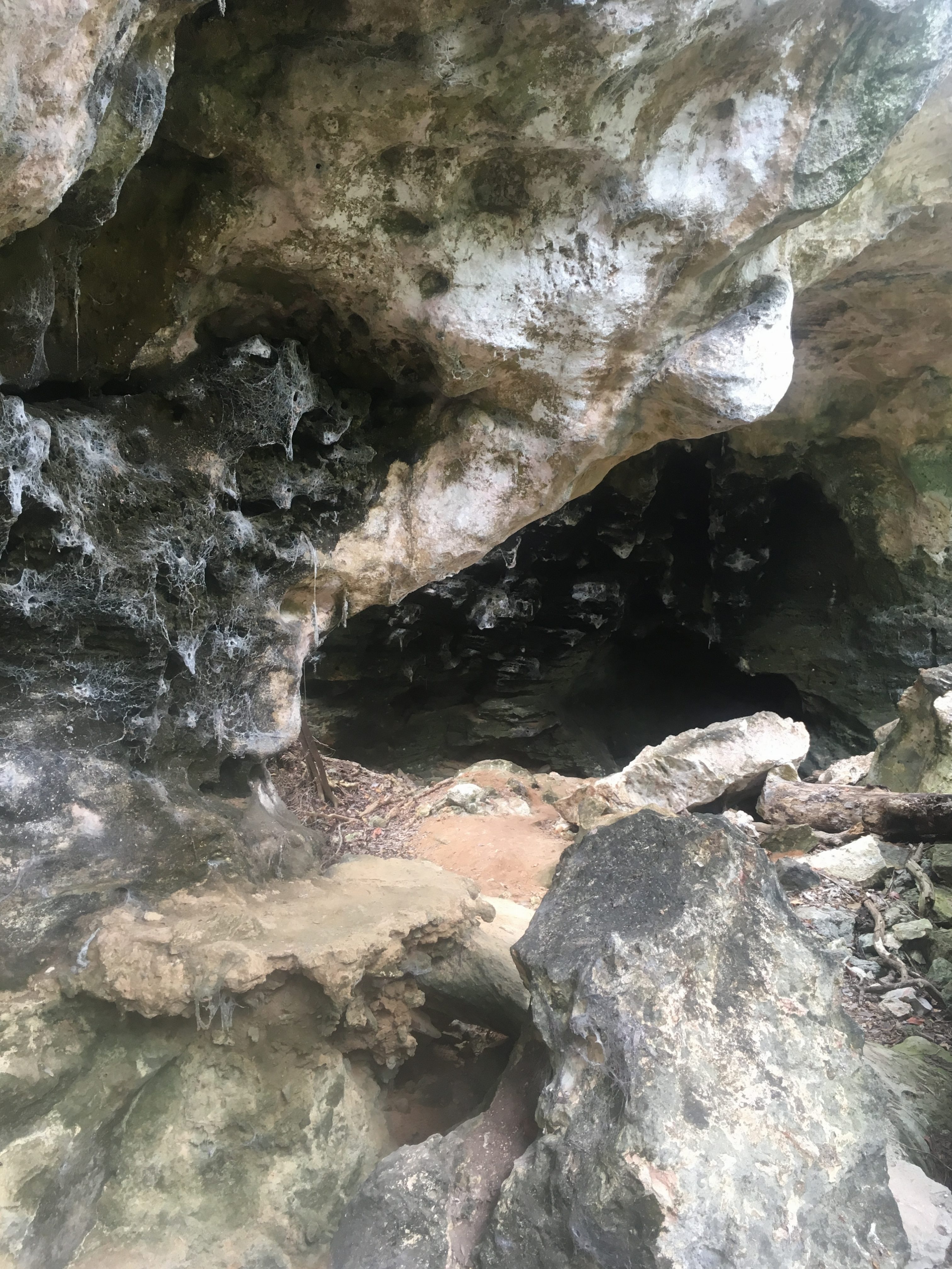
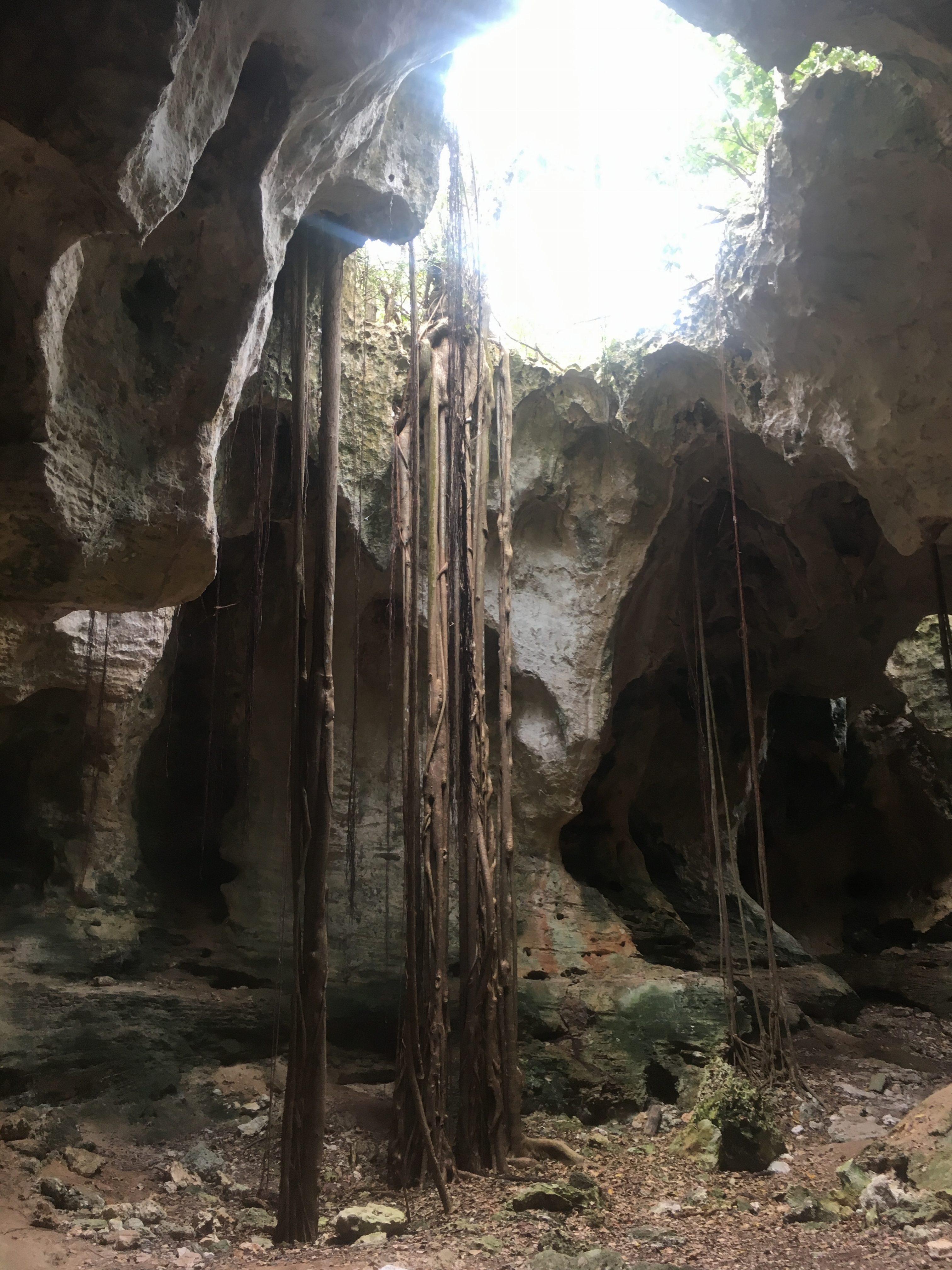
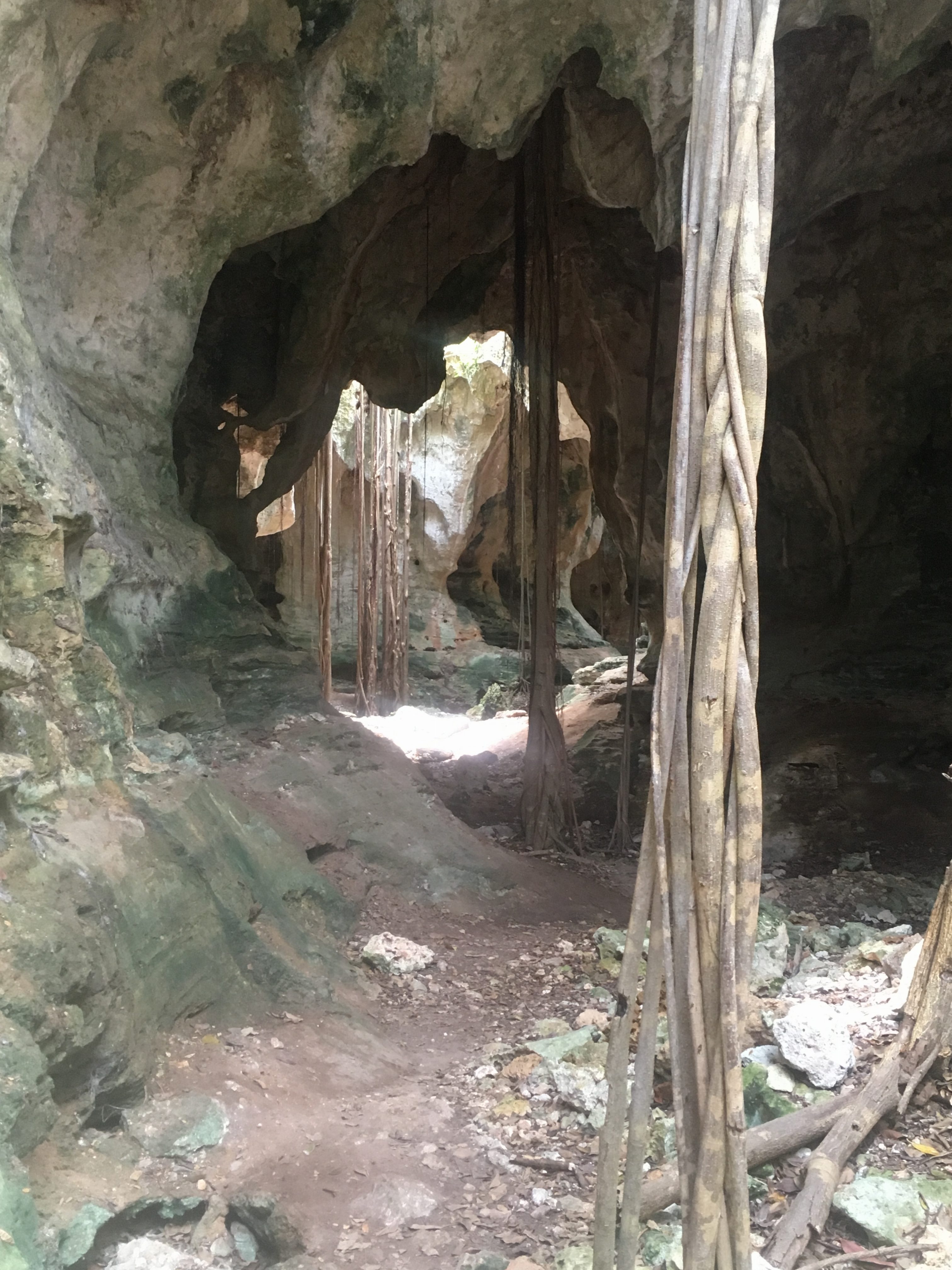
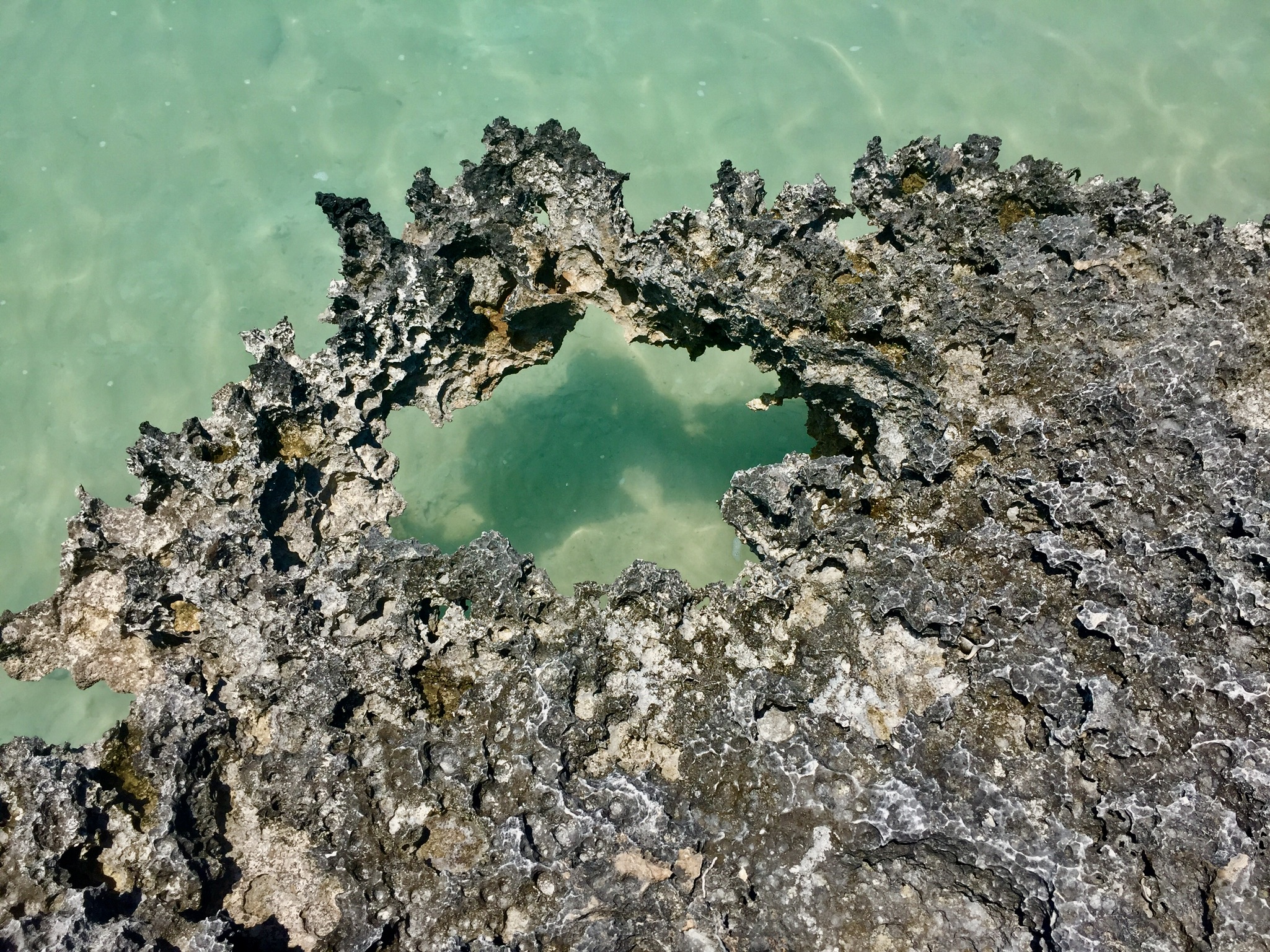
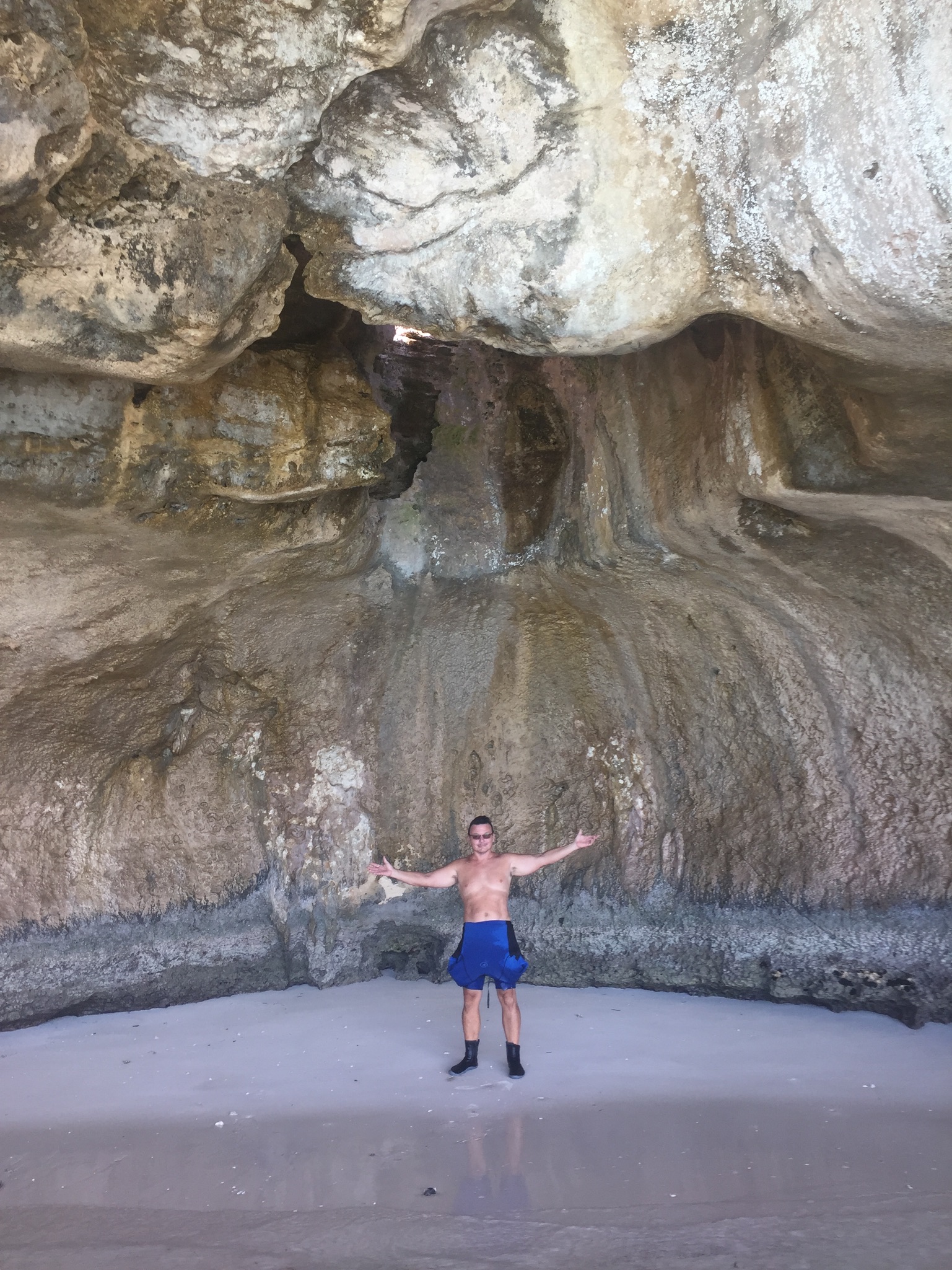
The “Boiling Hole” near the Spider Cave
The “boiling hole” is essentially a blue hole or a cave that is connected to the ocean. At times, if the tide rises or falls rapidly, the water will churn and bubble. Many of the early residents believed these holes were homes to sea monsters. Animal and fish carcasses would occasionally surface in these holes after hurricanes which only reinforced that belief.
Kim descends to her spidery doom….The spiders are here !!!
Kim looks apprehensive …..
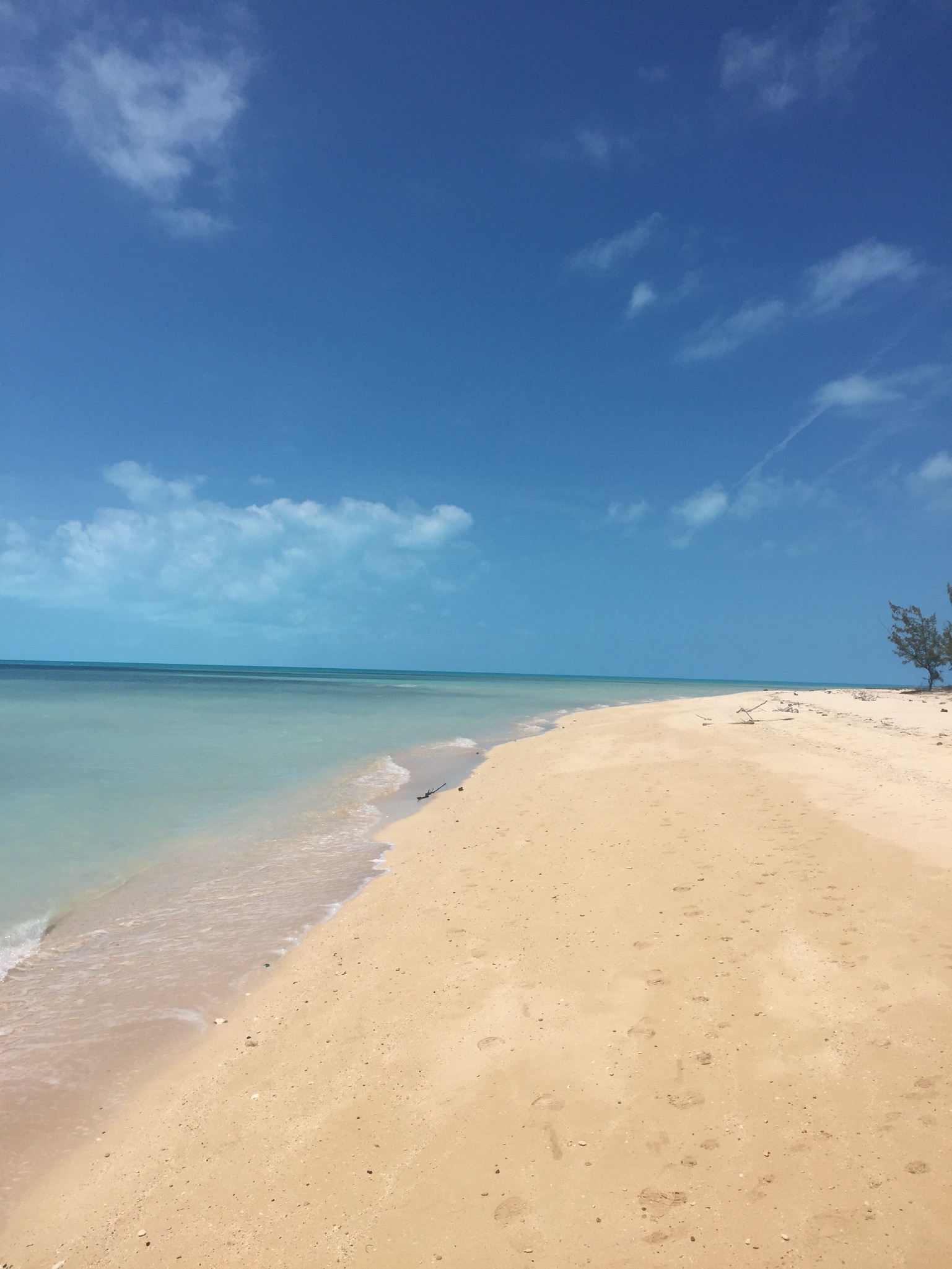
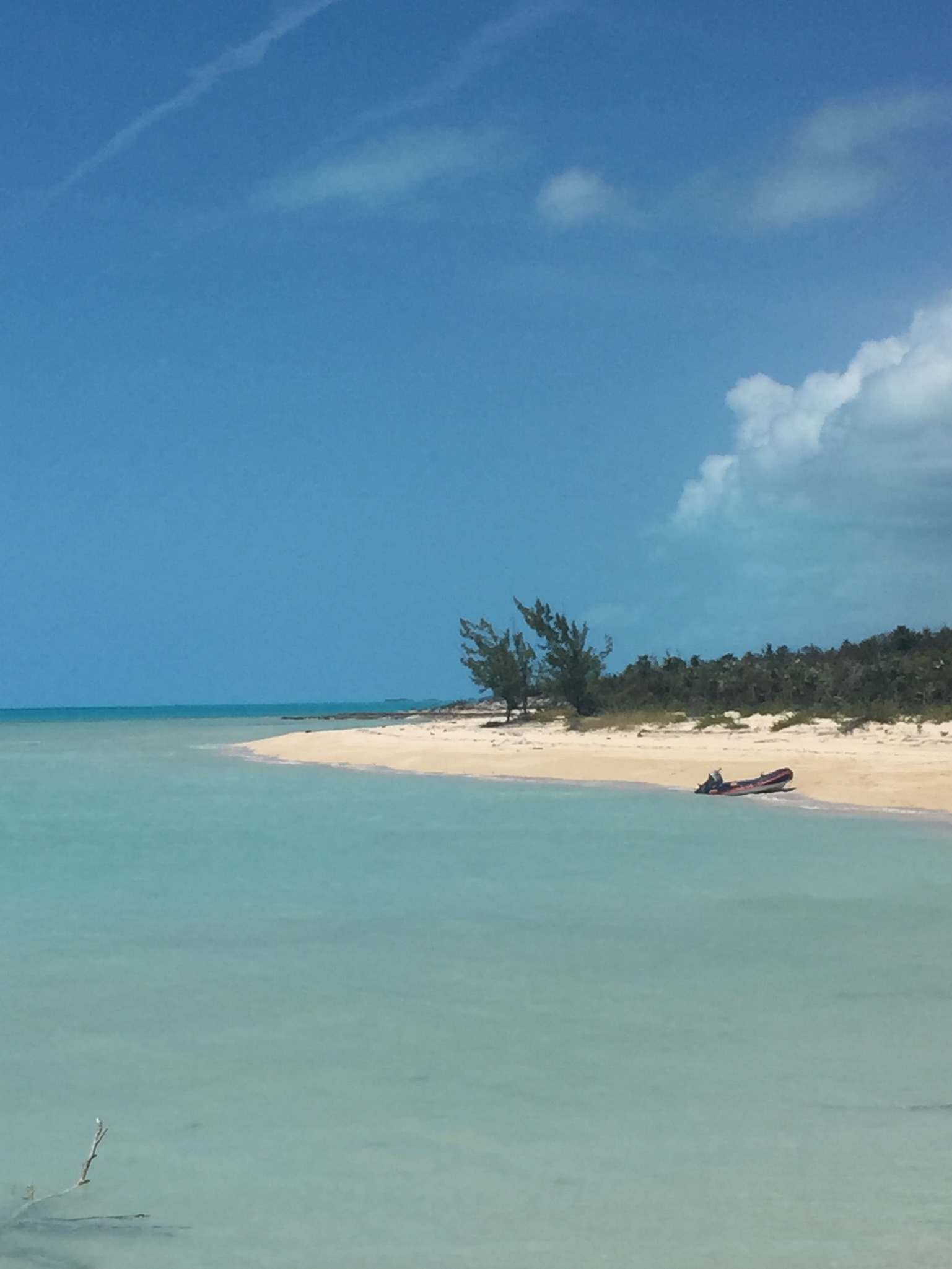
The beaches on the east side of Eleuthera were among some of the most beautiful and isolated….there was also a TON of seaglass…..
The spoils of a couple of hours of seaglass hunting…we found a few black pieces which are the third most rare ….Believe it or not….that’s the moon
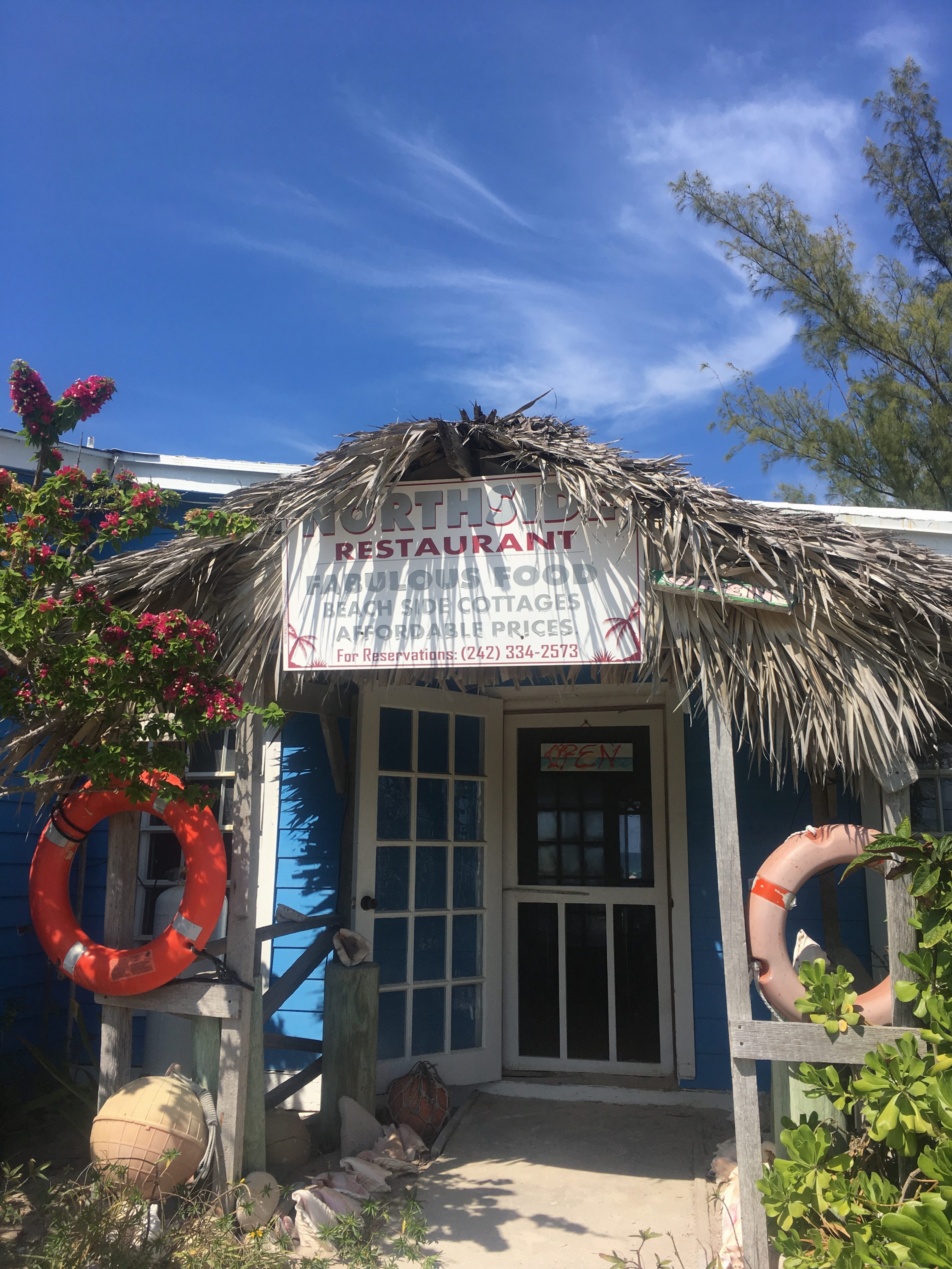
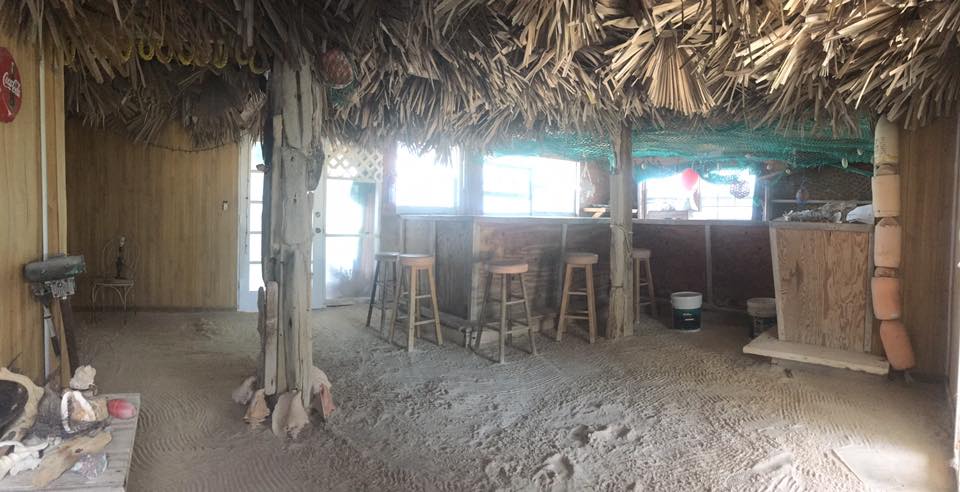
We found a great little restaurant and resort on the east side of Eleuthera across from Rock Sound. It was owned by a wonderful lady named Rose Gibson. She was super friendly, would pick us up when she saw us walking around town, took us for an impromptu island tour one day while fish shopping and was a great cook !!! There are five cabins on her property that are on a hillside overlooking the ocean…..
Here’s a link to her website…..if you go tell her Brett and Kim sent you !!!
http://www.northsideinneleuthera.com
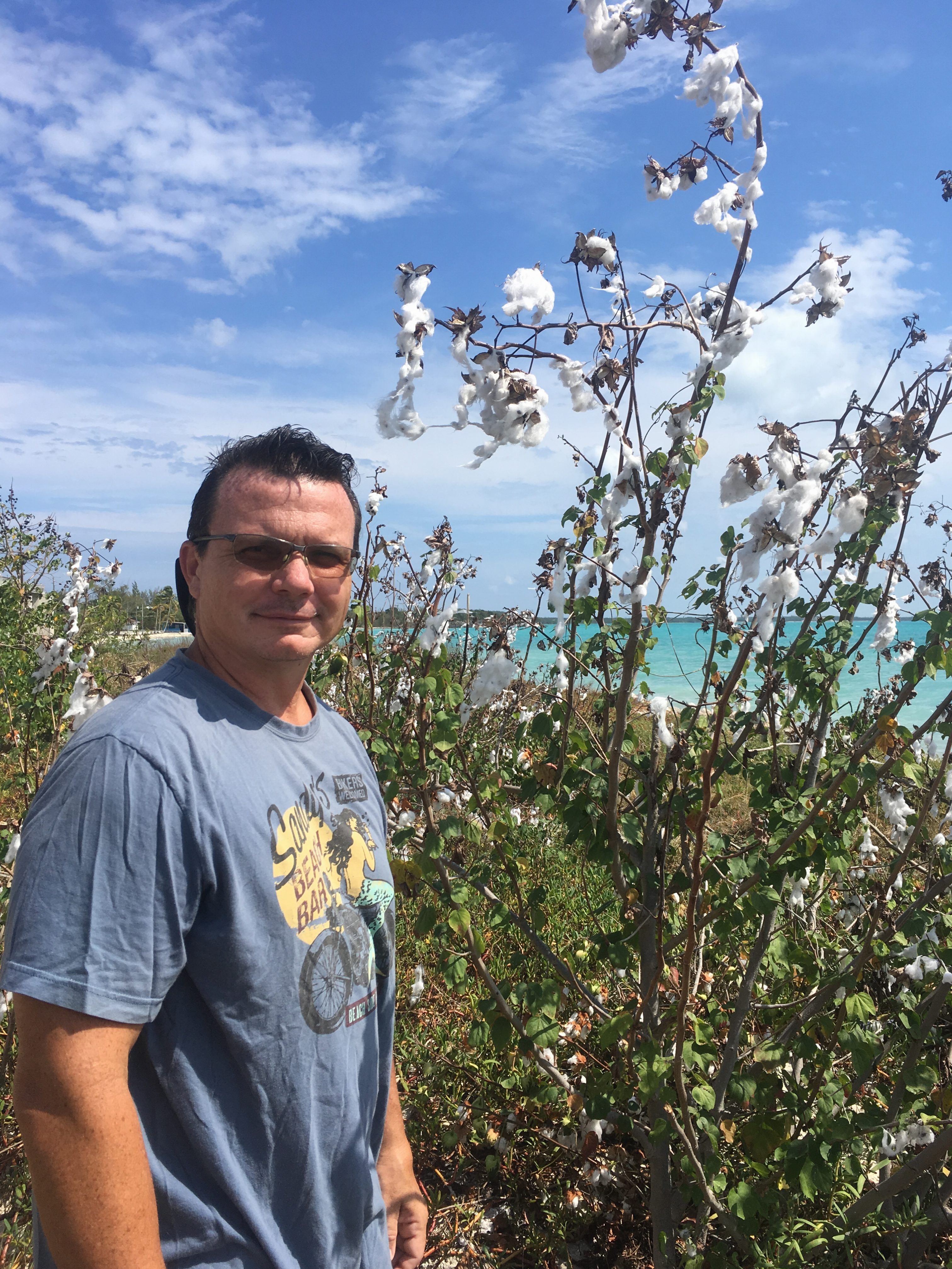
Remnants of the former Cotton growing industry spring up all over the island ……
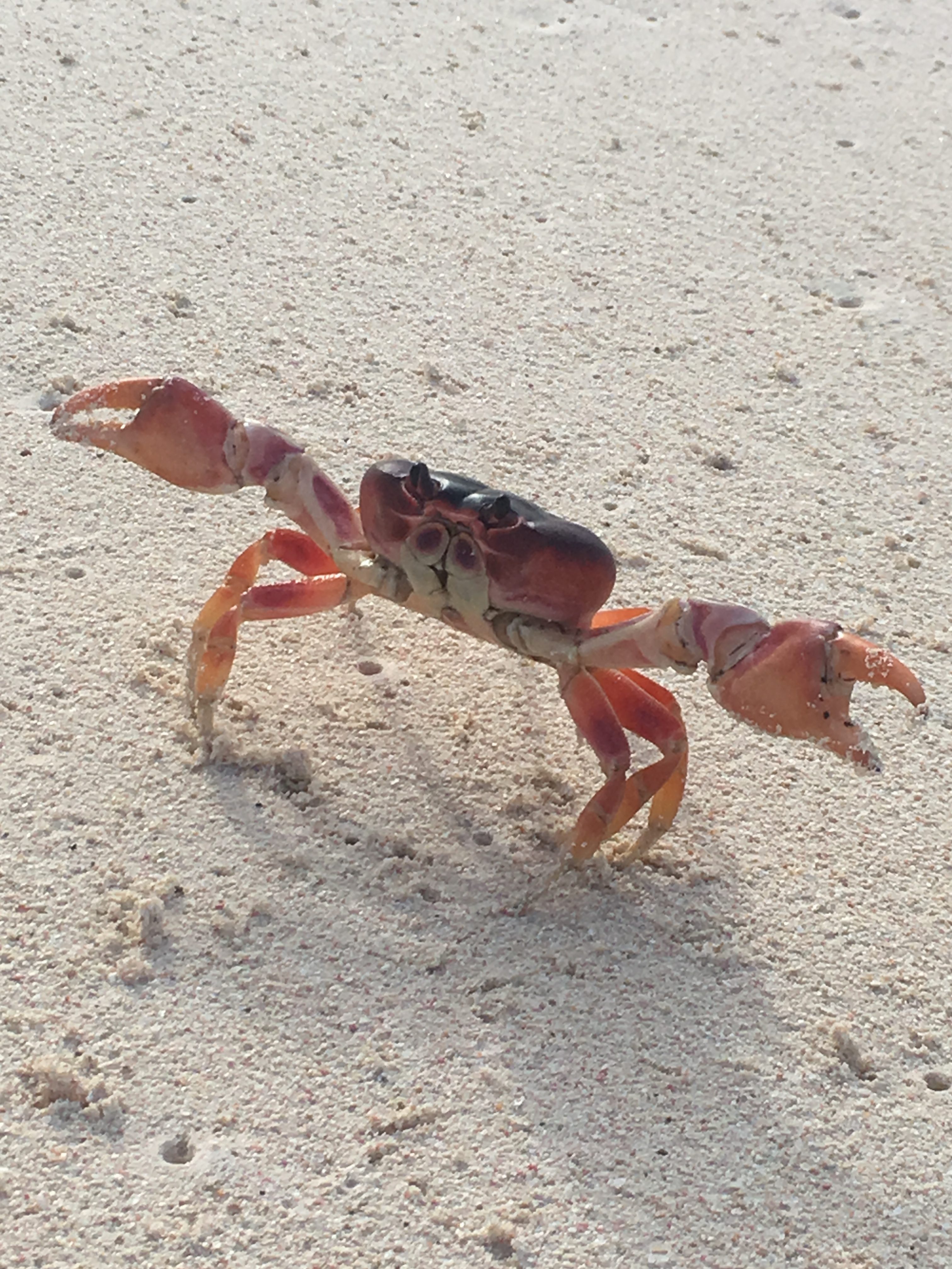
There were thousands of these little land crabs running back and forth between the foliage and the surf….dropping off their eggs
A cropped version of this photo of Kim was used in Cruising Outpost Magazine’s weekly online photo collection….
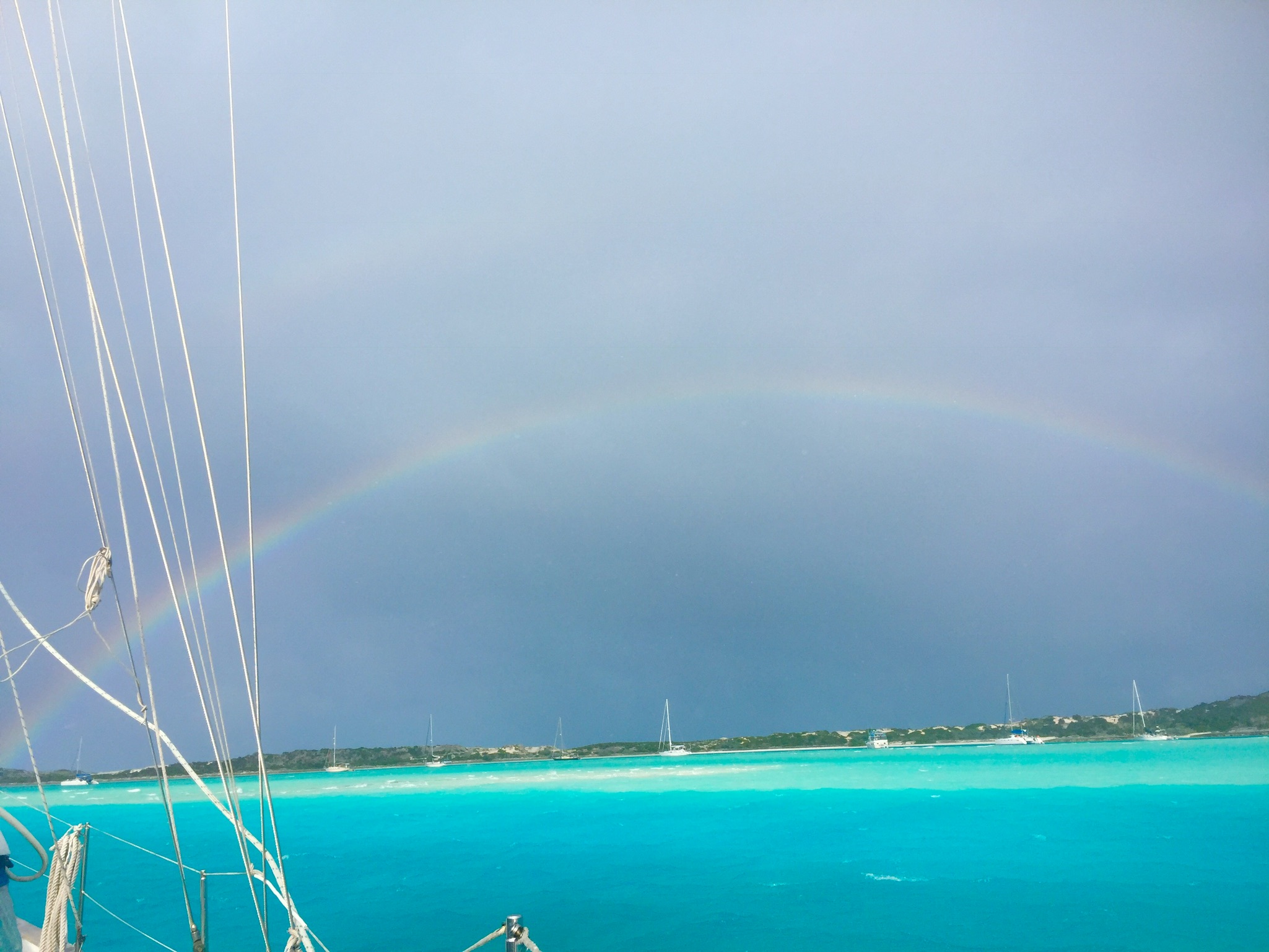
Mike arrives and brings a double rainbow….and has a Kalik !!
Since Hurricane Irma’s recent swing past the Bahamas you’ll be pleased to know that the islands here were largely untouched. We haven’t heard of any structural damage anywhere in Eleuthera.
Our next stop after our long stay in Long Island was for a short stay in Cat Island to the North. Cat Island is typical for this stretch of the Bahamas, in that, it is a long, slightly curved piece of land that runs generally southeast to northwest and has little protection from the West and few or no anchorages on the east side. That makes Cat Island a tough place to linger unless you don’t mind having some rough nights at anchor.
Cat Island has its share of “boiling holes” (lakes that connect to the ocean through a series of caves and caverns) the interesting thing about the lakes here is the variety of local superstitions and folklore about the denizens of these lakes. One has been rumored to be the home of Mermaids, while another, home to a sea monster, due to bubbles and burping sounds caused by the tides. Dead animals dumped into the lake would also be drawn into the caverns by tidal changes and would sometimes wash up on the oceanside beach, which was credited as the activities of the sea monster.
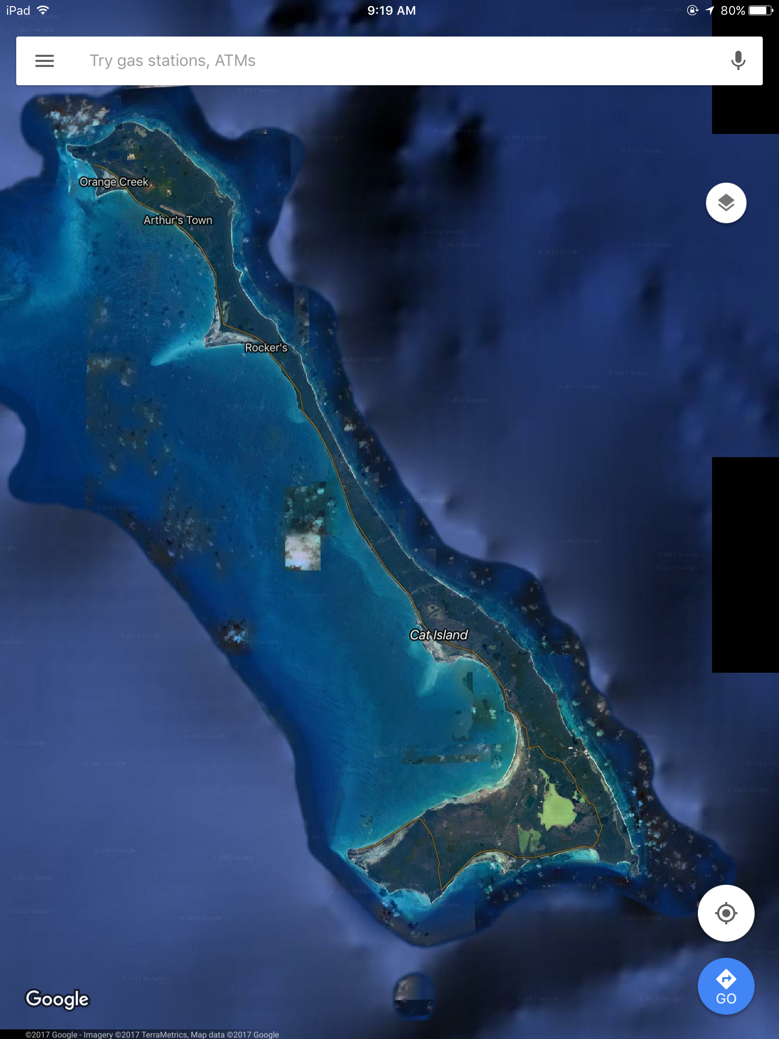
We anchored in an area called the “New Bight” which is just south of the “Cat Island” label on the satellite image.
image courtesy of Google Maps
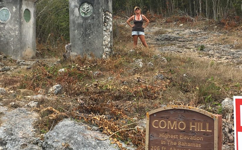
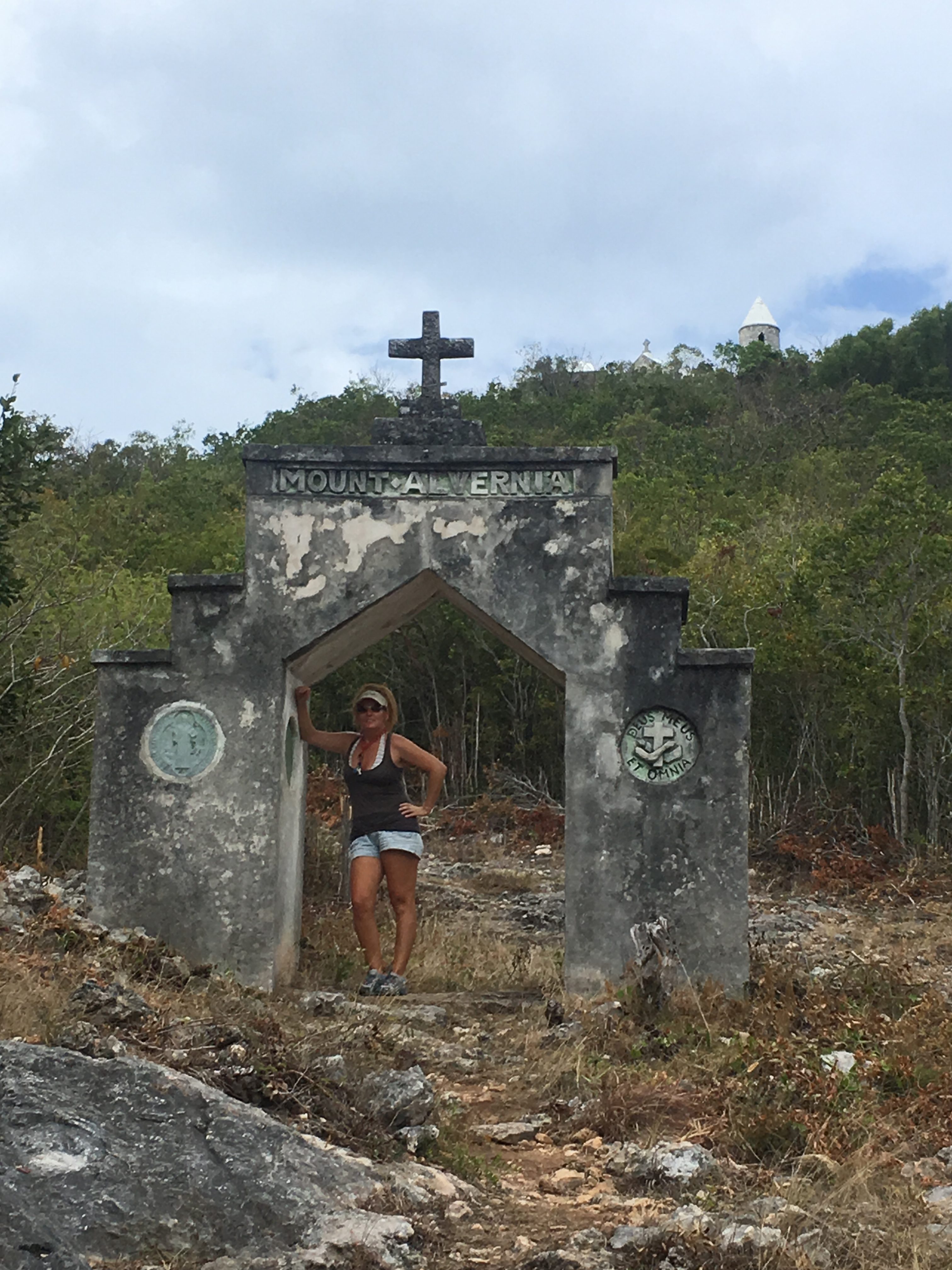
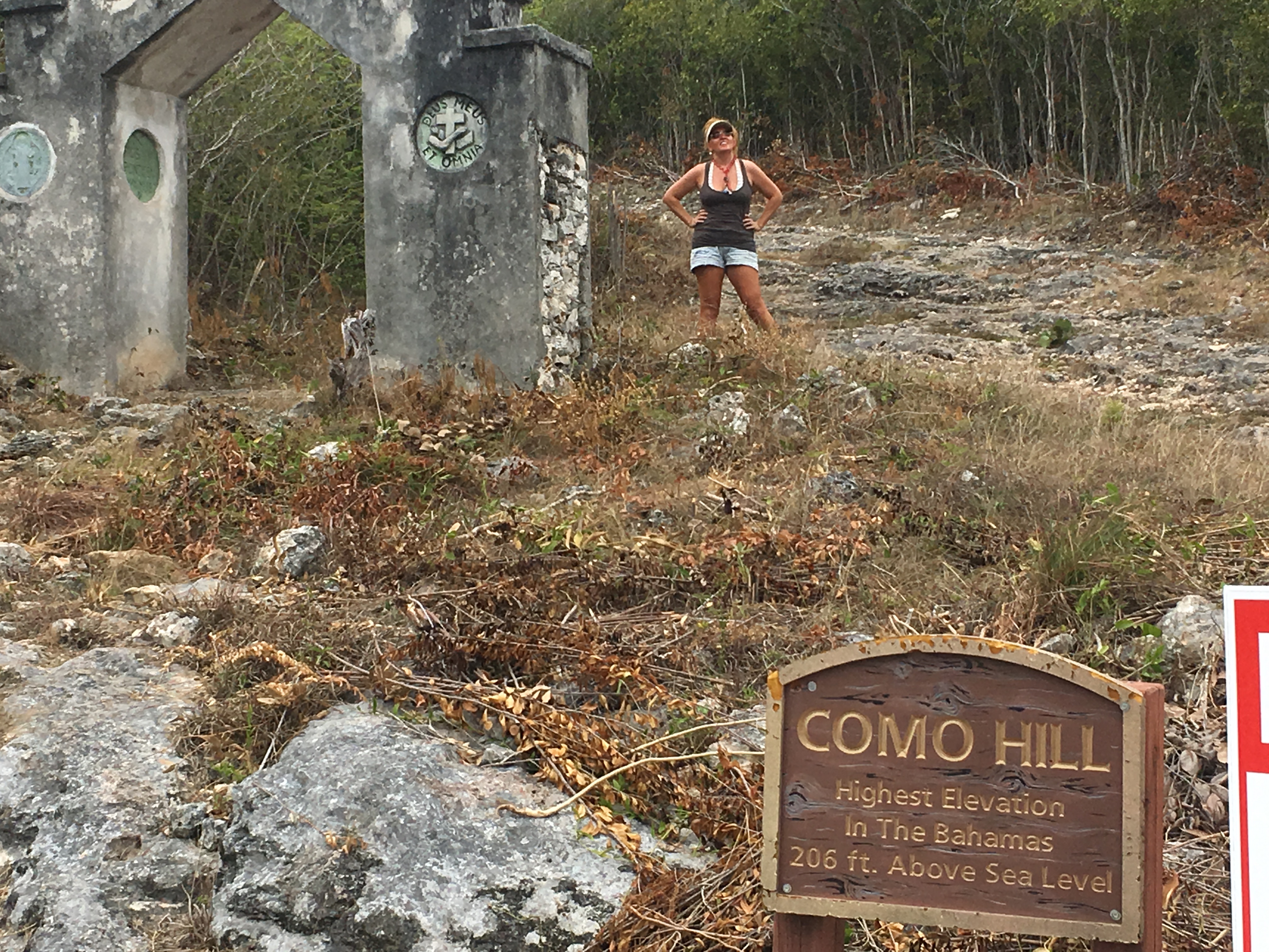
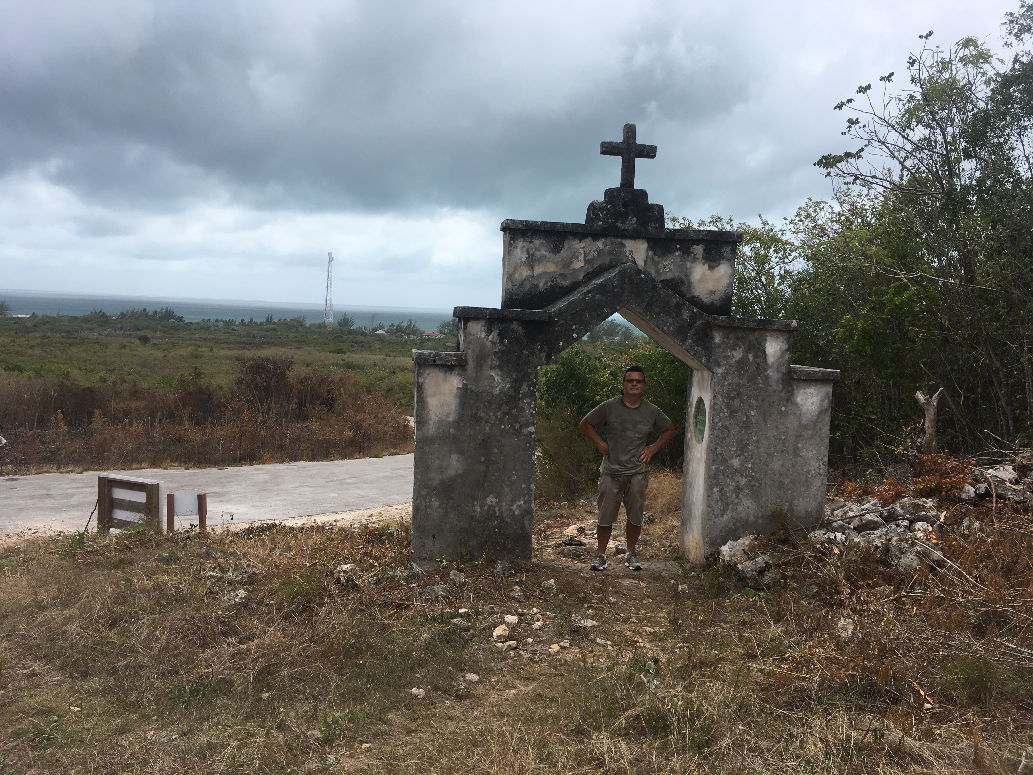
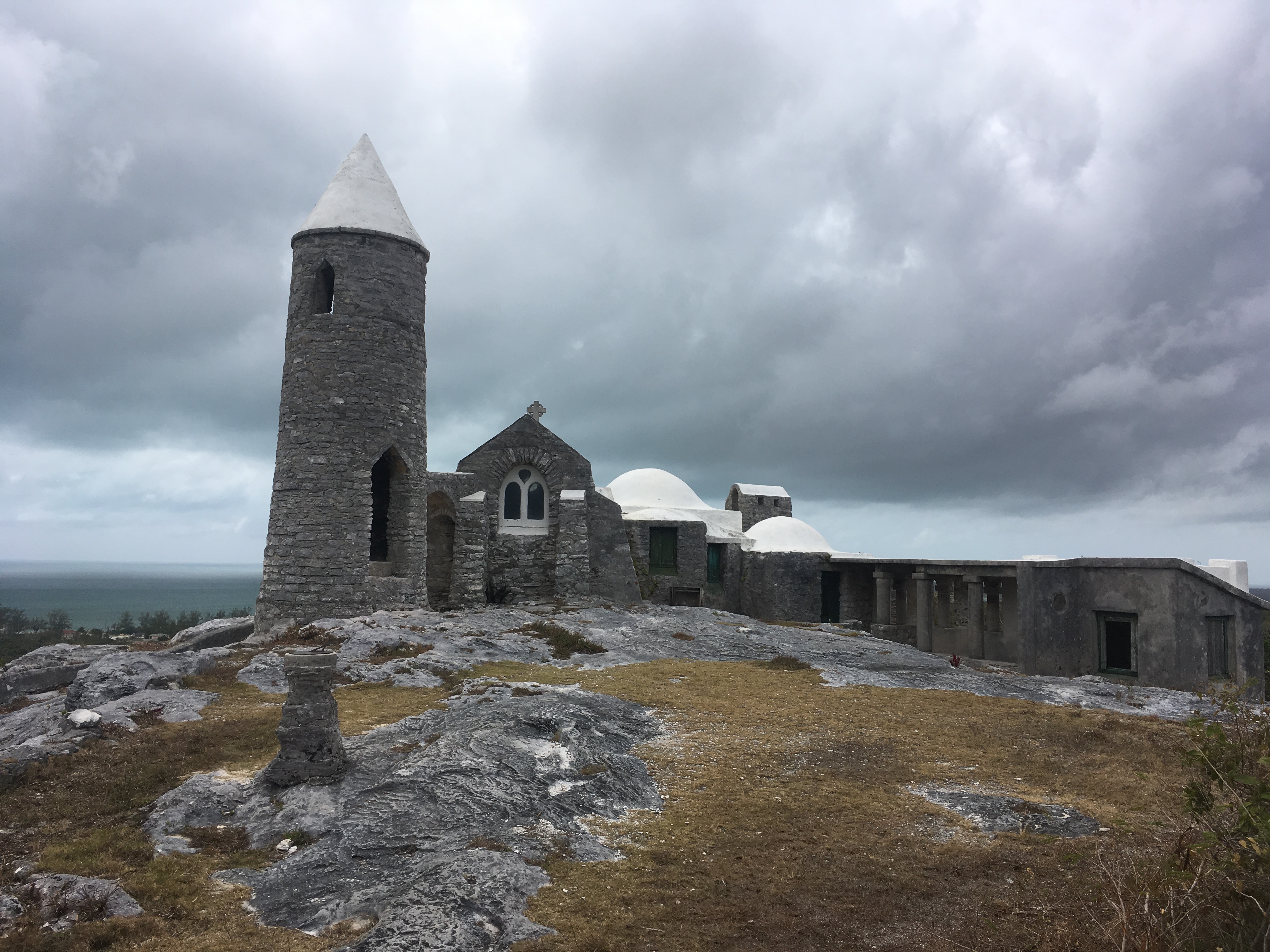
That area is well known for the Hermitage, a monastery designed and constructed by a Franciscan priest named John Cyril Hawes, (1876-1956). Hawes, was an architect who designed and constructed church buildings in England. Hawes became a Franciscan reverend and from 1903-1911 was posted to a church in the Bahamas. Hawes left the Bahamas (and the Franciscan church) in 1911 and spent several years in the United States where he roamed the country and worked different jobs. Hawes converted to Catholicism, studied to enter the Catholic priesthood in Rome and was ordained in 1915. He worked in Australia until 1939, when he retired from the church, he returned to the Bahamas and constructed the Hermitage. It is unclear why he was commonly referred there to as Brother Jerome. He was buried in a cave under the Hermitage following his death in 1956.
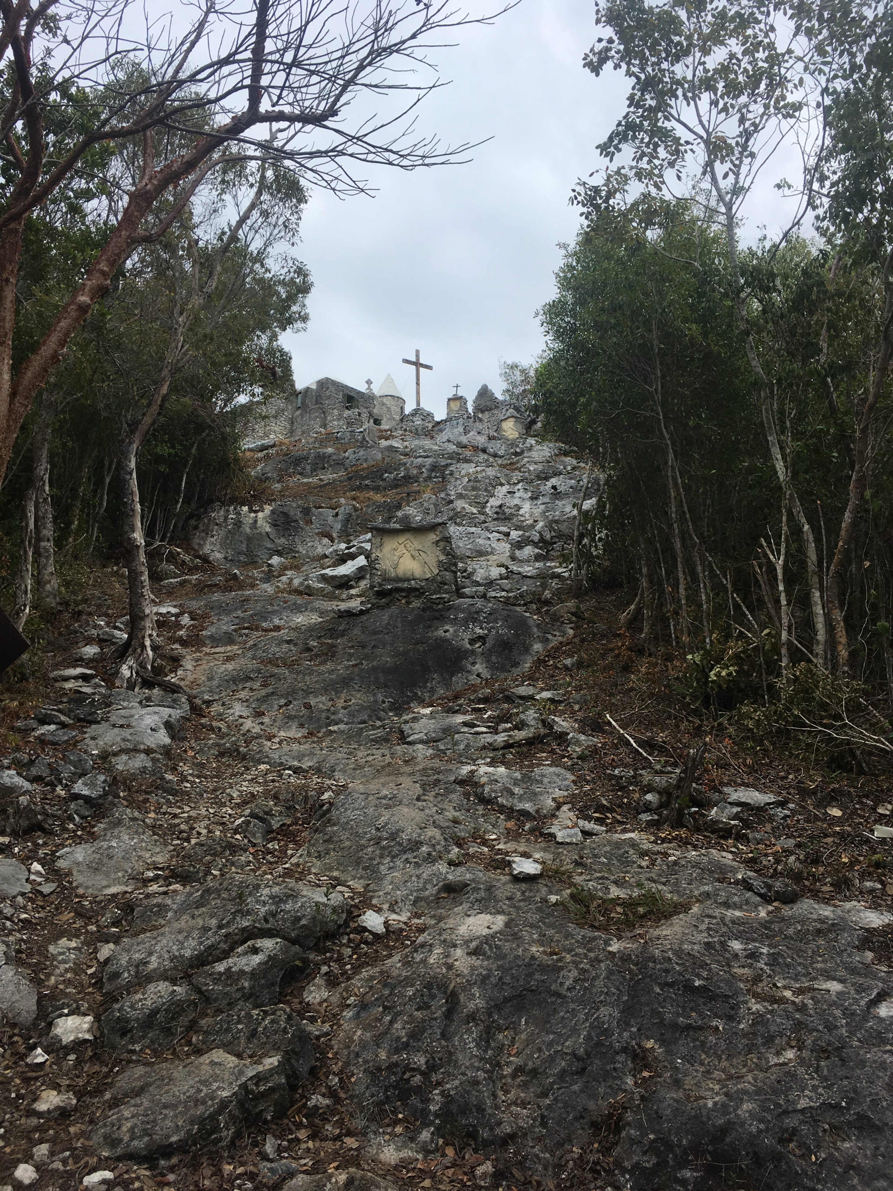
It is an impressive structure, located on a hill originally named “Como Hill”. It was renamed Mt. Alvernia in honor of La Verna hill in Tuscany and is the highest point in the Bahamas.
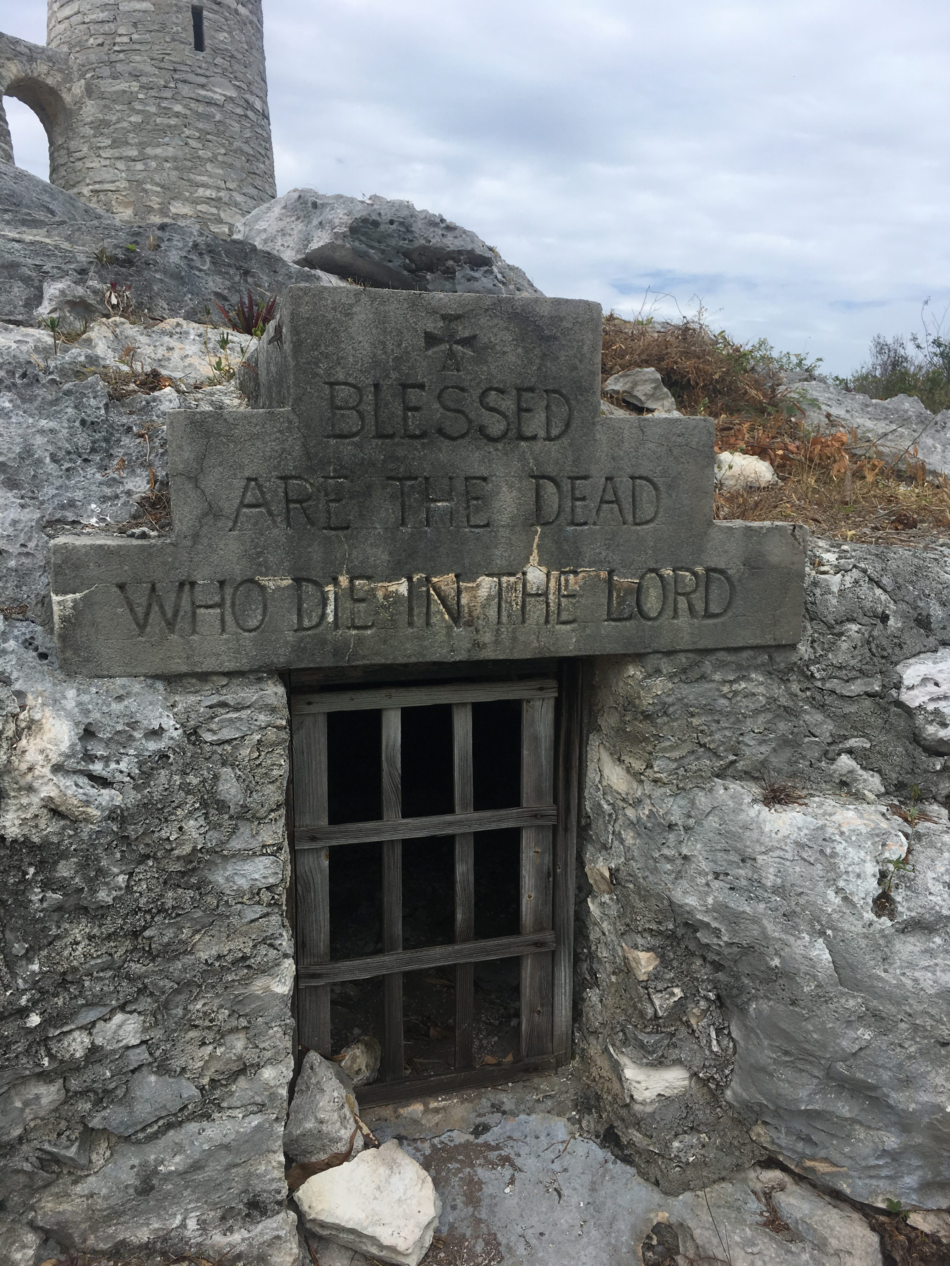
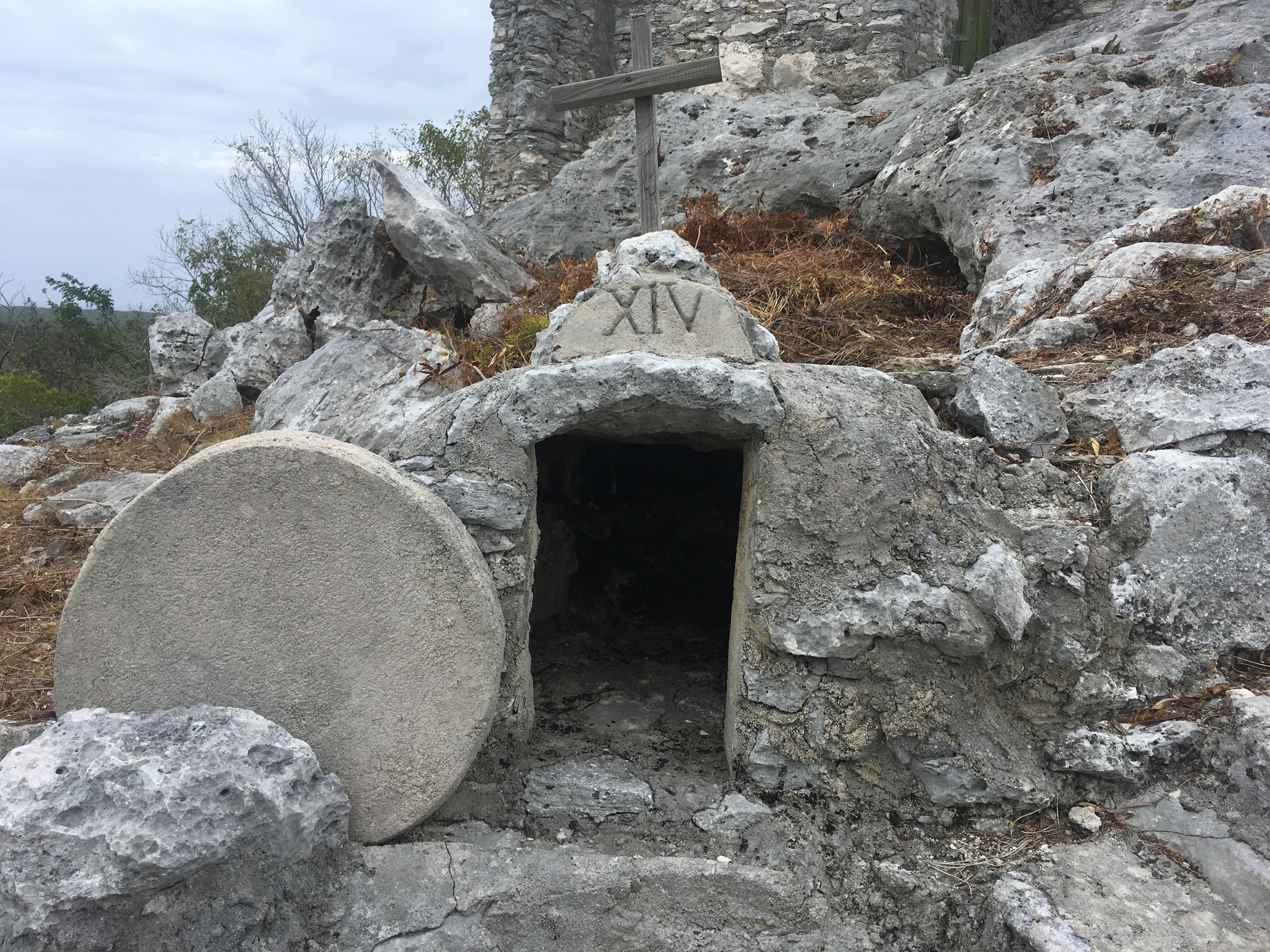
The final path to the hermitage has several “stations”
If you look closely….you can see the blurry image of Kitty Hawk behind the white house…this was the view from the Hermitage.
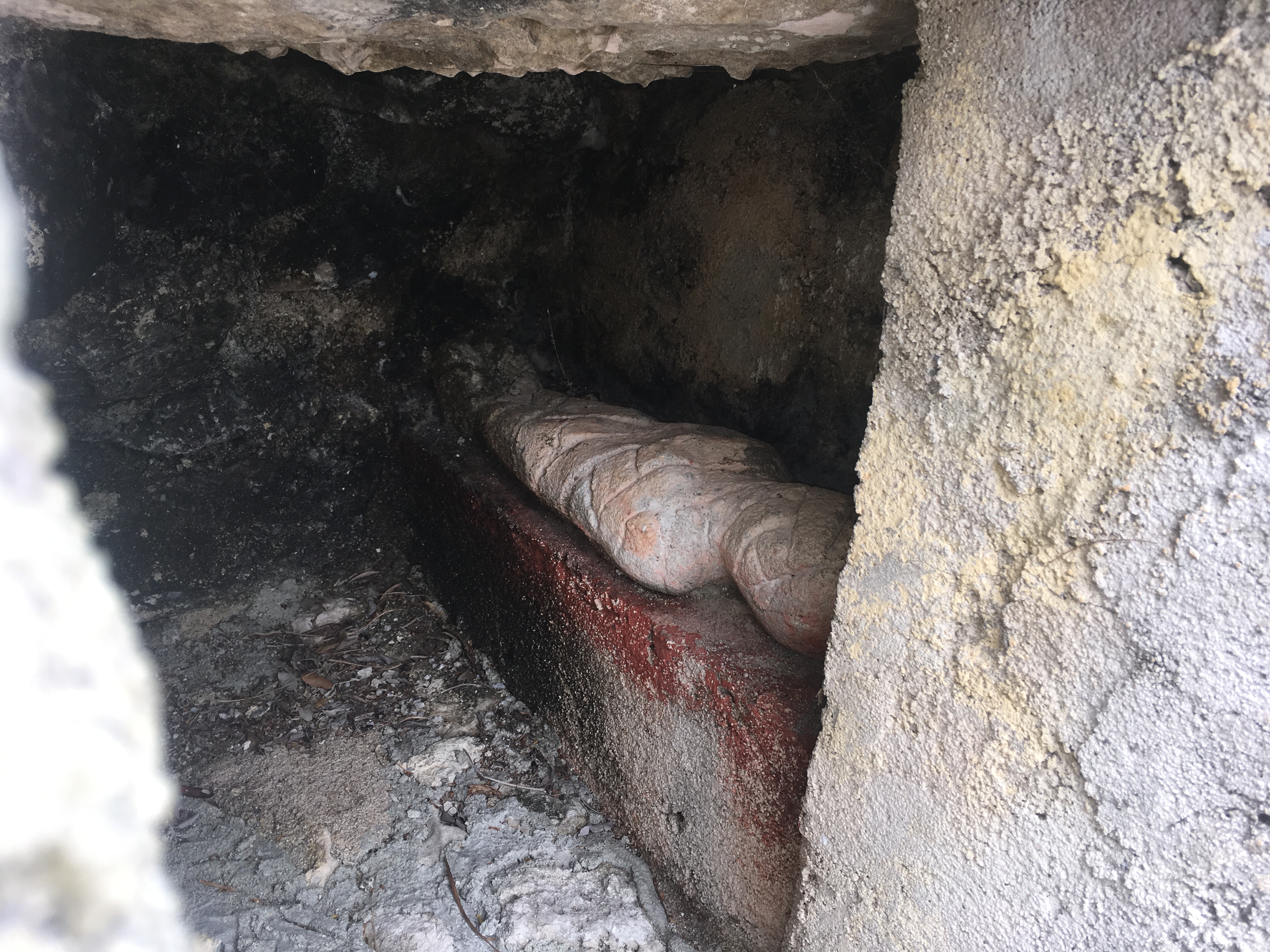
The details of the stations are impressive…..even the model of the tomb of Jesus has a small enshrouded body within it.
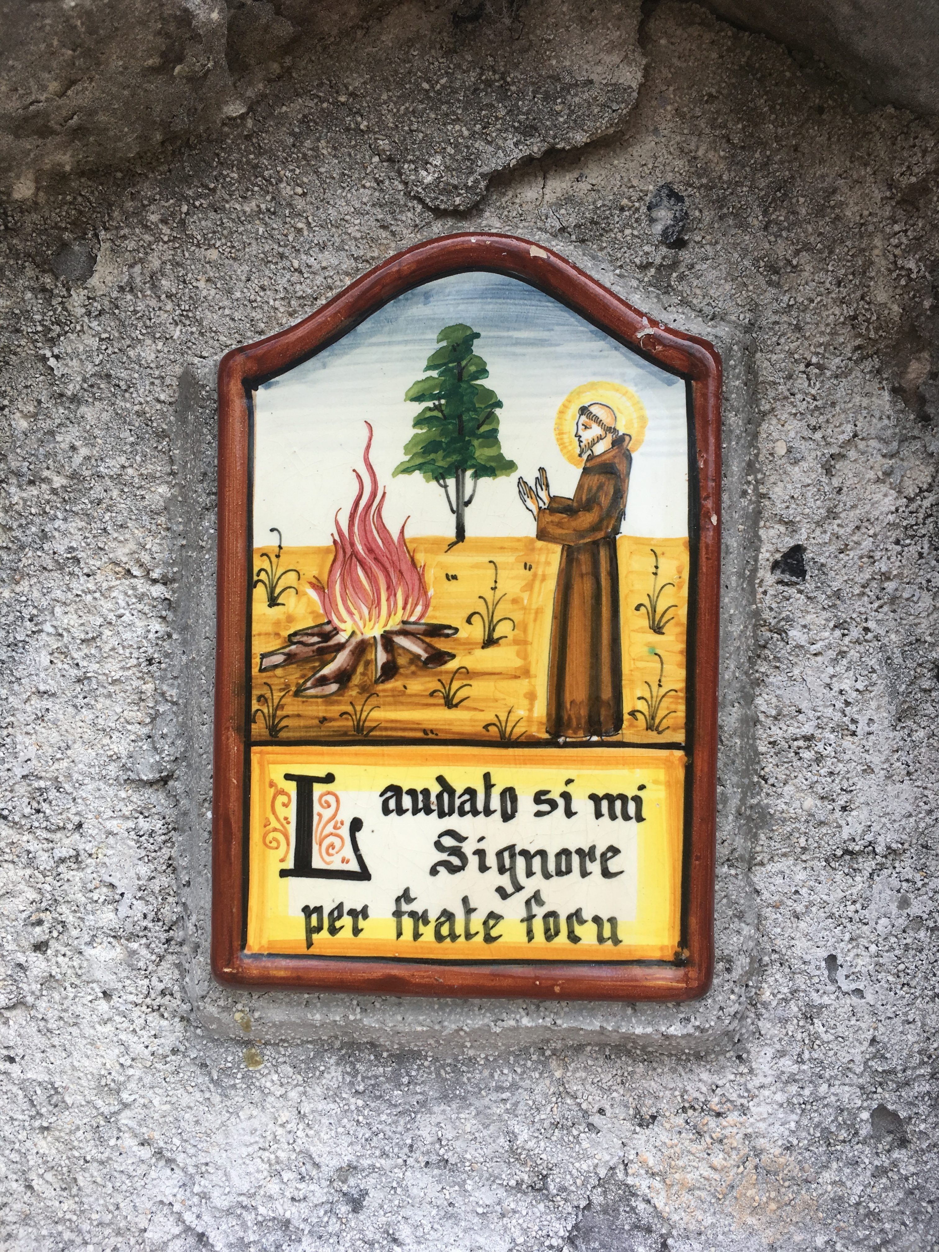
The ceramic plaque on the outside of the remote kitchen……A rough translation…”praised my Lord through Brother Fire”
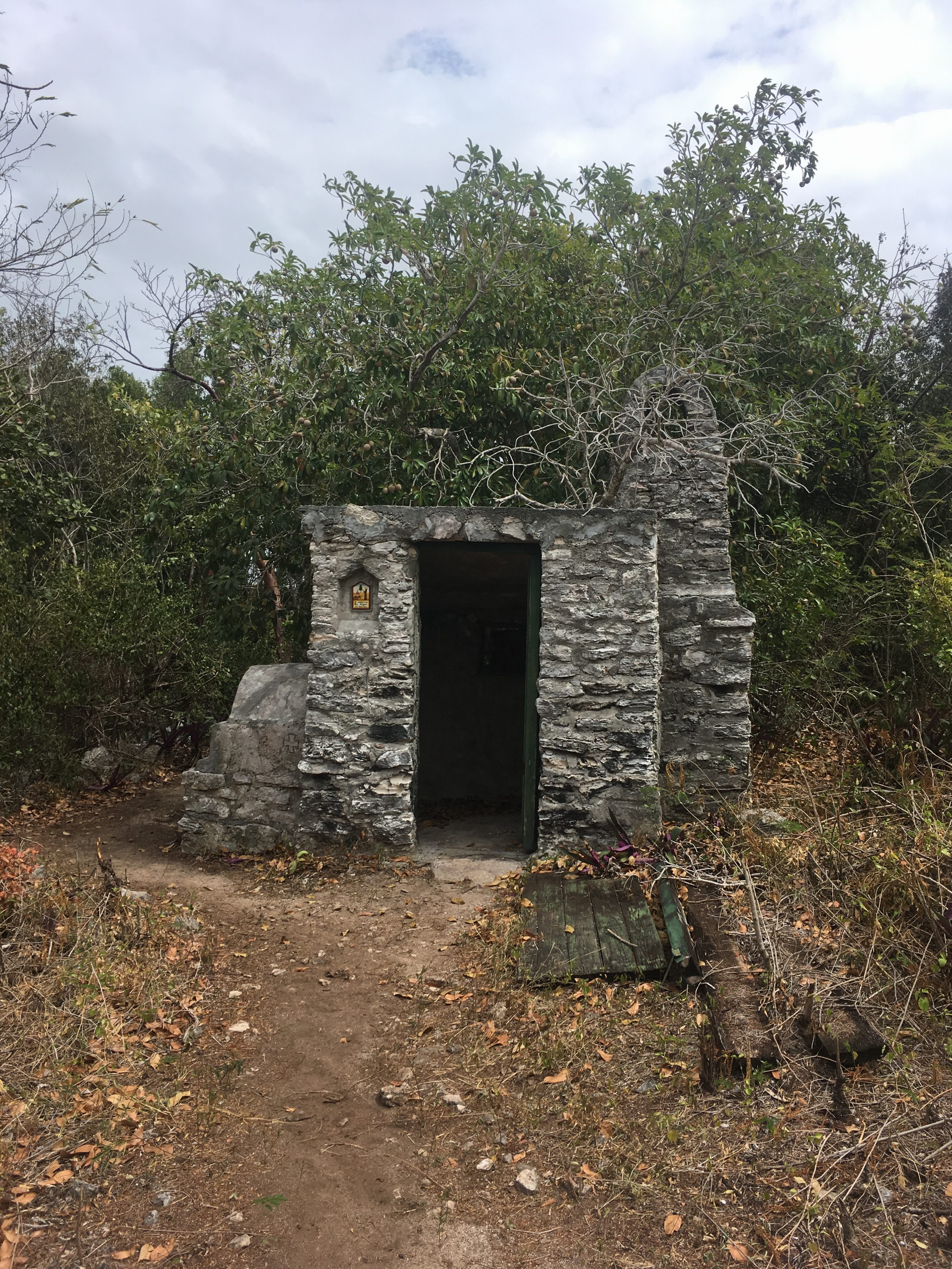
The small remote kitchen for the Hermitage.
We made a quick overnight stop at Fernandez Bay after two bouncy nights at the New Bight anchorage. Fernandez is a small, somewhat more protected spot just around the point and a few miles North of the New Bight. It is home to a small resort with a very nice restaurant.
Up next, don’t miss the horrors of Little San Salvador ……
On March 31st, we departed from Georgetown with our friends Bill and Judy, they were on their boat Whisper, and we covered the approximately 45 miles to Long Island. For us that’s about a ten hour day. We had heard a lot of good things about Long Island and they all turned out to be true!!
The red pin on the satellite image is Thompson Bay / Salt Pond where we were anchored for the bulk of our long stay in Long Island…..which ended up being about 16 days…..we made one aborted attempt to leave with another of our friends, Mark on Halo, but it turned out to just be too rough that day so we turned back and spent four more days waiting for the wind to die down some more……
Image courtesy of Google maps
We met a nice Canadian couple, who winter in Long Island, while we were at a local restaurant and we mentioned renting a car to see the island. The husband said he knew a minister at a local Boys Club who would let him drive us around in their van if we wouldn’t mind making a donation to the organization. Since we could fit three couples plus our tour guides in the van that was much cheaper than renting a car and we got a free tour guide !!
We have discovered that renting cars in the Bahamas can be problematic. Bahamians don’t have insurance in the way that we are accustomed to thinking about it. If they have a wreck and they are at fault, their insurance company won’t pay to fix their car unless they have what they call “comprehensive” coverage (apparently different from the comprehensive we have in the states that covers window glass etc etc) but it is prohibitively expensive and none of the rental car businesses offer it. On top of that most rental companies don’t take credit cards so you have trouble making sure you’re covered here. Couple that condition with our friend’s George Town experience detailed below and you’ll understand why we went the van route.
Another of our new friends (I won’t mention his name here) rented a car in George Town. He was pulled off to the side of the road trying to get his bearings when an intoxicated local guy hit his rental car head on. When the police showed up they called the other driver by name and he quickly disappeared from the scene. Our friend, however, was whisked away to the police station where he was cited. The whole incident cost him about $300 out of pocket and cost his credit card company $5,000 for the rental car. One day while he was in town walking around he stopped by the police station to try and get a copy of the report for the his credit card company. The officer, without warning, told him he had to appear in court immediately. He was obviously not dressed for the occasion. He was nearly fined for contempt for wearing swim trunks and a t-shirt to court. Fortunately, he was able to explain he had been given no notice that he was to appear and the judge believed him. It was his intention to plead not guilty, but he was told he wouldn’t be allowed to leave the Bahamas until his trial day ….IN THREE MONTHS…which was beyond his visa expiration. Thankfully, when he rented the car, he had found a place that took credit cards and they covered the rental car damage, or it could have been much, much worse. So we decided to put a ban on renting cars in the Bahamas.
The “tour” took us to an old Spanish church with an interesting cave behind it…..the locals call it Shrimp Cave….
my apologies for the odd order of the photos ….they refused to let me rearrange them once I uploaded them this time.
A pink crab in Shrimp Cave….I wonder if he’s pink because of all the Shrimp he eats ? Like a flamingo ?
A stretch of beach on the west side just north of Thompson Bay….
Me hunting for Whelks……
This is the church from our tour …..
We also went down south a short way to a settlement called Dean’s. Now here’s an interesting oddity. In the Bahamas they say “down North” or “Up South”. It was explained to me that because of the general orientation of the sunrise and sunset it appears to rise, or come “up” in a more southerly direction and go “down” in a more Northerly direction….rather than the map orientations where North is usually up and South is usually down.
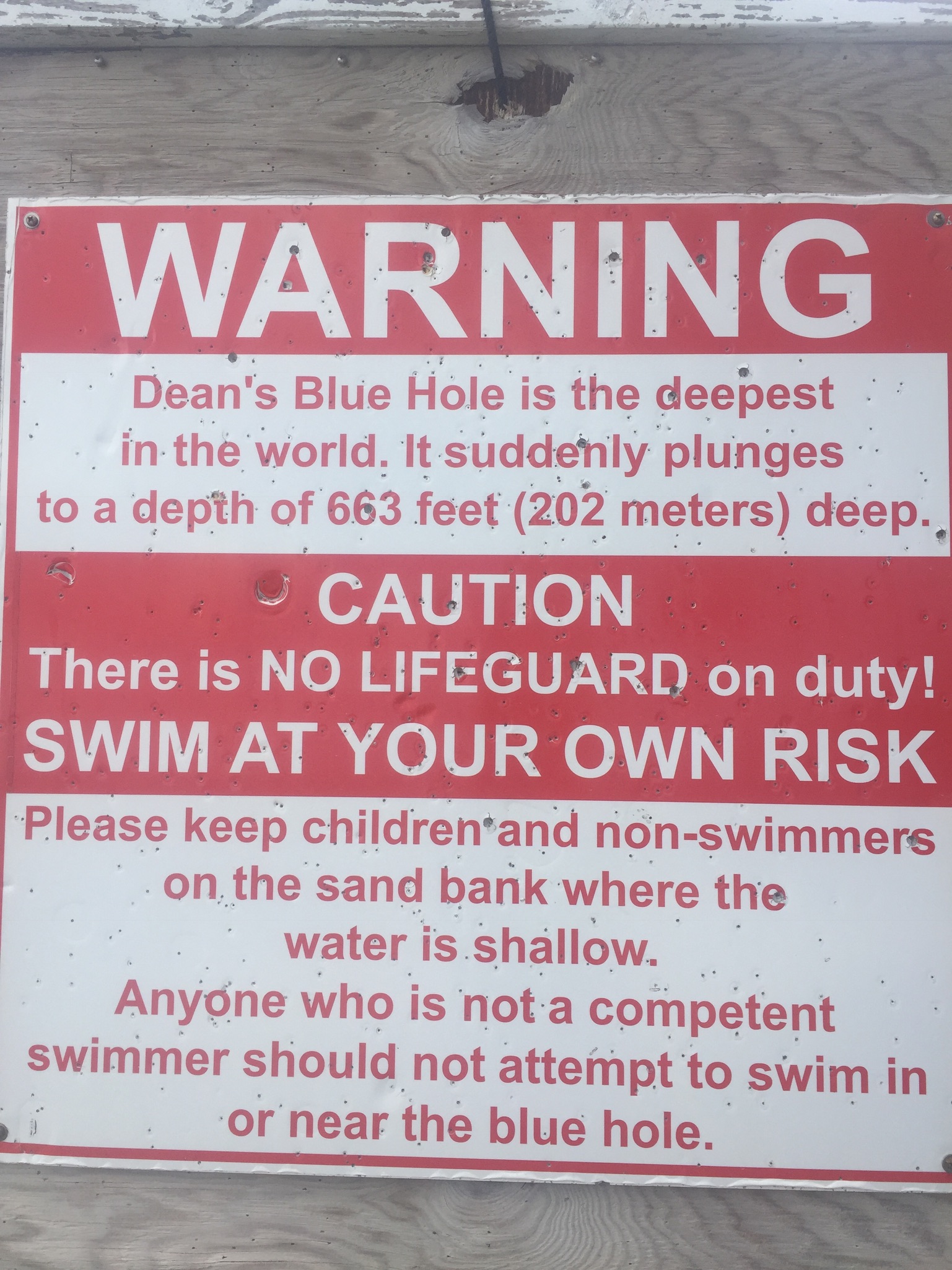
Dean’s is the home to the aptly named “Dean’s Blue Hole”….. currently the second deepest documented Blue Hole in the world…..the current deepest known one was recently discovered in China…..at least it was discovered after the sign below was made…..
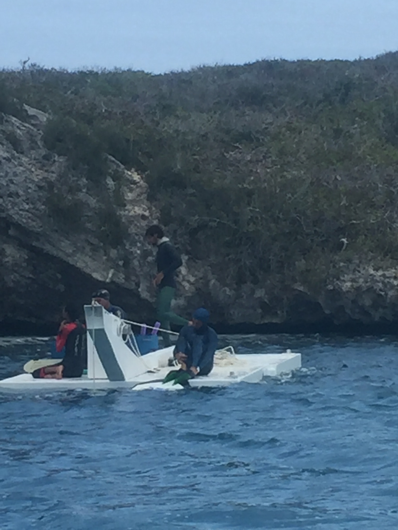
There were some free divers practicing for the upcoming competition. It was interesting to watch them prepare for the practice dives……
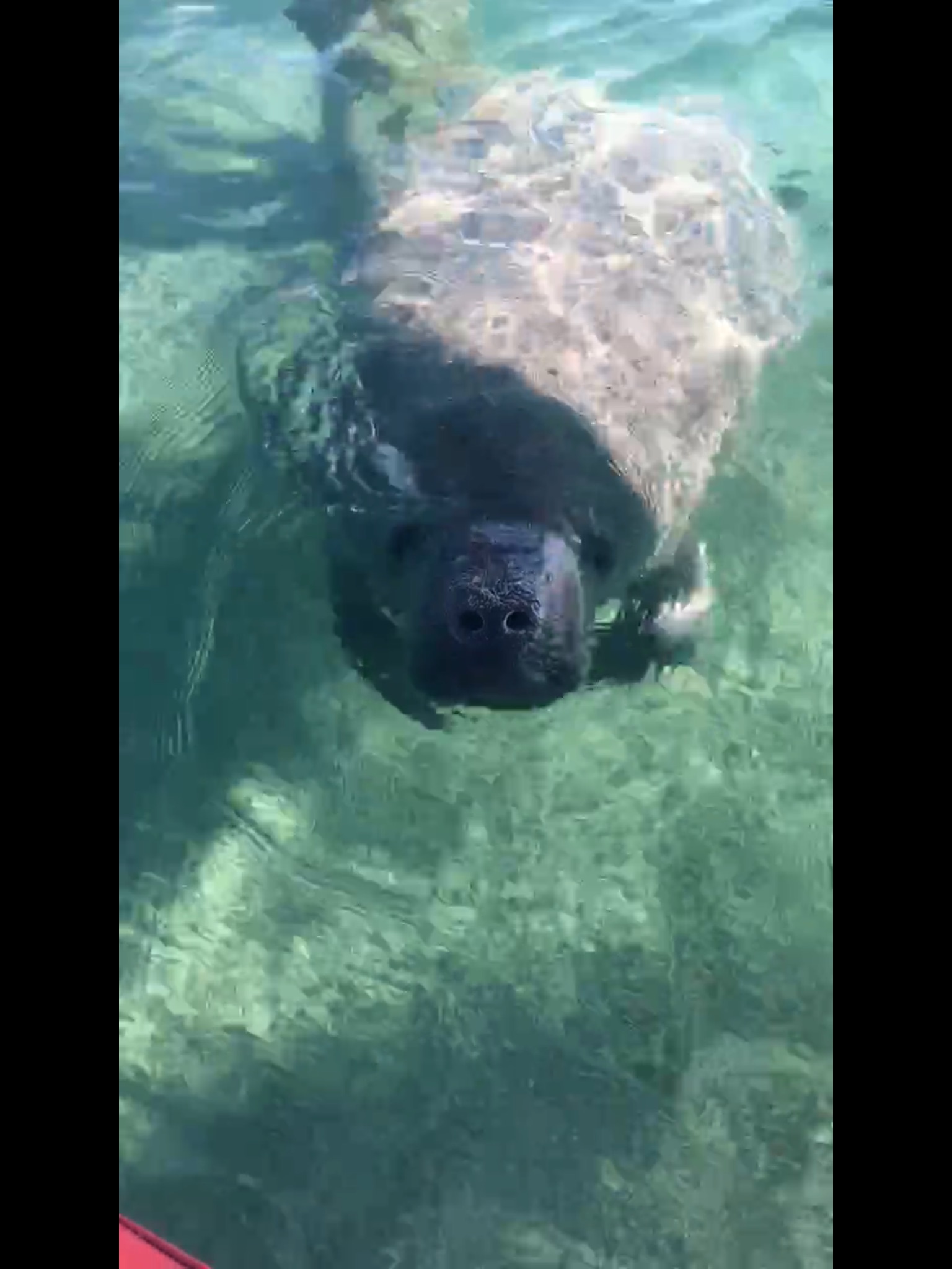
Kim’s Manatee friend….
The east side beach scenes……the east side beach in Long Island was the first place we found seaglass in any quantity and Kim immediately started making charms …….
An interesting formation of seagulls….commonly called “gully’s” here in the Bahamas…..
About two thirds of the way as you go up Long Island, there is a resort community that was founded in the 60’s called Stella Maris. The development was surveyed and subdivided but not much building ever occurred away from the main beach area. There are a lot of empty lots and some nice isolated hilltop houses in the area. They also have an interesting salt water pool….why build a pool with all those complicated pumps and filters when you can just cut a channel through the rock to the ocean???? This was one of three pools in the development. If you own a house here you get resort privileges for about $300 a year.
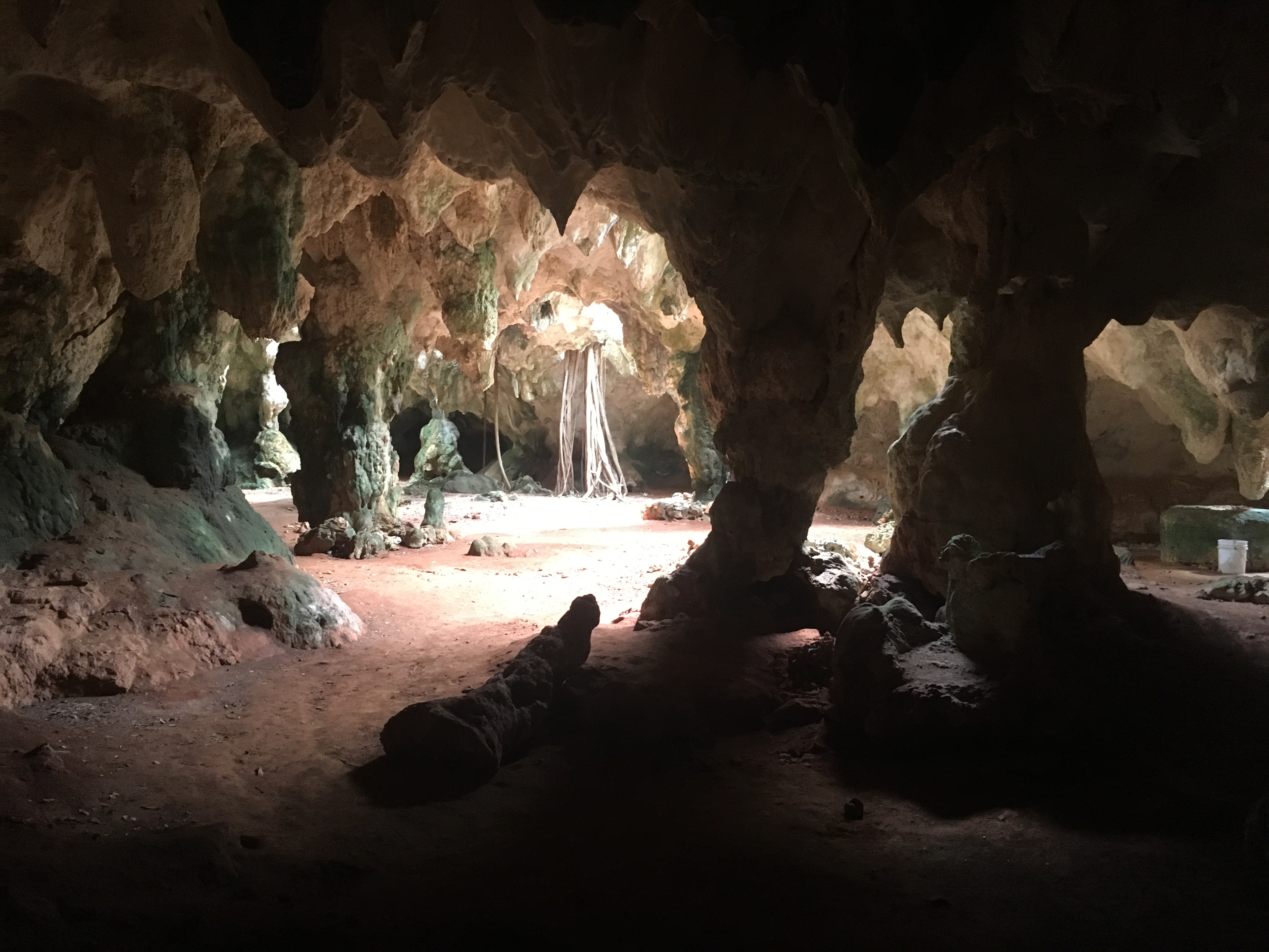
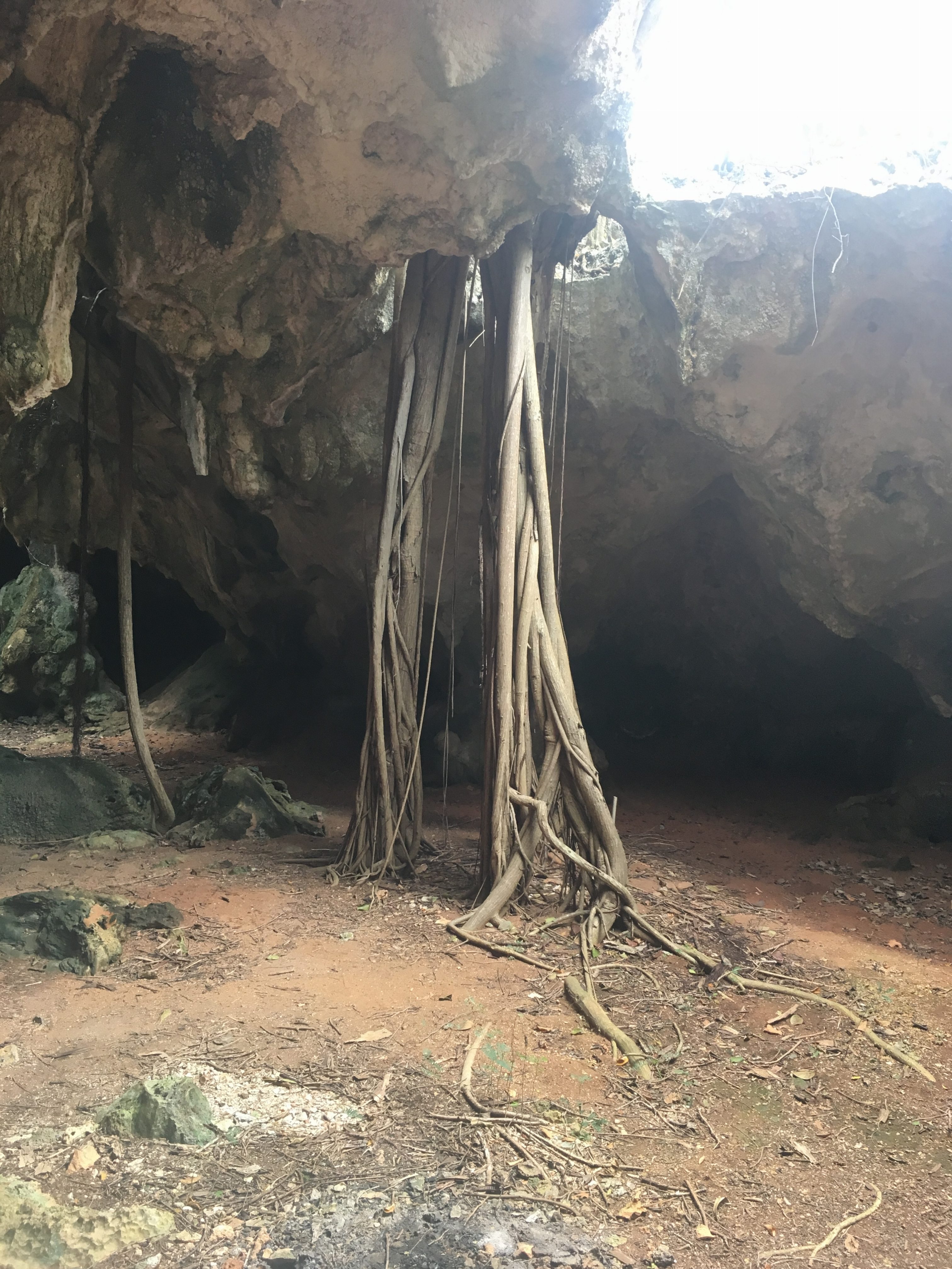
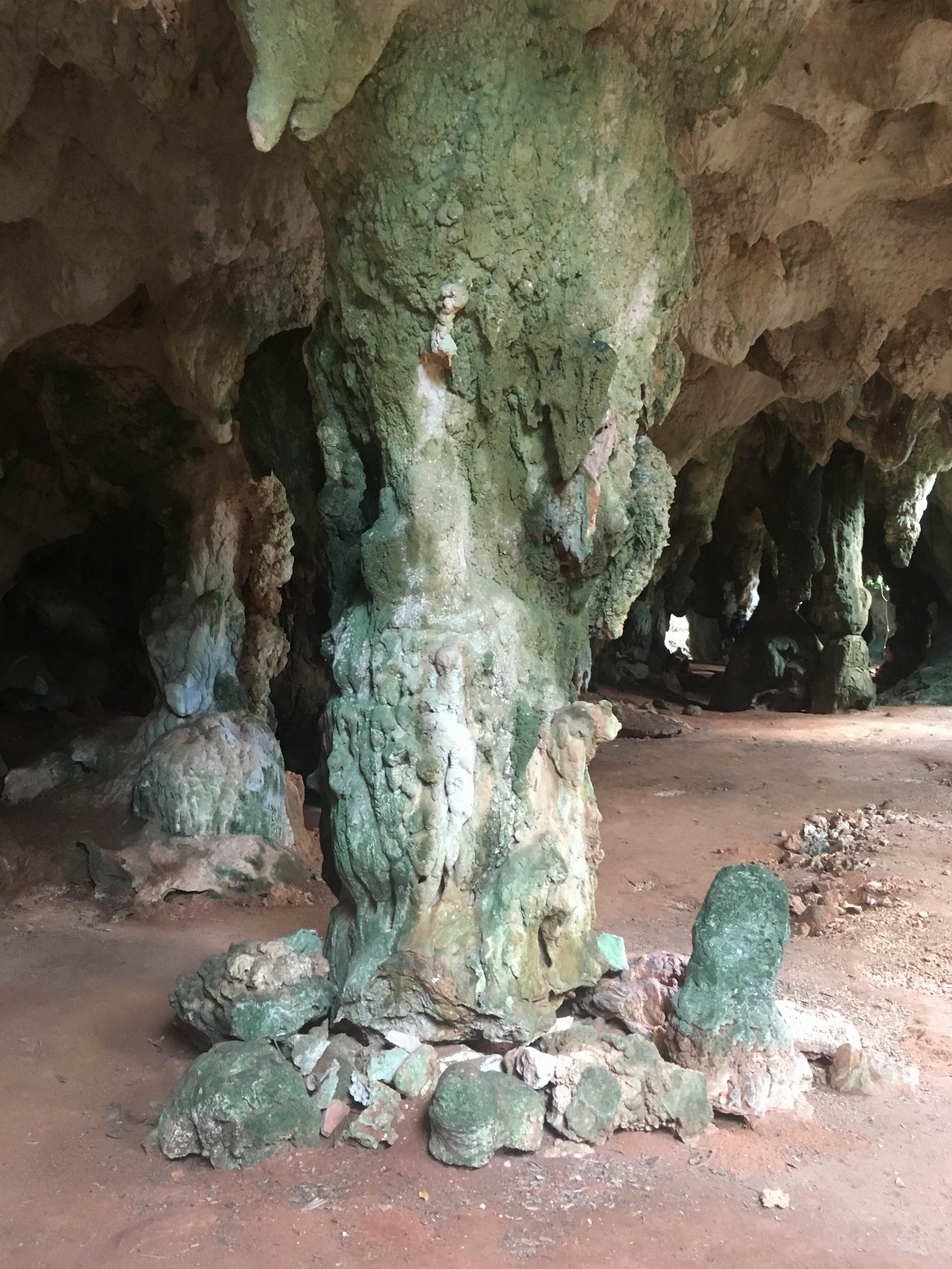
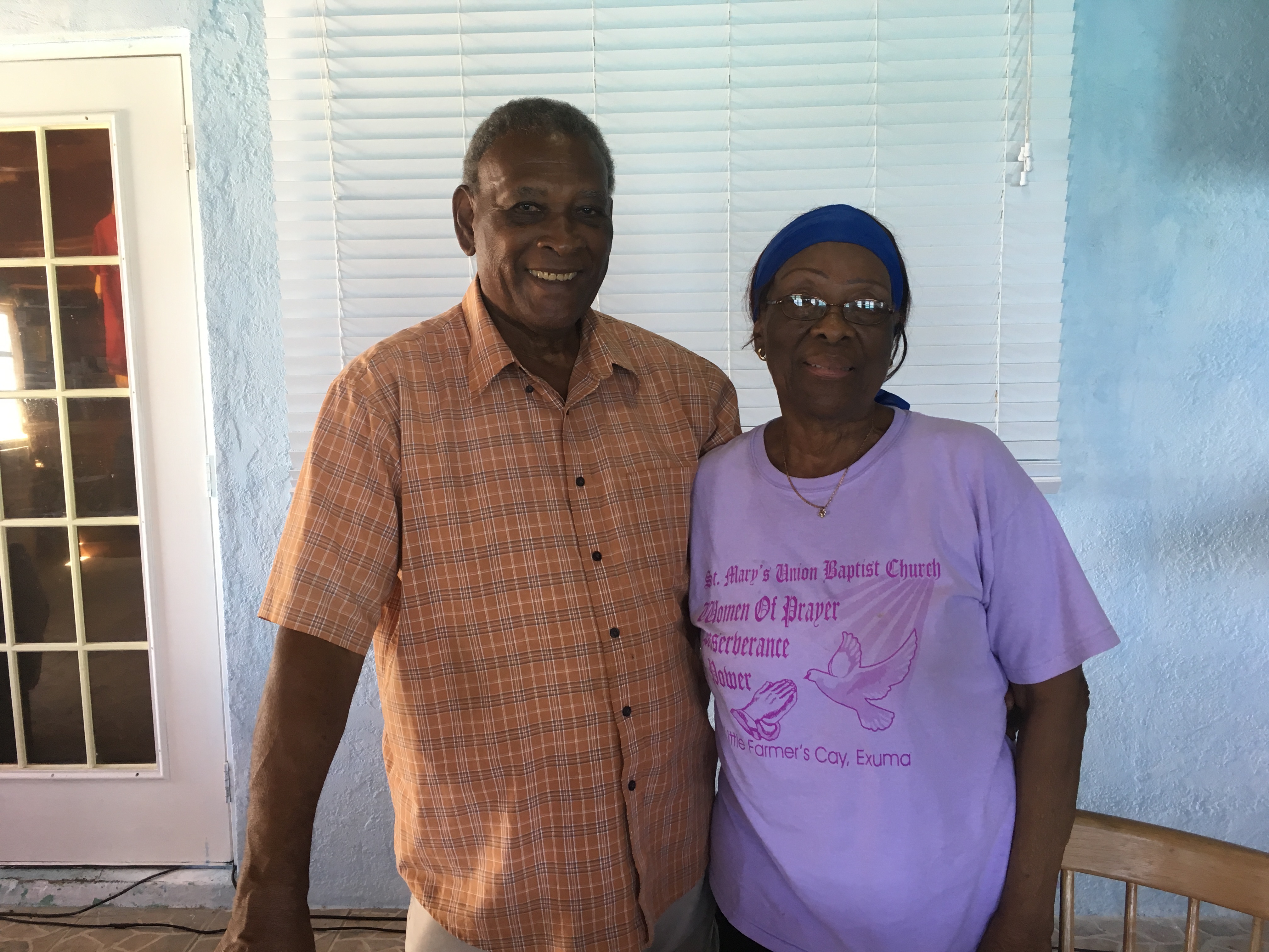
One of our other stops during our tour was a second cave system called Hamilton Cave…..it is usually a guided tour but the guide was already inside with another group so we just wandered around the main entryway waiting…..we decided happy hour was fast approaching and decided not to wait for his return…..
The caves in the Bahamas are frequently more caverns than true caves as they are open in many places above. This is generally caused by erosion and tree roots working their way through the ceilings looking for water……some of these tree roots look like bundles of telephone poles…..
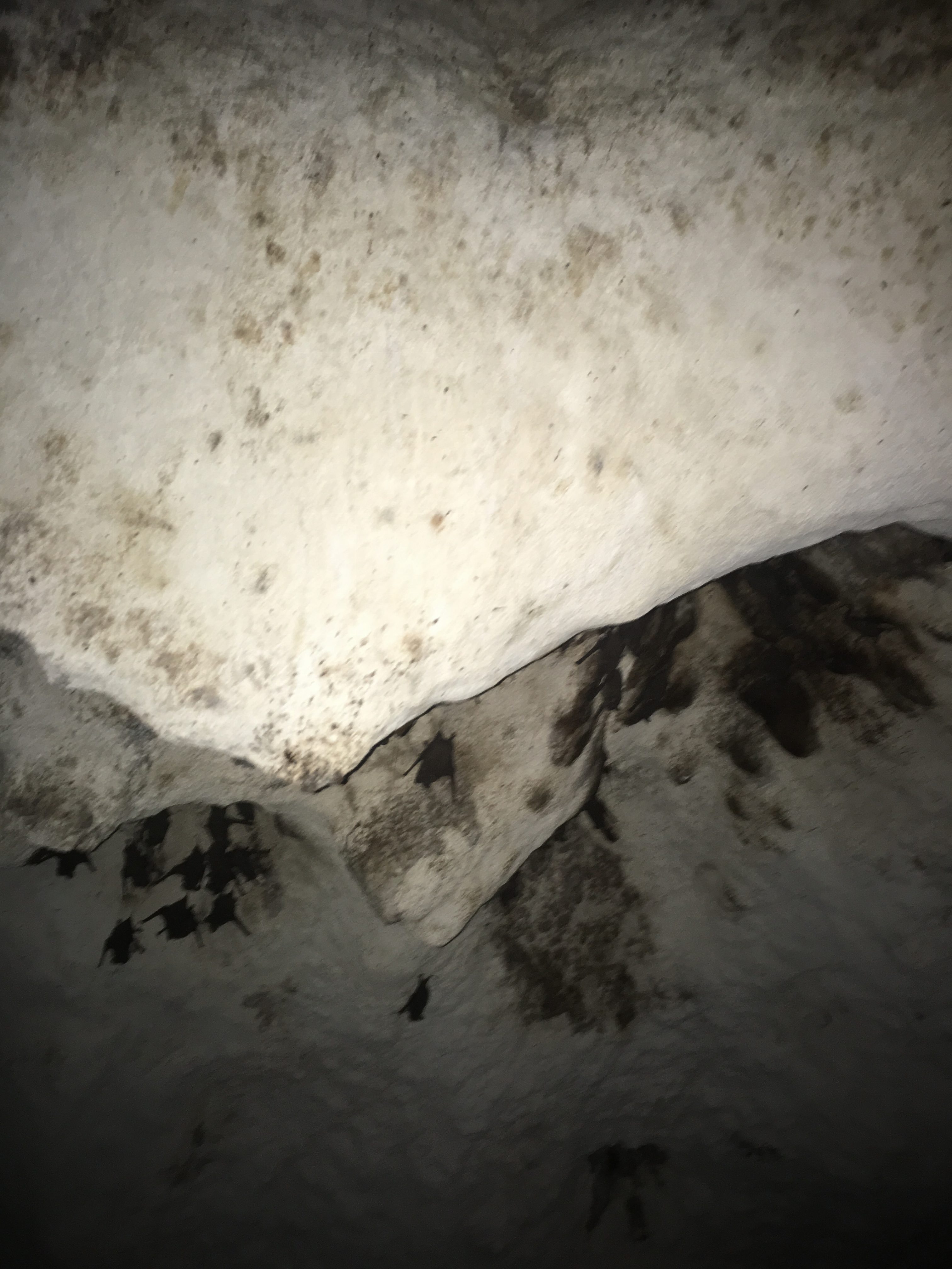
Bats ….!!!!
Another shot of Dean’s Blue Hole
The below photos are actually Shrimp Cave but somehow they wouldn’t stay in order as I was writing this post…..
Here’s a shot of Kim to round out this blog entry lounging on a stone formation on Long Island’s east beach……
So, in early February we made the run from Little Farmers Cay to George Town to send Mike home from that airport. We were sad to see Mike leave, but, he has a home and boat of his own. The palm fronds were taking over his yard and breaking out all of his windows (hahaha inside joke there)……
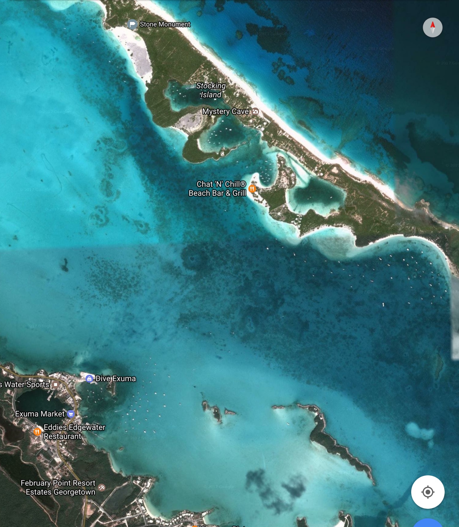
George Town is west of and adjacent to Elizabeth Harbor, which is bordered on its East side by Stocking Island. Stocking is the home to a few interesting sights. Boats in George Town tend to do what they call the “George Town shuffle”. As the wind changes directions the boats scurry from side to side of the harbor trying to hide from it to insure a smoother night’s sleep at anchor and a shorter, drier dinghy ride to shore. We are fortunate enough to weigh in at about two to three to three times what the average sailboat weighs, so unless it’s blowing over 20 knots consistently and we are very exposed we sleep well at anchor no matter what. That weight, coupled with our 85lb Mantus anchor and our inventory of 300′ of 3/8″ chain tends to keep us in place and peaceful once we set the hook. It has the added bonus of allowing us to avoid anchoring close to the crowds all desperately seeking that protection.
The below image centers on Elizabeth Harbor…..with George Town in the lower left corner. One of the interesting features of G-Town is Lake Victoria. That’s the small lake in the center of town that is open to the harbor via a small overpass/tunnel that makes you feel like you’re on a small water ride at Disney. I could never get a straight answer from anyone about whether or not the lake access was manmade or natural and the bridge was simply added for vehicular access…..but my gut tells me the water access was cut for boats to enter and the bridge added afterward.
Satellite image courtesy of Google Maps
We spent ten days, a few before Mike’s flight and a few after. We had to get away from G-Town though, as it is crowded and was becoming more so as the cruiser’s regatta approached. There were over 400 boats by some accountings. Now, don’t get me wrong…it’s a huge harbor….but that’s still a lot of people and boats for a lifestyle we chose because of an ability to escape crowds….We met some great people in George Town, we just didn’t want to meet ALL of them in one week…..
We are asked about George Town a lot and the only way I can describe it is a “summercamp” (although technically in winter) for adult boaters. There are quotidian activities that made it feel a bit like groundhog day, …..volley ball, yoga, art classes, water aerobics and so forth. It’s ok in small doses for us, but that’s about it. Different strokes for different folks. There were some people who stayed there for the whole season and it is their entire destination every year.
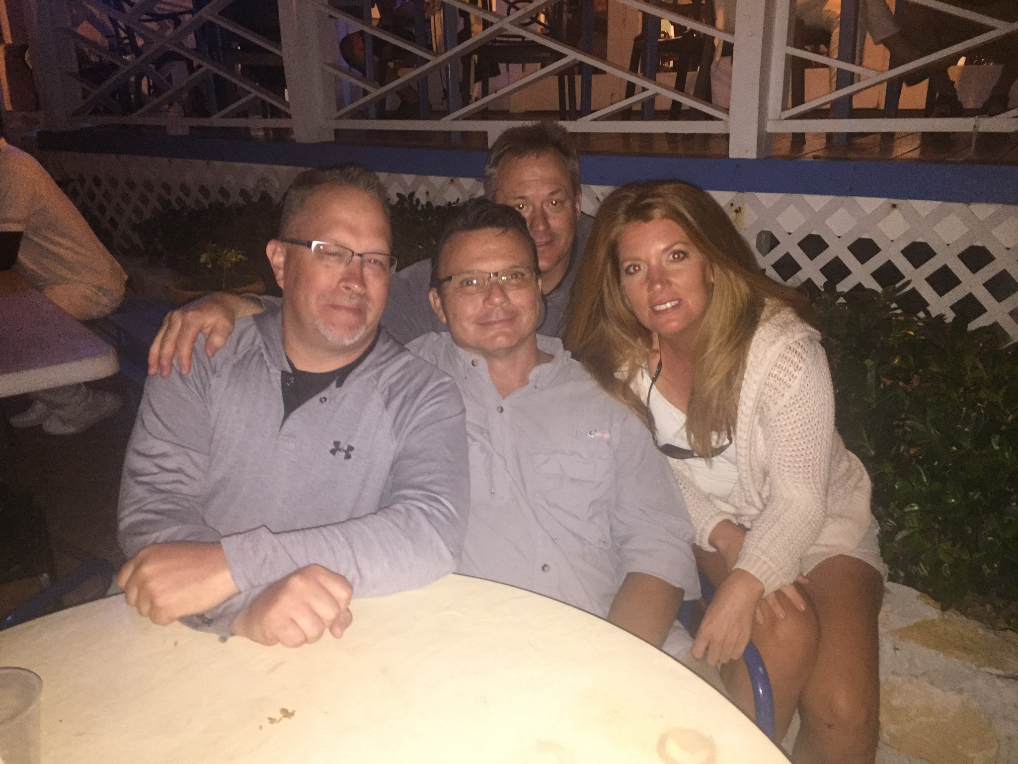
We went back to George Town a few weeks later when two of my childhood friends (Bob & Tom) came to visit for a week. That’s right..in the Bahamas it’s……Brett’s childhood friends 2 Kim’s childhood friends 0 ….hahaha
Swim faster Bob …..it’s coming …..
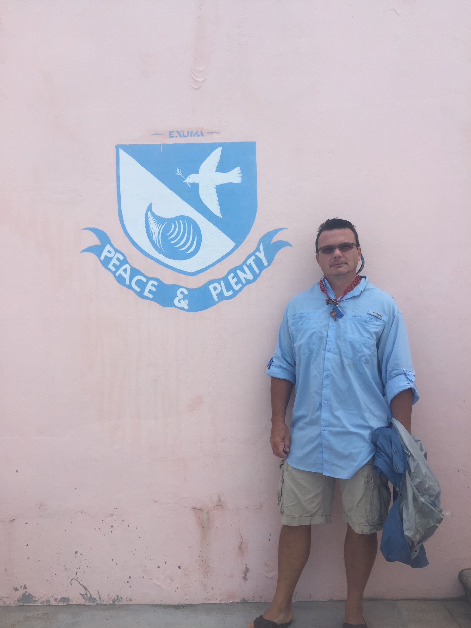
At Peace n Plenty ……
There was some decent hiking to be done, some spear fishing and snorkeling in the George Town area. We even managed to get a dozen whelk (a catchall name for a variety of species snails) which we boiled, cleaned and dipped in garlic butter. I thought they tasted like chewy lobster….Kim disagreed…..the parts we had to clean off made great bait though….
A whelk of the variety which we feasted upon…..
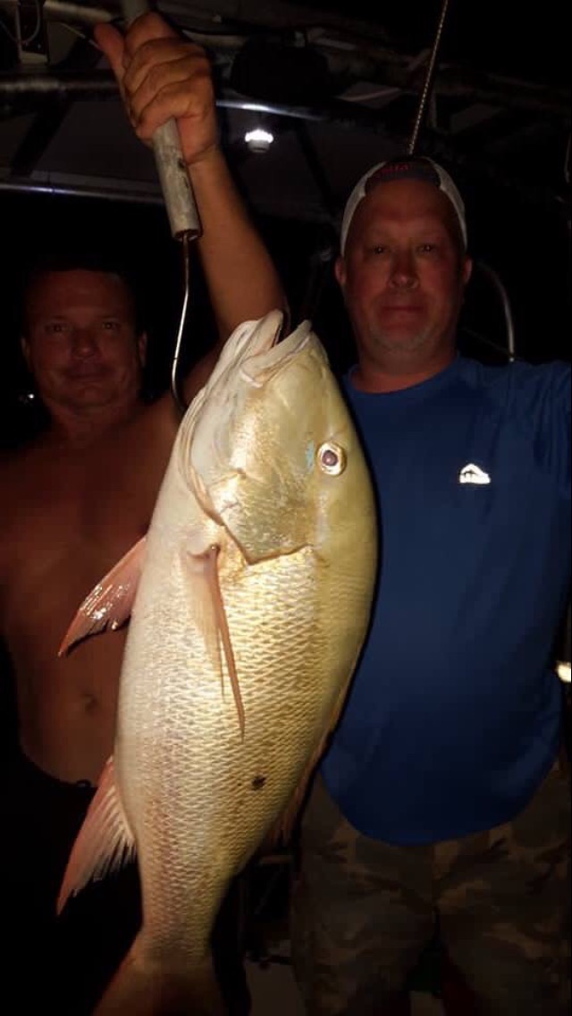
and Tom caught this …….he was kind enough to call it a team effort …..
Yes it was as big as it looks ….about 20 pounds…even the locals were jealous of this one
Tom and Bob looking for Atlantis…..on the east side of Stocking Island….
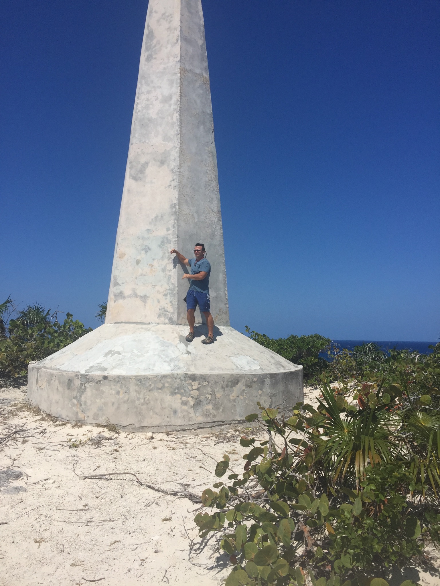
The stone monument on Stocking Island east of George Town……view from the bottom
The view from the top…..
Me…..one foot in the dark and one in the light …..as usual
Tom, me and Bob……at the Chat n’ Chill Beach
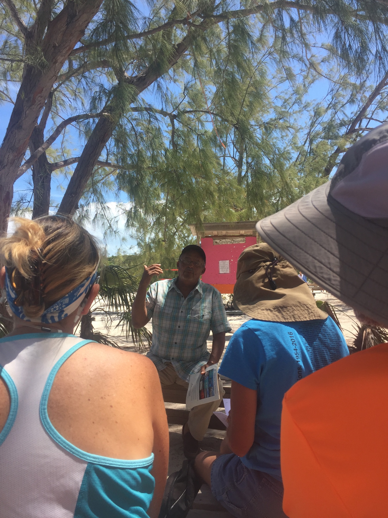
Cordell Thompson of the Exumas Historical Society giving a talk about the history of the Exumas…….
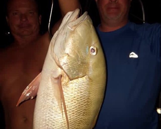
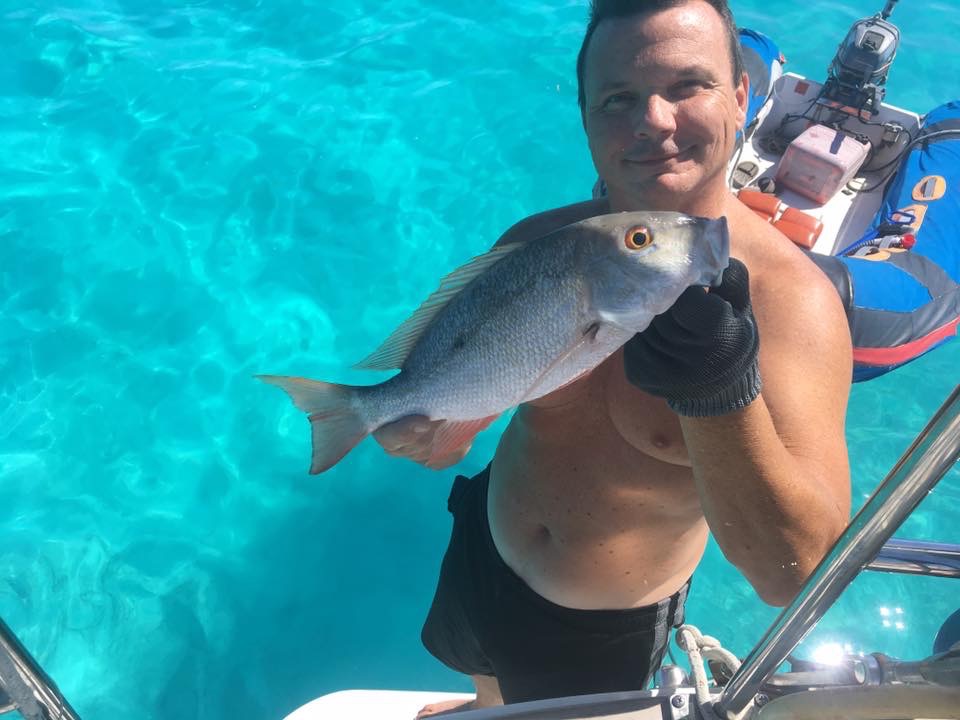
Mutton Snapper!!!! Caught during our first stay with Mike…
The famous Peace n Plenty hotel…..it became our favorite place due to Jamaro, Emmitt and Tim (plus his adorable son Mason) the bartenders !!!!
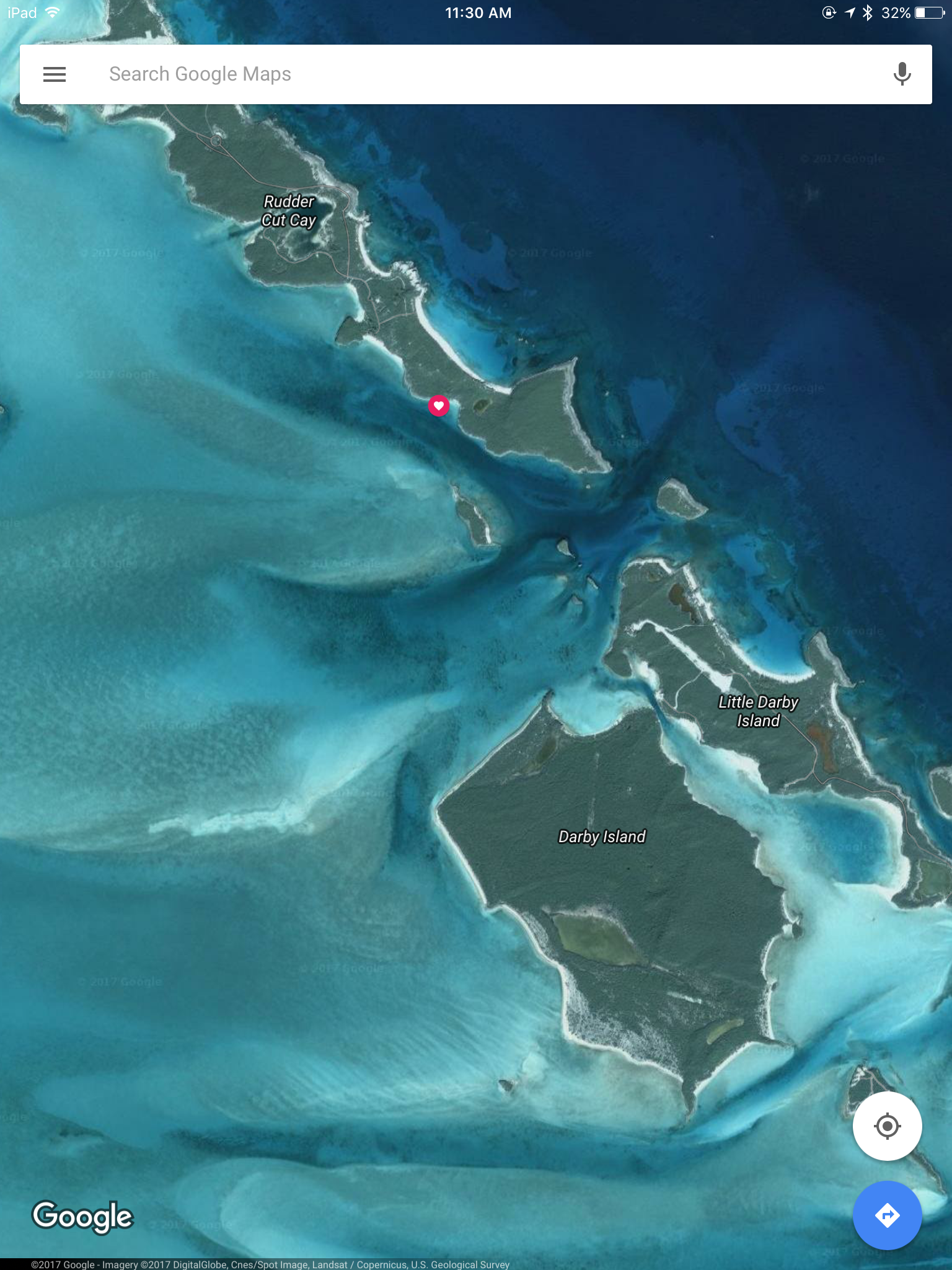
Leaving Little Farmers Cay was hard to do…..we made a quick hop down the Exuma chain and tucked in behind Rudder Cut Cay which is one of a few islands in the area owned by David Copperfield.
Image courtesy of Google Maps
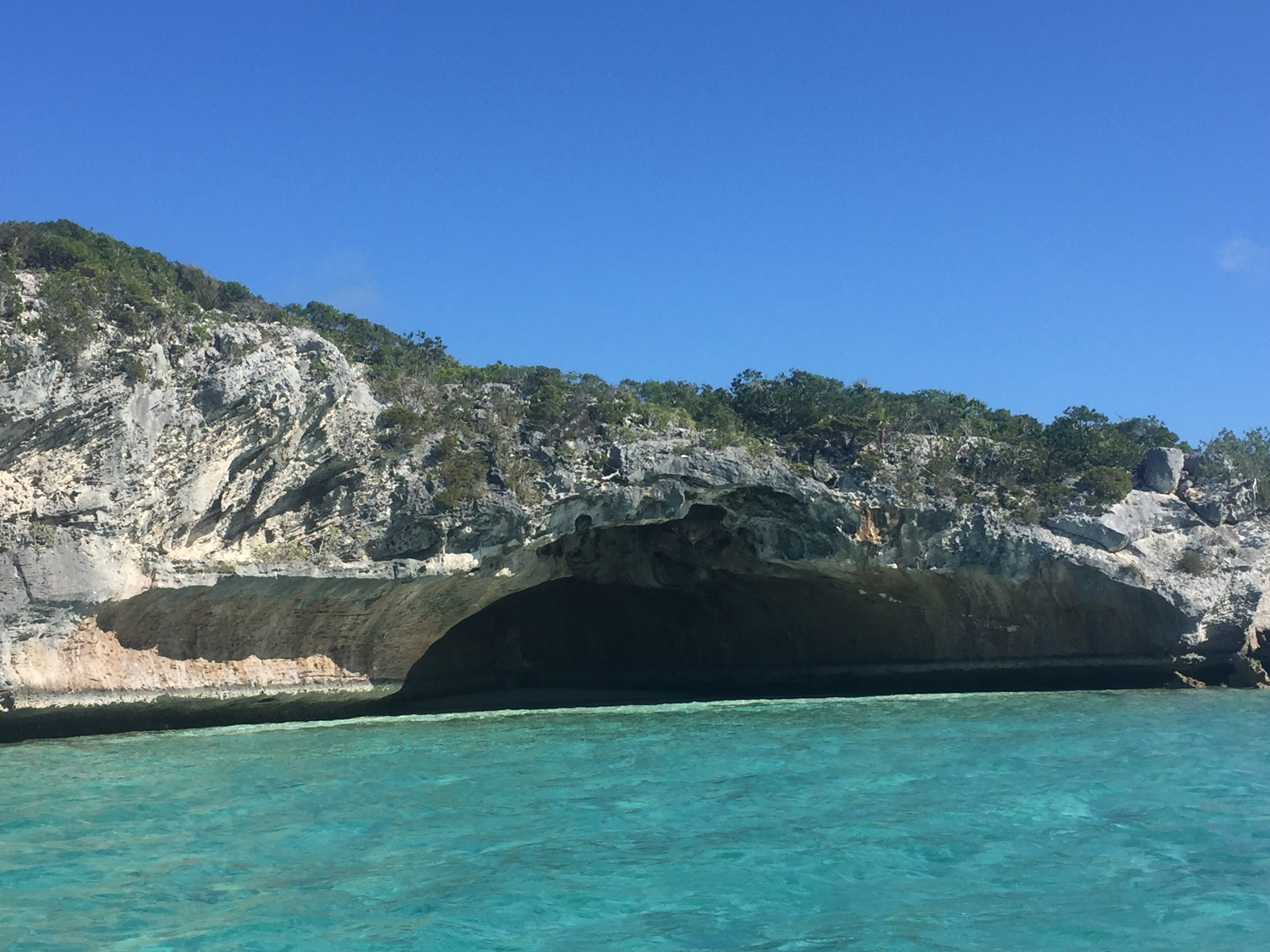
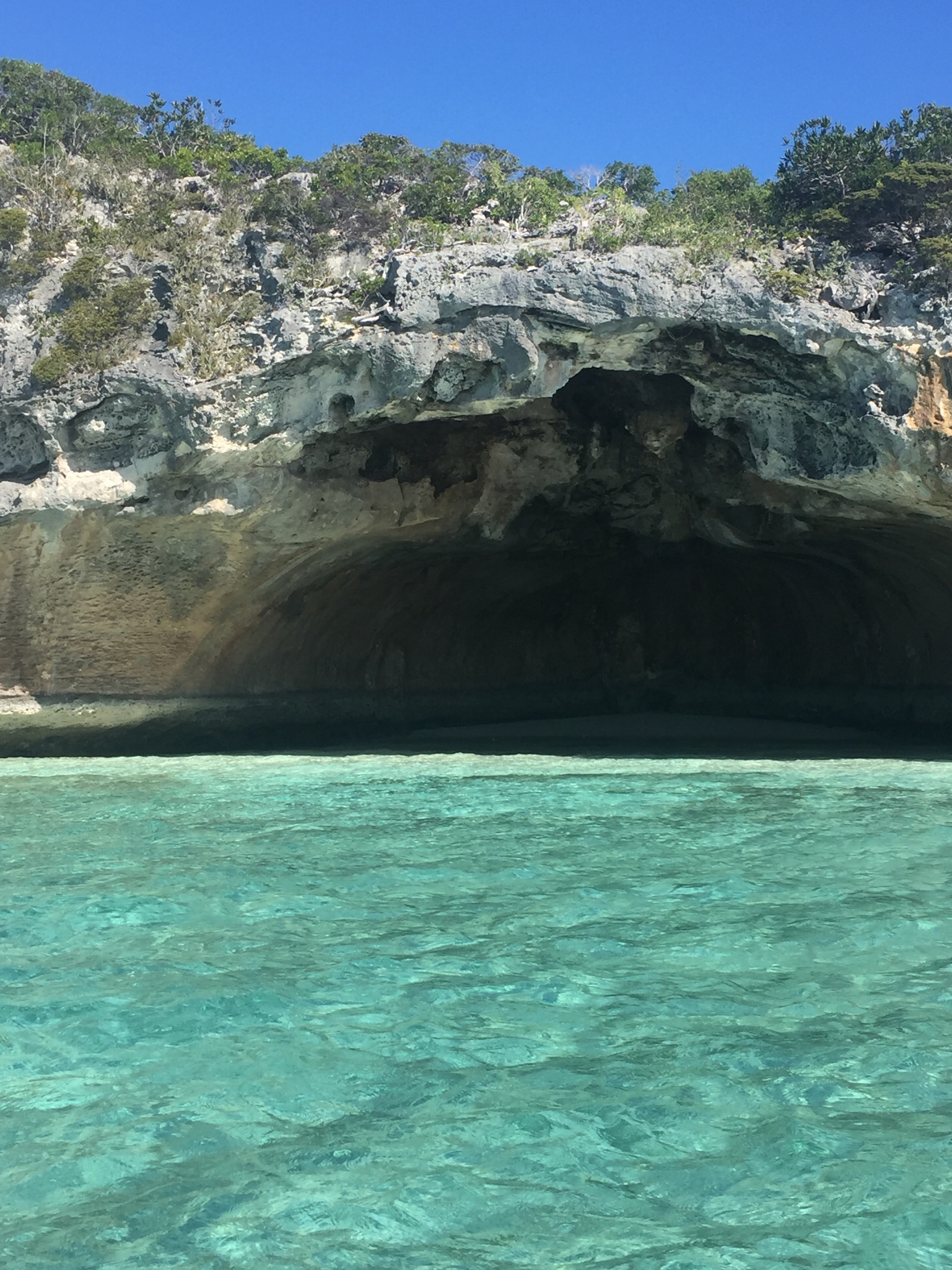
This is a cave located on one of Copperfield’s islands…..we went in, shot some pics and “disappeared” before anyone noticed us…..Tada!!!! …….there were actually some security cameras on the hilltops nearby……interesting note….you can only own an island in the Bahamas down to the high tide line on the shore….so, technically anyone can walk the beach as long as your feet are in the water…..
Kim all up in David Copperfield’s cave…..
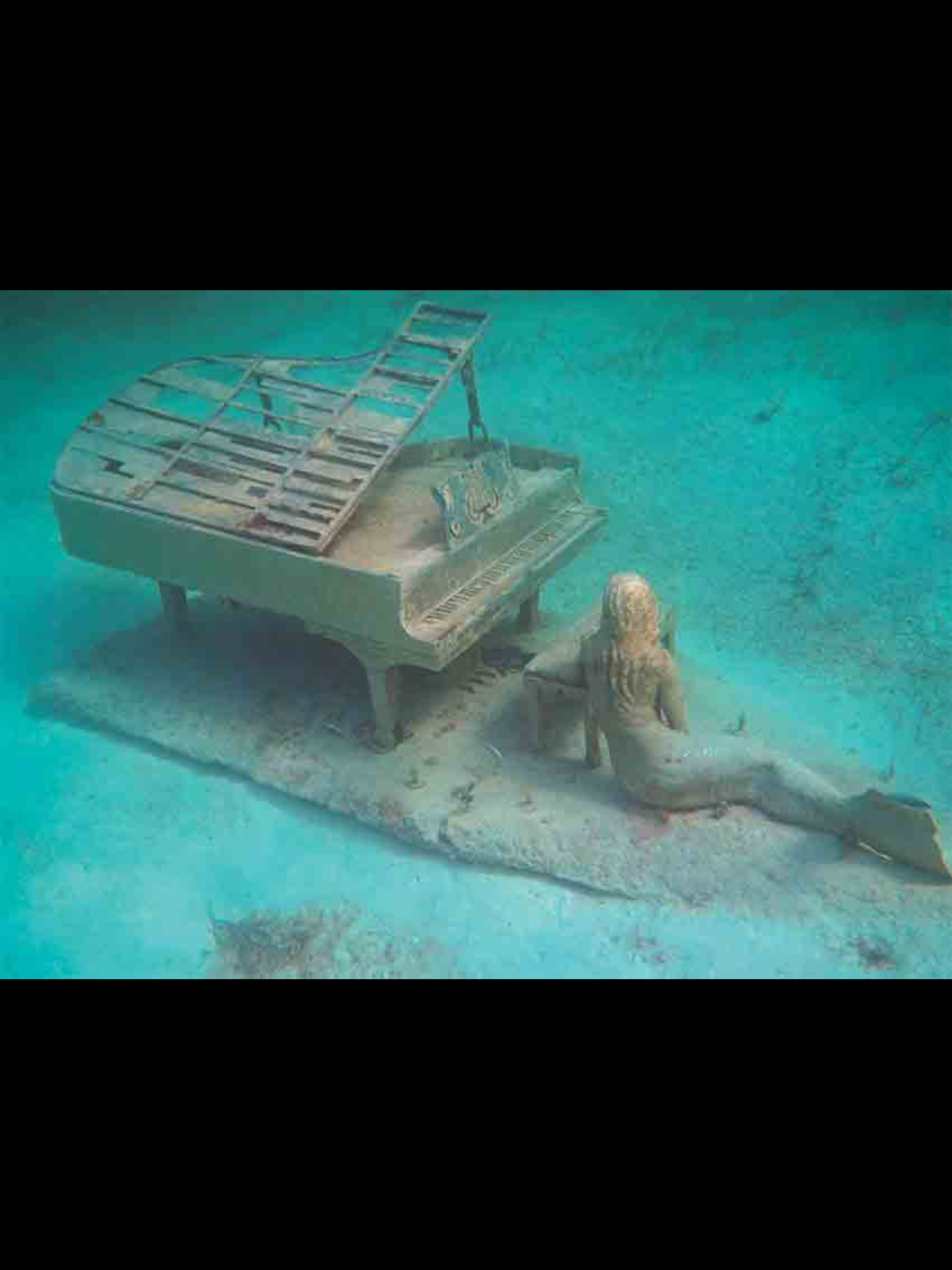
The famous Piano and Mermaid statue submerged just off Rudder Cut Cay… marked with the heart icon on the satellite image…..
A few Mermaid shots through our look bucket (a glass bottom bucket)….
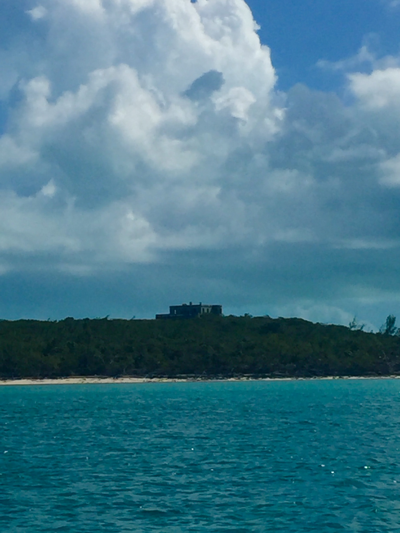
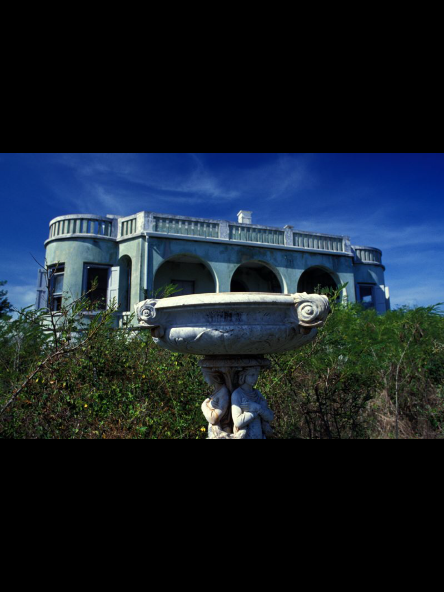
Before and during WWII Darby Island was owned by a Nazi sympathizer and hotelier named Baxter. He built an 8,000 square foot “castle” on the highest point of Darby Island in 1938. I interviewed a few older locals and they reported seeing strange flashing lights during the war from the rooftop of the castle. Later they discovered these were signals to U-Boats that would come to the large dredged channel and concrete dock on the east side of the island and reprovision. Some of the people who worked on the plantation talked about seeing an elaborate radio and telegraph station inside the house. Darby Island was reportedly one of the largest and most productive plantations in the islands at that time. Darby Island is currently for sale……
A long view of the Nazi castle…..
Closeup….and creepy ….
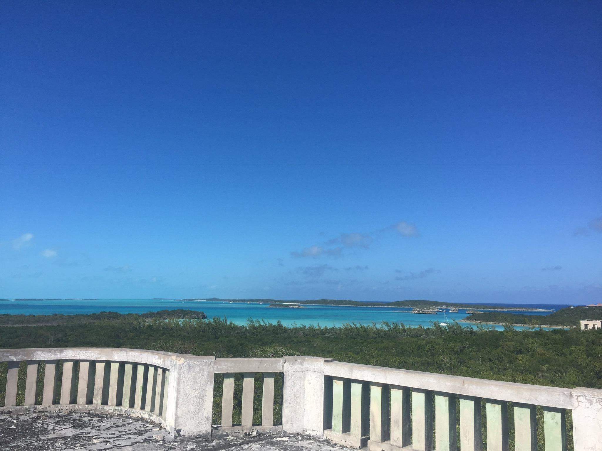
View from the balcony…..
Mike even found a Gordon’s gin bottle from the 1920’s buried in the sand !!!!
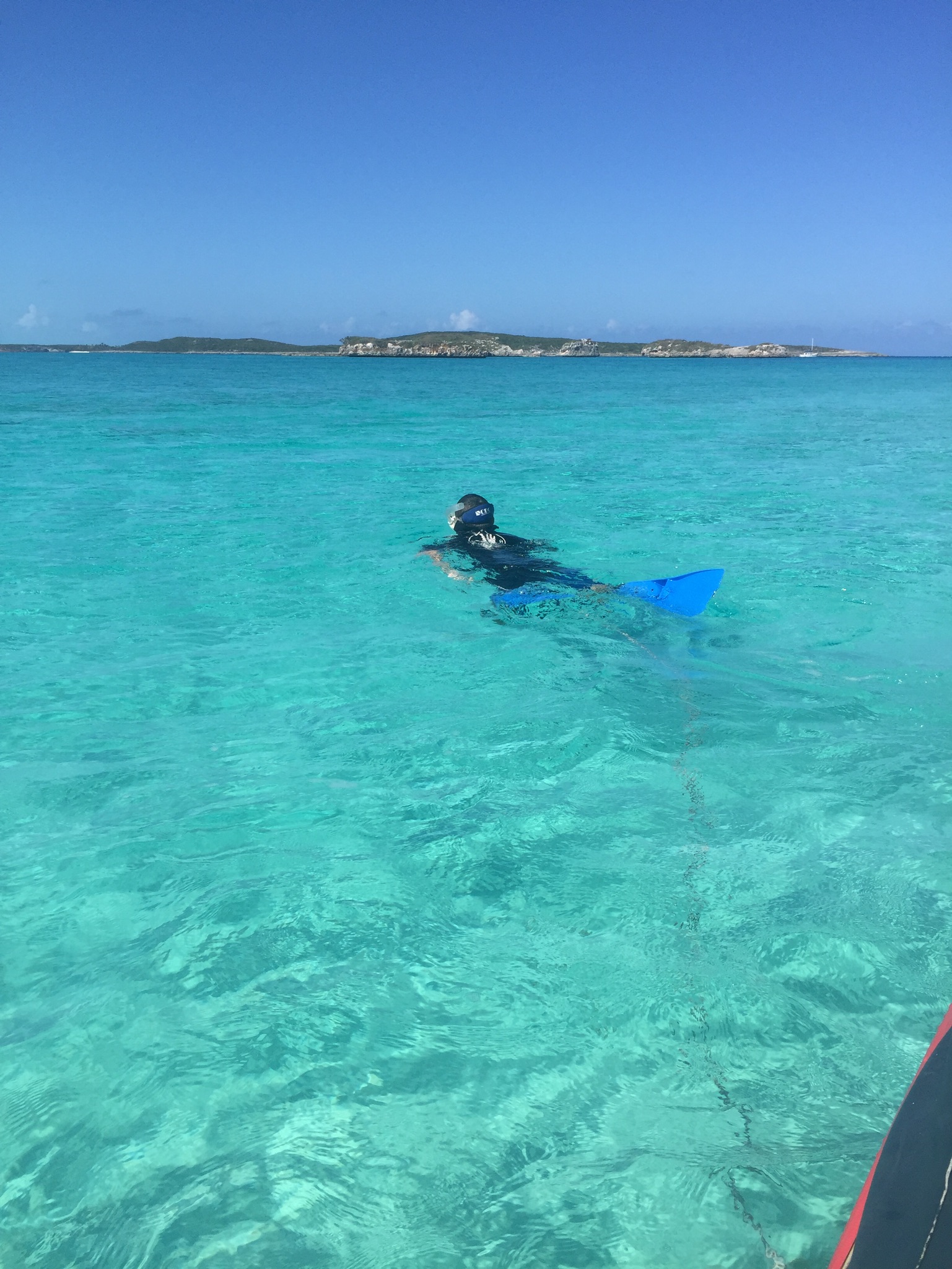
Snorkel towing the dinghy …..
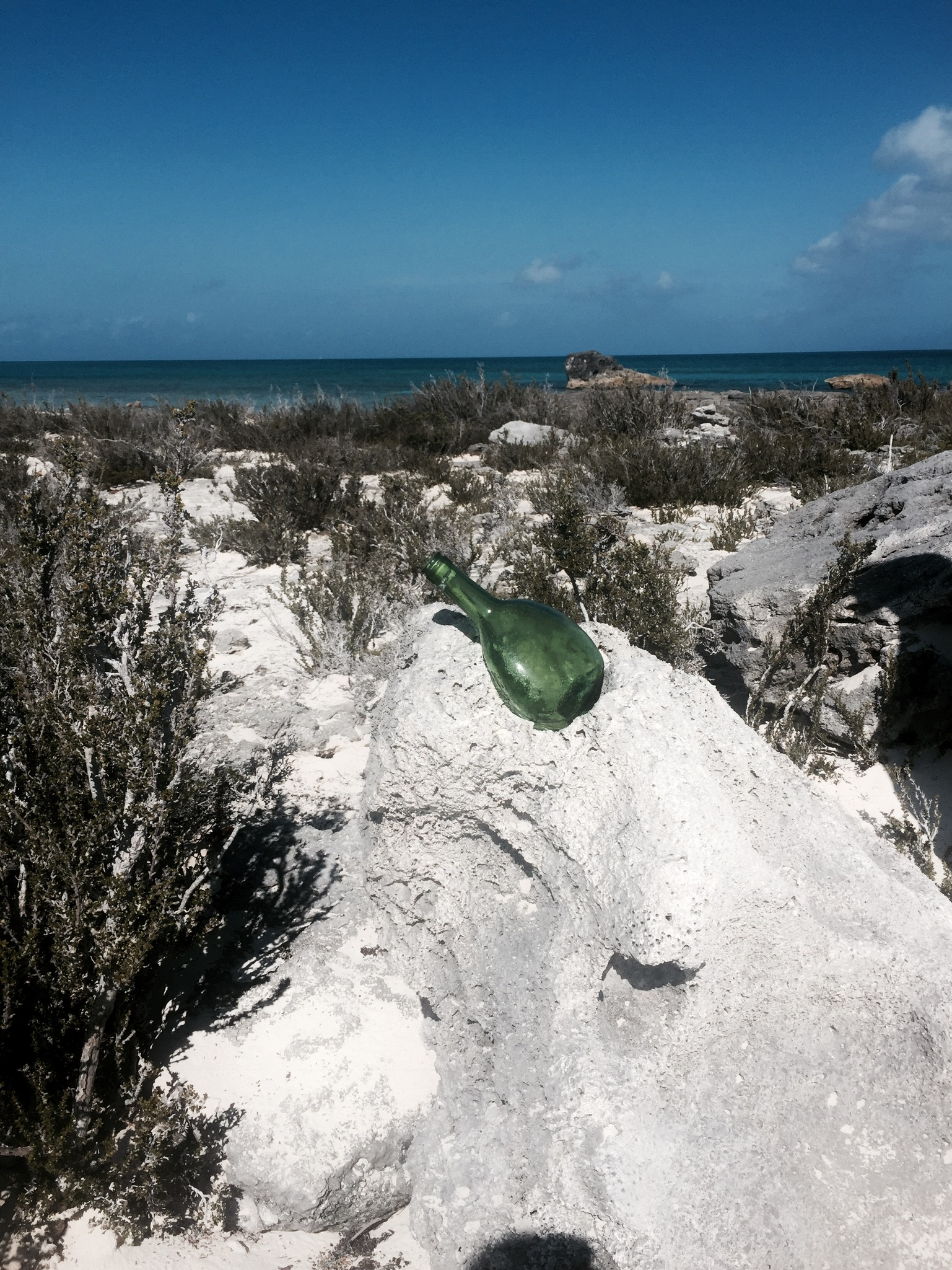
A message in a bottle…..set adrift on our way to George Town the next day……
It’s time again for a quaretly entry from the “Crewman Stoopid” files….courtesy of our guest writer……..enjoy
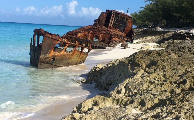
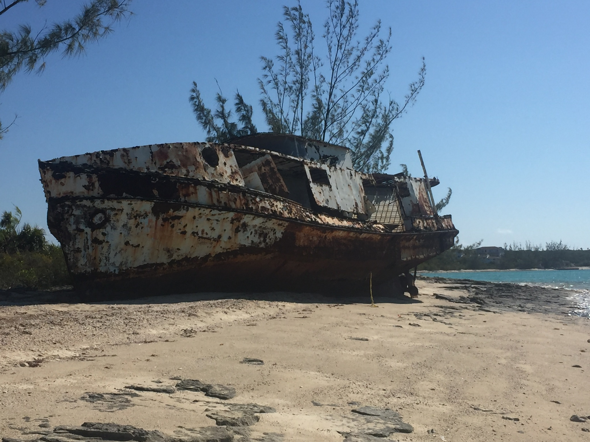
“What in the world is Crewman Stoopid doing?” said the Captain to the Admiral. The Admiral looked over and saw Crewman Stoopid standing rigidly at attention and saluting a wrecked ship on the Bahamian coast. “Oh that?” she said. “That’s a family tradition for him, going back quite a few generations as I understand it.”
The Captain looked at the Admiral, looked back at Crewman Stoopid, and then again at the Admiral. ” I know I shouldn’t ask, but…..”
“Well as I understand it,” the Admiral began,” according to family legend there has been a Crewman Stoopid on every significant voyage or in every war throughout history.”
“But what does that have to do with saluting wrecked ships?”said the Captain, who, although he knew better, was unable to contain his curiosity about such a seemingly bizarre association between Crewman Stoopid and his family’s history of significant voyages.
“Well,” said the Admiral, who, because she had spent a lot of time tending to the various injuries of Crewman Stoopid, and had listened to many stories from him, knew more about him than most, ” according to Crewman Stoopid, there were actually four boats with Columbus when he came across. There was the Nina, Pinta and Santa Maria, and the San Miguel. That was the ship that Crewman Stoopid’s ancestor was on, but unfortunately it wrecked and all aboard we’re killed.”
“I’ve never heard of that !” the Captain exclaimed.
“Well of course not'” said the Admiral, “people want don’t want history to remember their failures, only there successes ” The Captain, though still dubious, remembered that the Admiral was more often right than wrong, and wisely decided to remain silent.
“And then there was the second ship with the Pilgrims, called Thanksgiving, which also had a Crewman Stoopid aboard and which wrecked, and the pirate ship who’s captain was actually Crewman Stoopid’s great great great great grandfather, named Robert.” The Captain thought a moment and said with a smirk “don’t tell me , let me guess, the Dread Pirate Roberts, right ?”
The Admiral gave the Captain THAT look and continued “the pirate ship was named Tinker’s Bell, after his father, who was a tinker, and who gathered his customers by ringing a bell, but unfortunately it was wrecked while attempting to capture a fishing boat, and all were killed.” By now the Captain was thoroughly confused and in complete disbelief at what he was hearing, but couldn’t stop listening. It was like watching a train wreck occur, you just cant look away even though you want to. “Then there was the civil war ship named Liberty, which was captured by the British and destroyed” continued the Admiral, “and the World War I ship also named Liberty, which was sunk, and the World War II Liberty ship named…” The Captain interrupted “wait..let me guess..Liberty?”. “No grumpy” said the Admiral “they didn’t name the Liberty ships in WW II, it was just numbered 1313, and it was sunk too.”
At this point the Captain just decided to give up, sorry he had asked his original question, and not even sure what it was. “Ahhh .. I think I understand now.” he said, hoping that was enough to secure his exit from what was clearly a no win situation .
“Good” said the Admiral, ” now maybe you’ll have a little respect for other people’s customs.” The Captain nodded slowly and said “absolutely.” And he meant it. He was very impressed that Crewman Stoopid ‘s family tree had survived. Then he reflected that maybe the tree itself hadn’t actually survived…. maybe it was just the nuts.
As we made our way South through the Exuma chain of islands, we found what would become our favorite stop…..Little Farmer’s Cay. We spent a total of about six weeks here (between February and March) before and after a short George Town trip to get Mike to the Airport for his flight home to Tampa.
Satellite Image courtesy of Google Maps
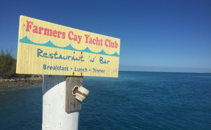
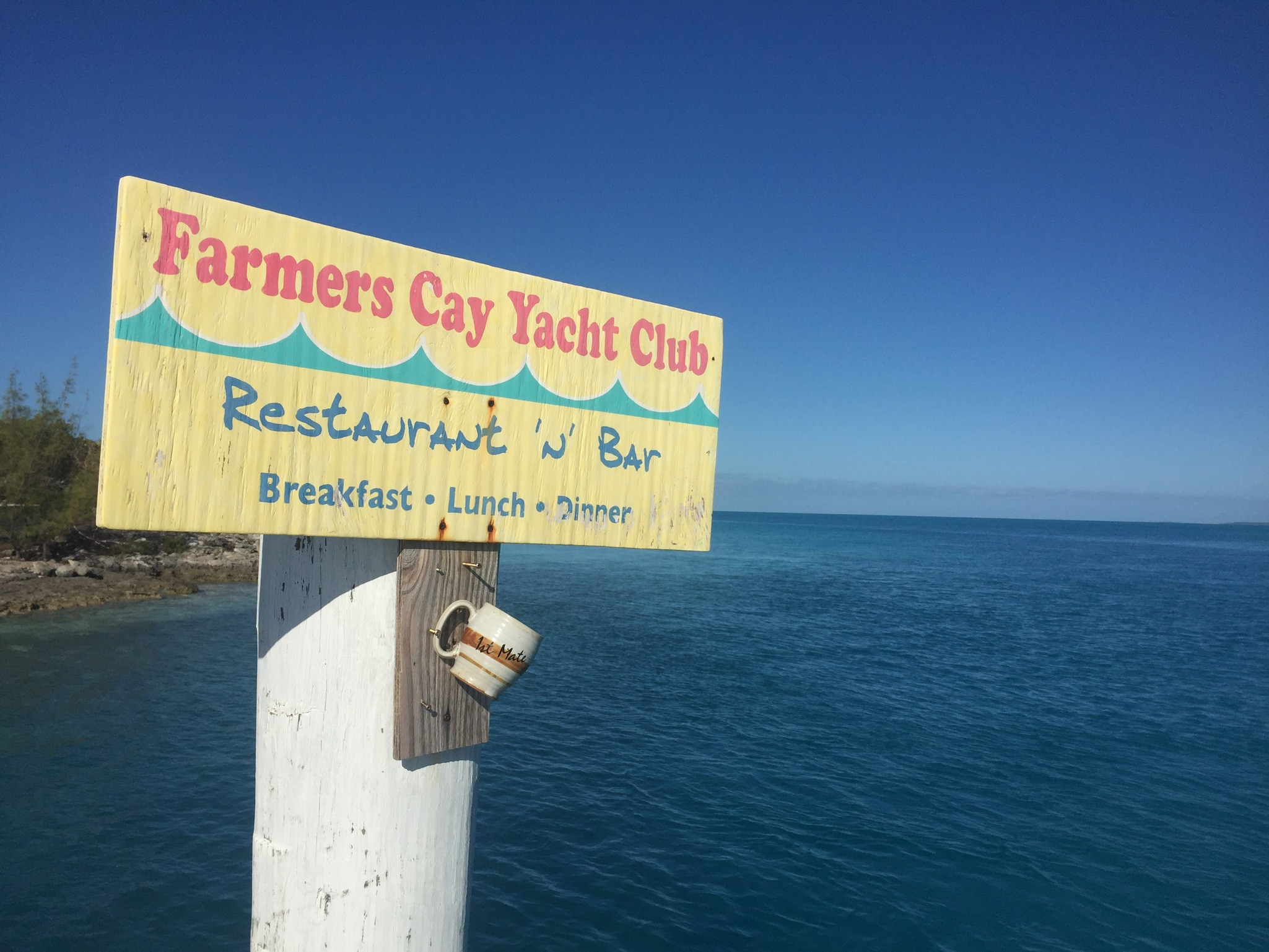
Little Farmer’s is home to the Farmers Cay Yacht Club (FCYC) which is located on the Northeast tip of the Cay. The FCYC is owned and operated by two of the sweetest people we have ever had the pleasure to meet. Roosevelt (Roosie) and Shirley (Bo short for Bolene, her middle name) Nixon have run this Marina for about 27 years and Roosevelt just celebrated his 82nd birthday !!!! Their son Julian and his wife Daryll live just down the street from the yacht club also and are an amazing couple. Julian works for the electric company and Daryll runs a gift shop where she sells her handmade jewelry and is also the local agent for Flamingo Air.
Kim decided to hang her coffee mug, formerly my mom’s, up for this shot…..
The Nixons !!! “Roosie and Bo”
My sister Jo and I in the cave on Great Guana Cay Northeast of Little Farmers.
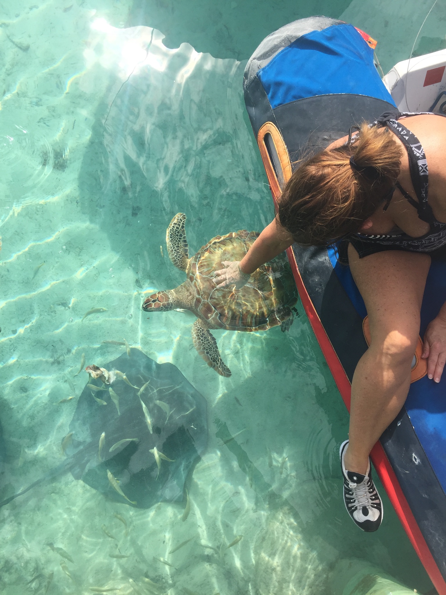
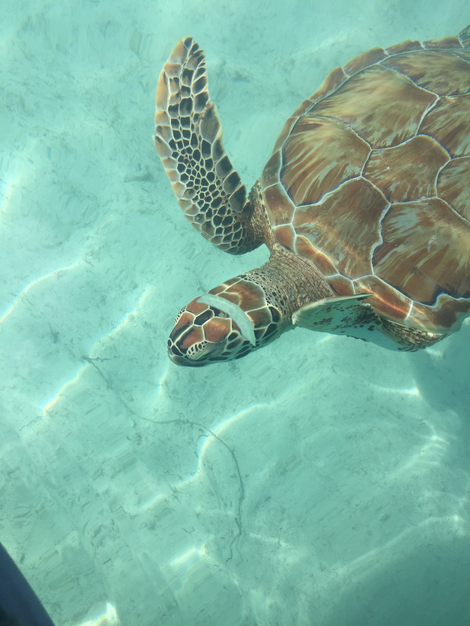
Jo realizing her lifelong dream of petting a sea turtle…..
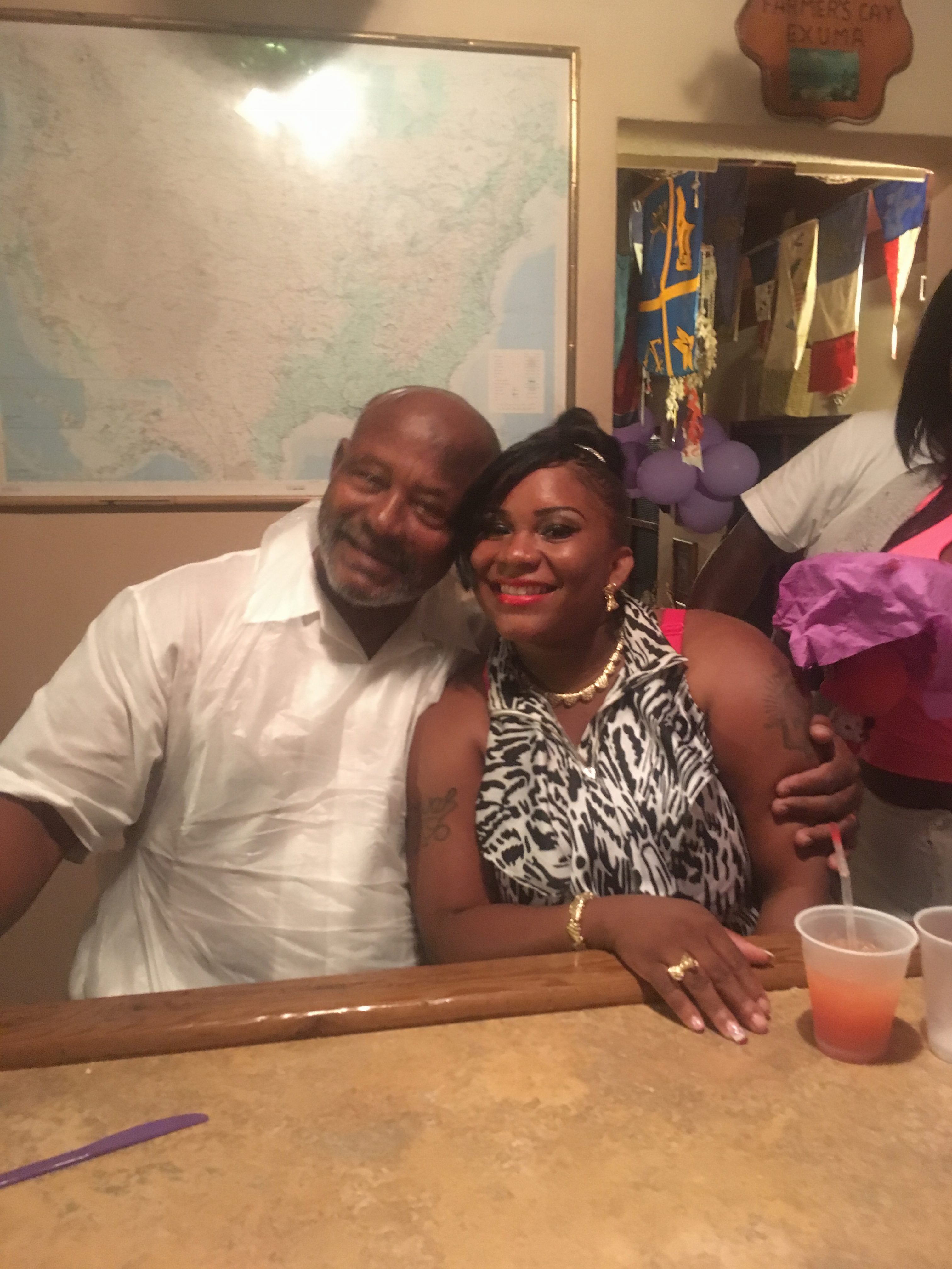
This is Kim and I with Earnestine Bain….wife of Terry Bain and co-owner of the Ocean Cabin Bar and restaurant. She is one sweet lady. There must be something in the water at Little Farmers that makes everyone so nice!!! She and her husband Terry (who took this photo and is pictured below at the party) have operated this establishment for over 25 years….Terry’s mother built the original bar. We attended their 25th wedding anniversary and Earnestine’s birthday party while we were at Little Farmers Cay…..it’s a great place and Terry makes a doozy of a drink named for the bar…..we came to know them as “the blue drinks that make Kim sleepy”
Terry and Merissa at the party….
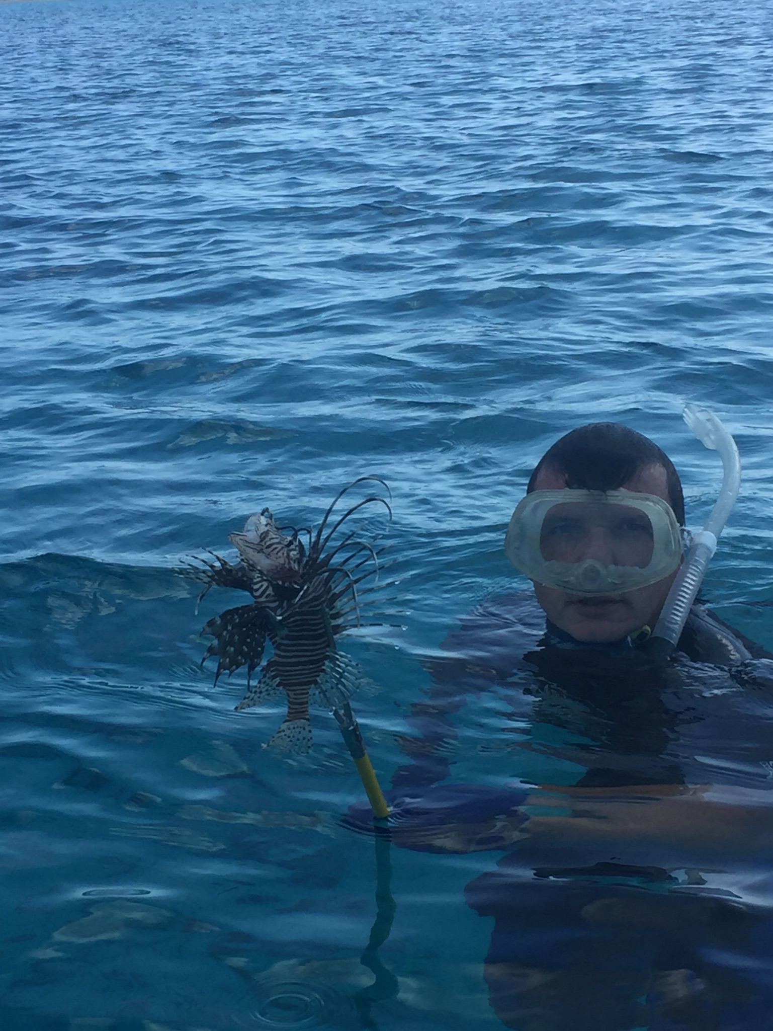
A freshly speared Lionfish….which I gave to our new friend Dave on a catamaran named Fifth Quarter…..then moments later …..
Dave’s subsequent Lionfish sting……if you ever get tagged by a Lionfish submerge the injured area in the hottest water you can stand for as long as you can…..sorry Dave…glad it’s better
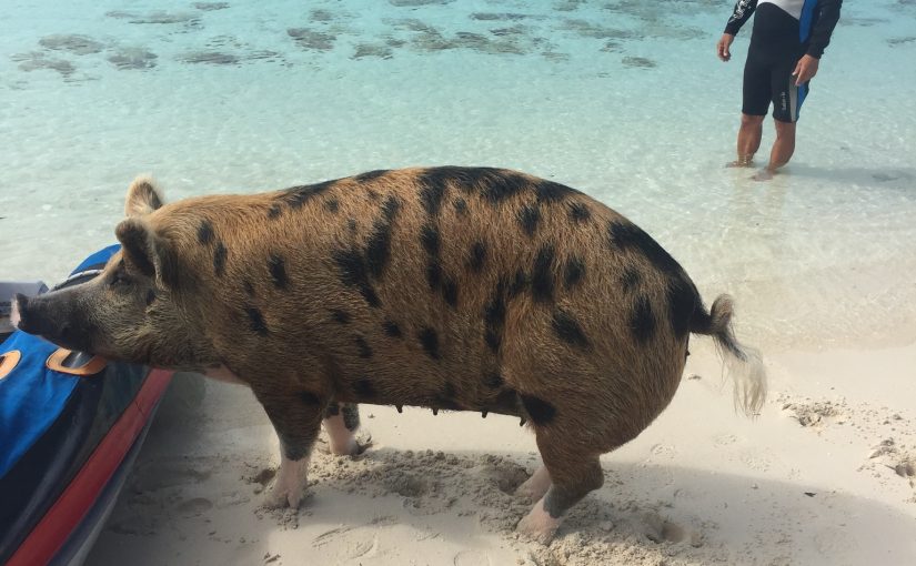
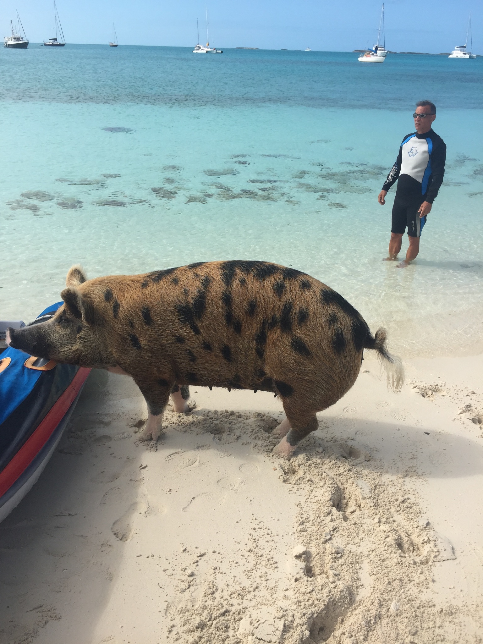
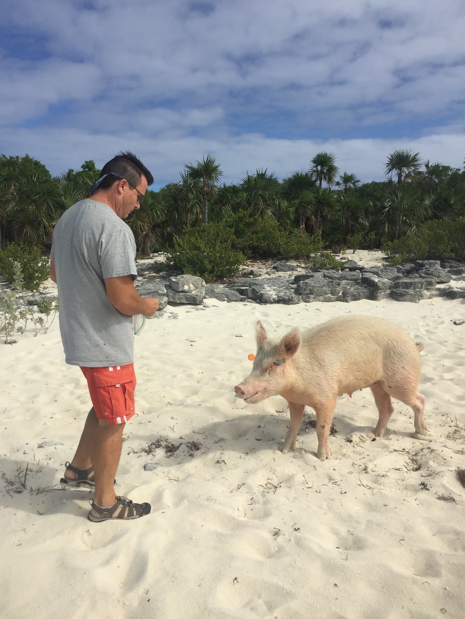
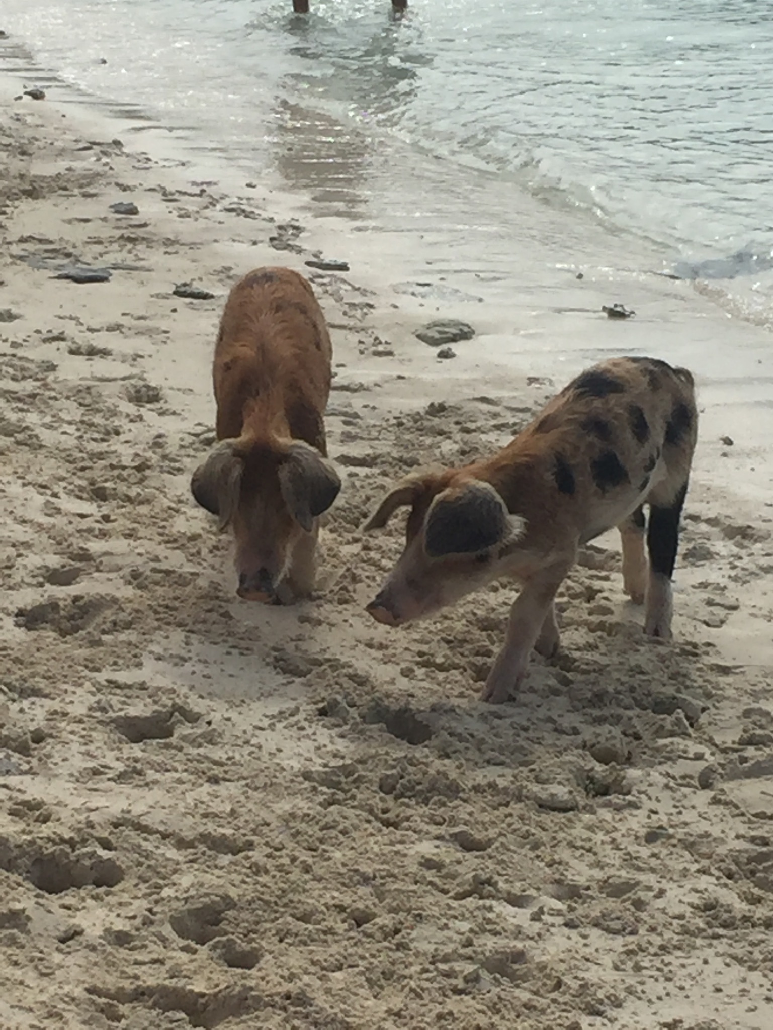
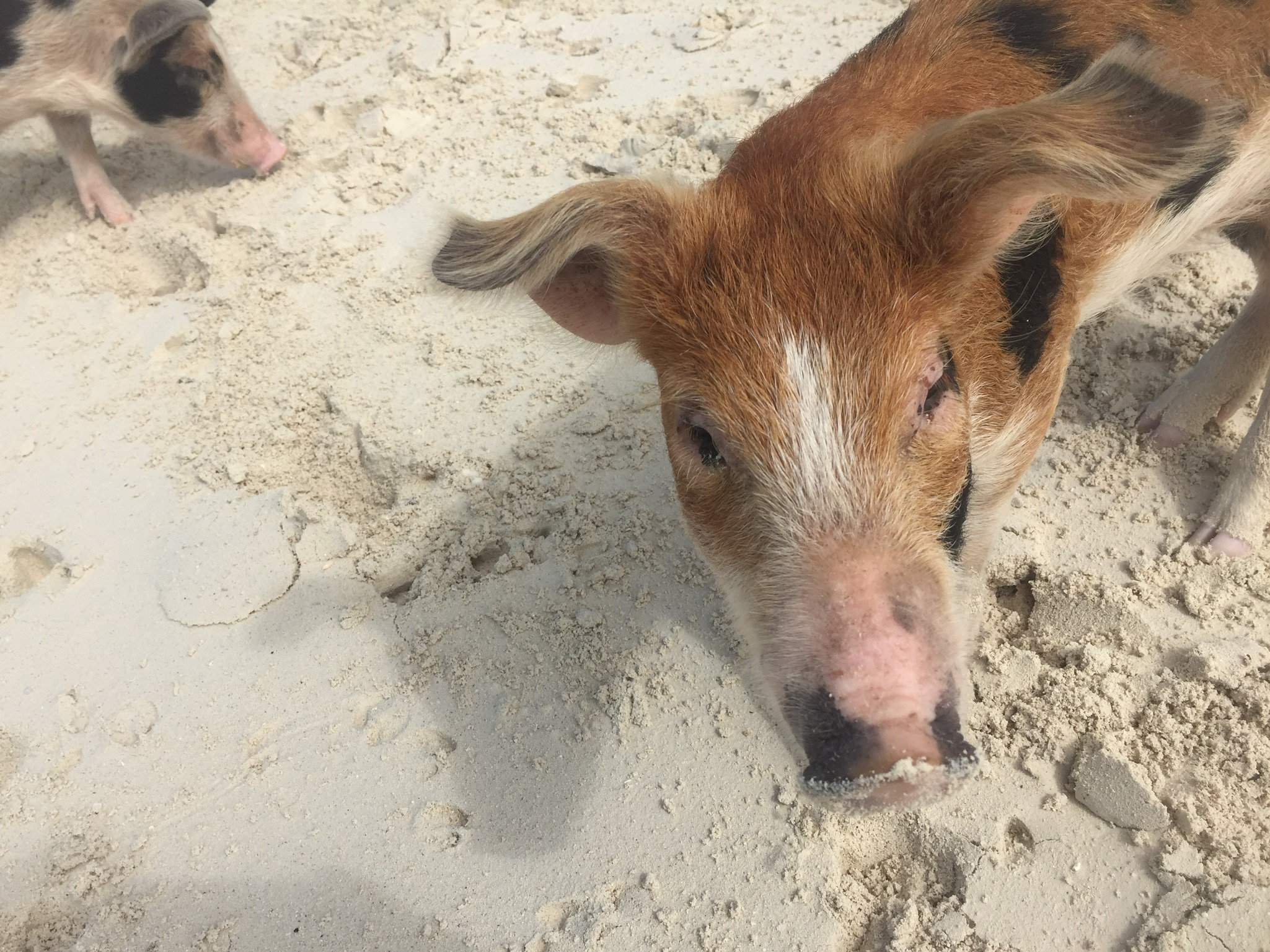
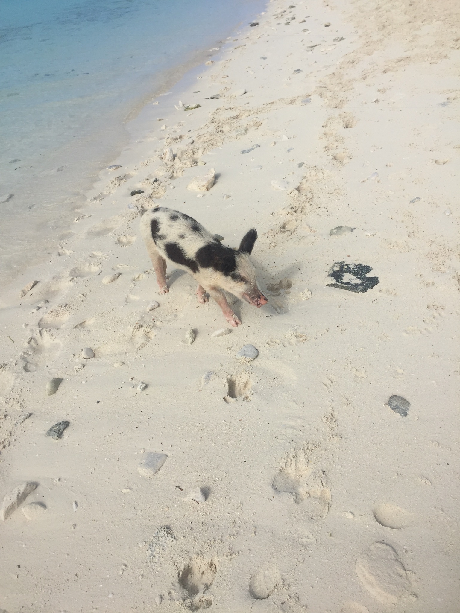
On our way South we stopped off for a few days near Staniel Cay which is also near where some scenes from the James Bond movie Thunderball was filmed. These were shot at the aptly named “Thunderball Grotto” ……We also hit Big Majors which is the Cay famous for the pigs who live on the island.
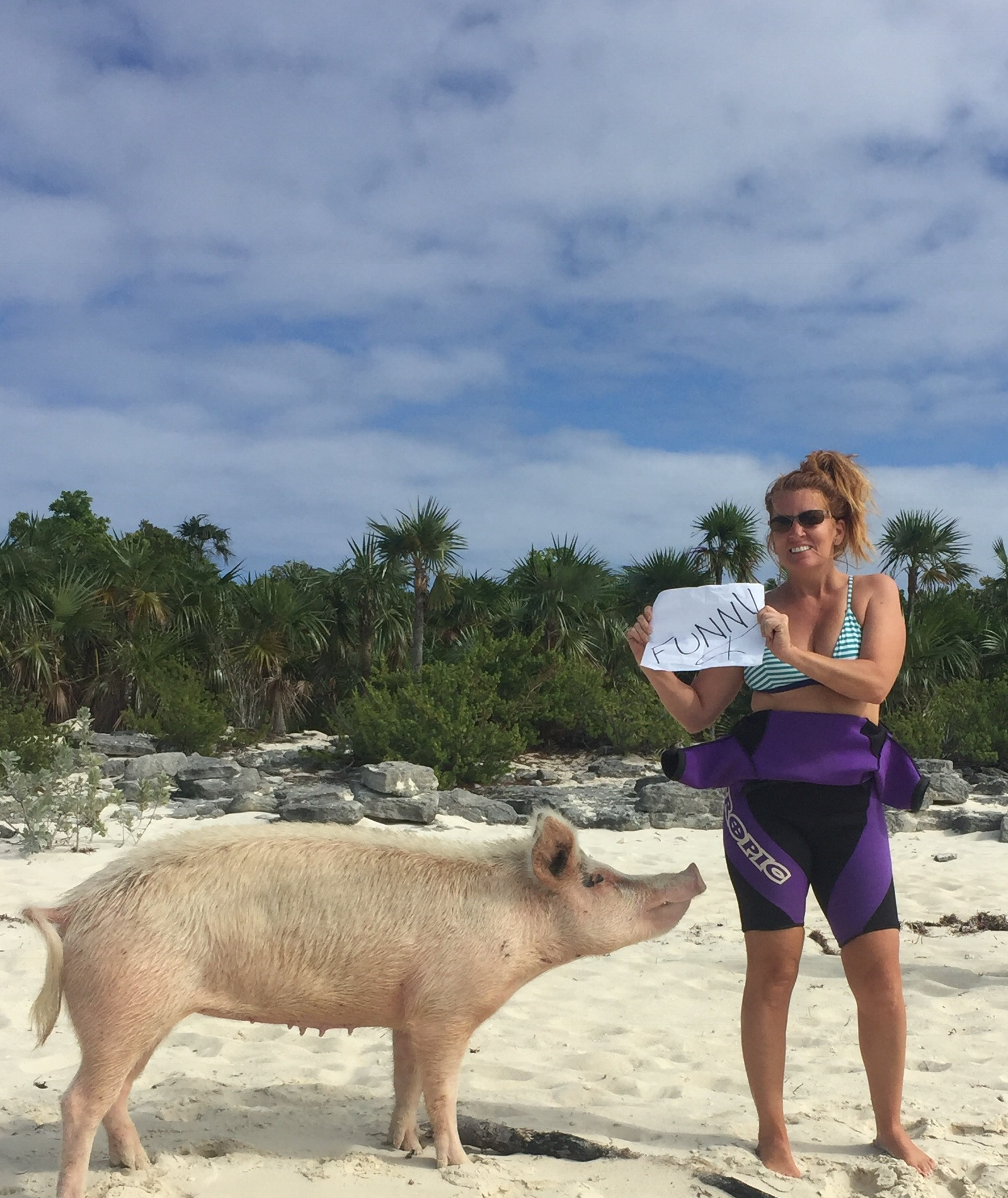
This is a shot of Kim which we made for a good friend’s son who needed photos for a project with words or phrases describing him. We thought it would be fun to add a pig….
Dinghy ride Piggy ??? Mike standing “guard” over the dinghy …..
So cute….
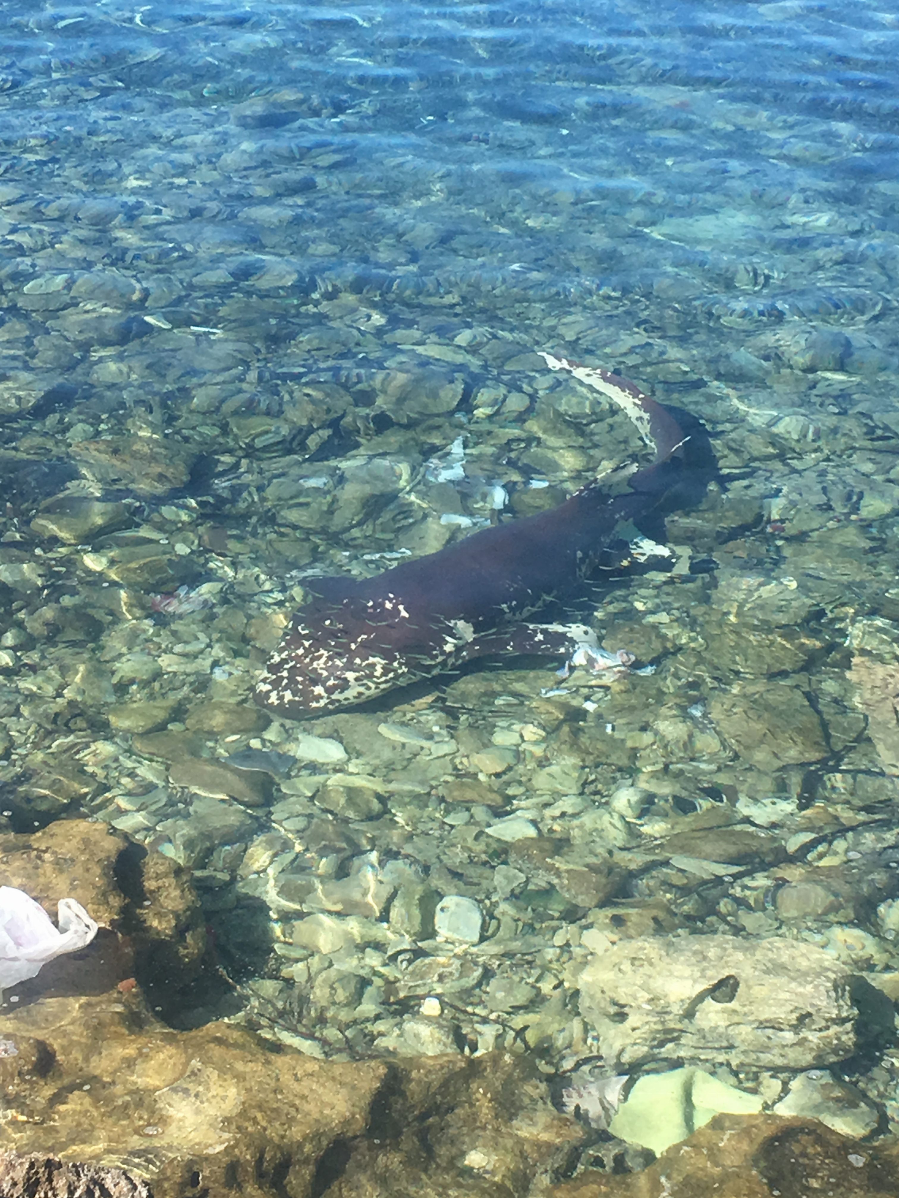
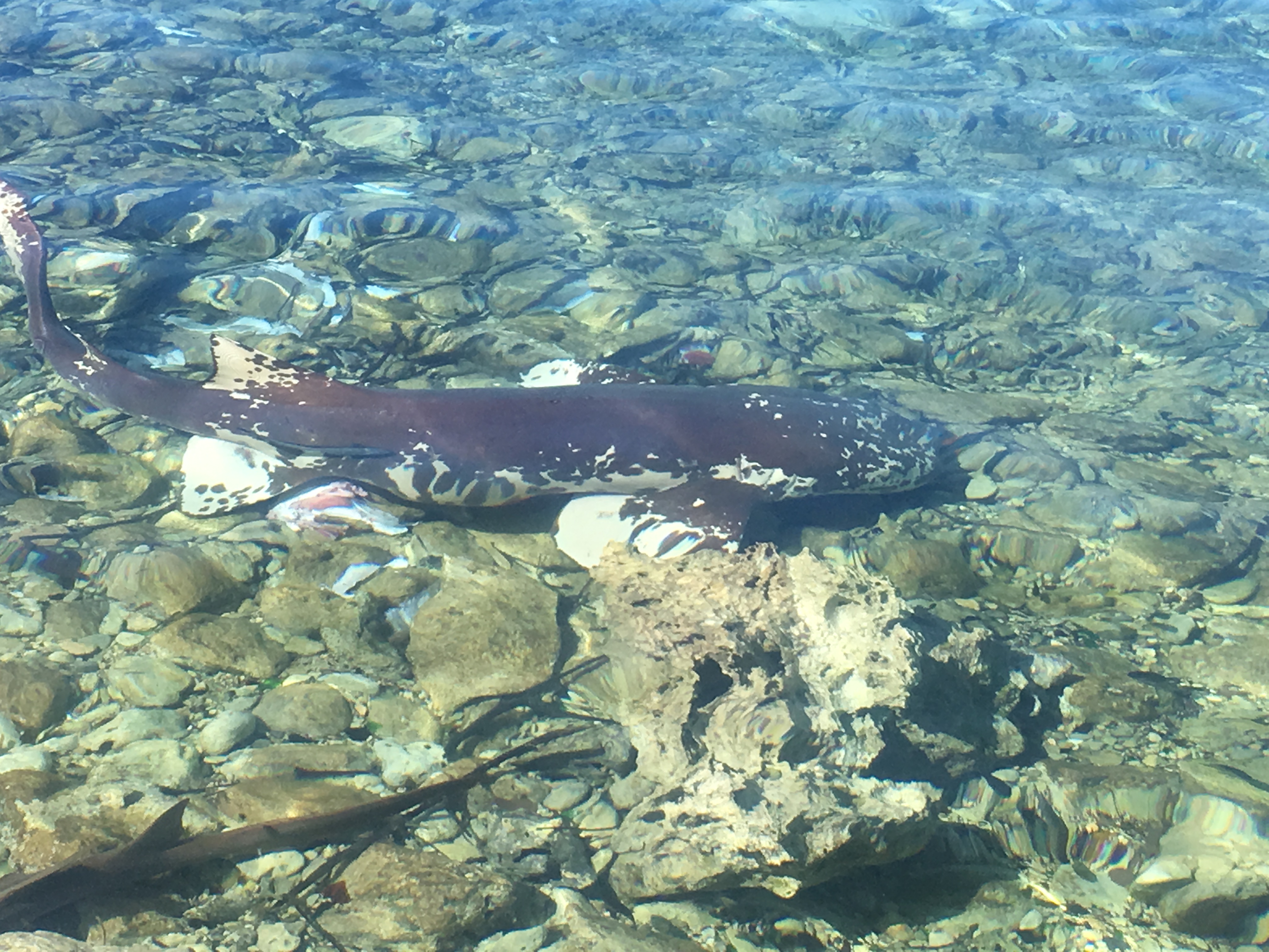
This was an odd one ….I’ve never seen a nurse shark with these kind of markings….
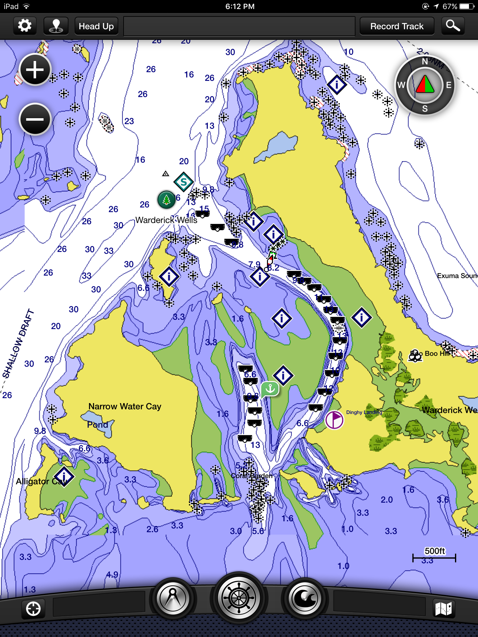
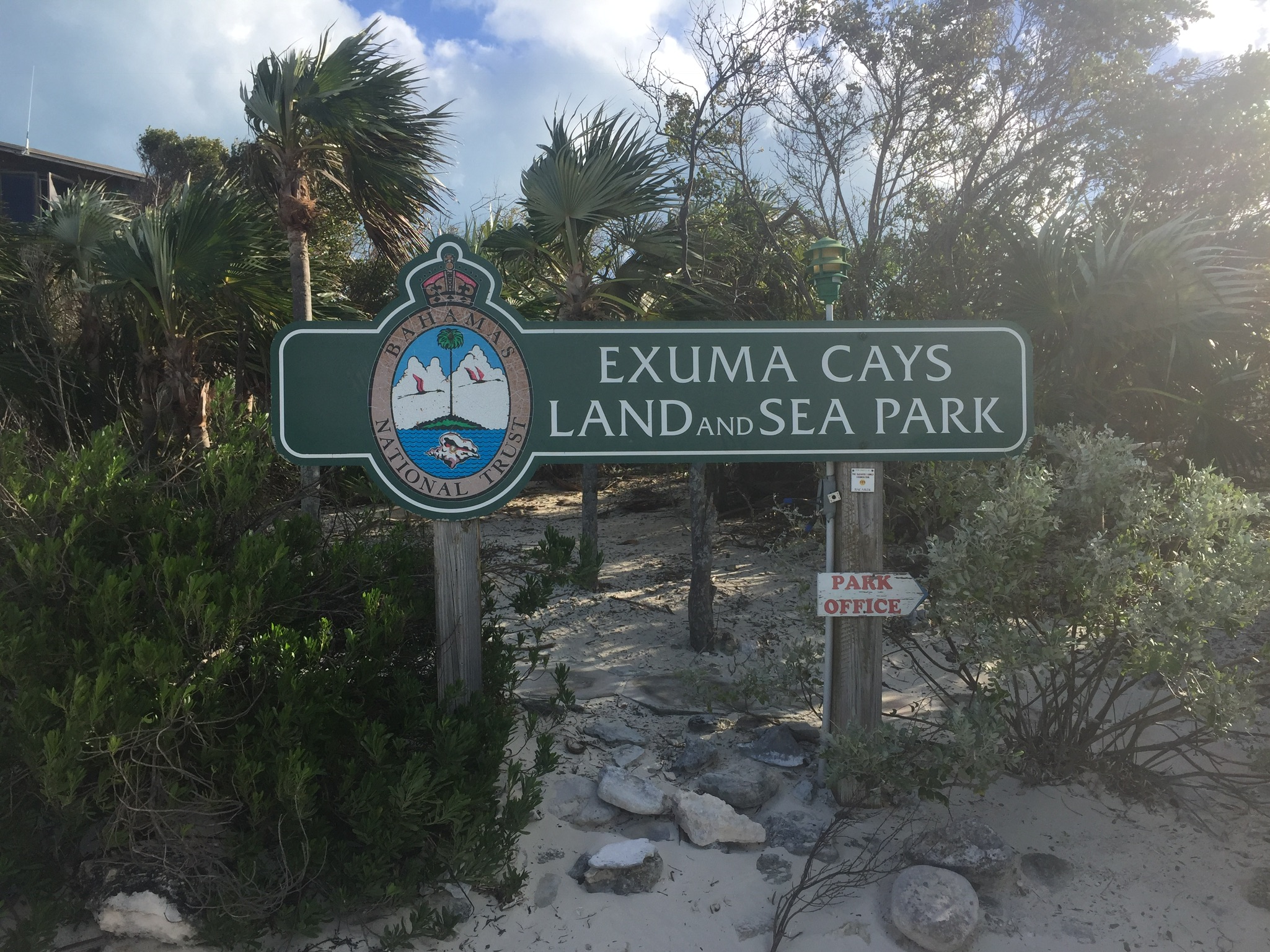
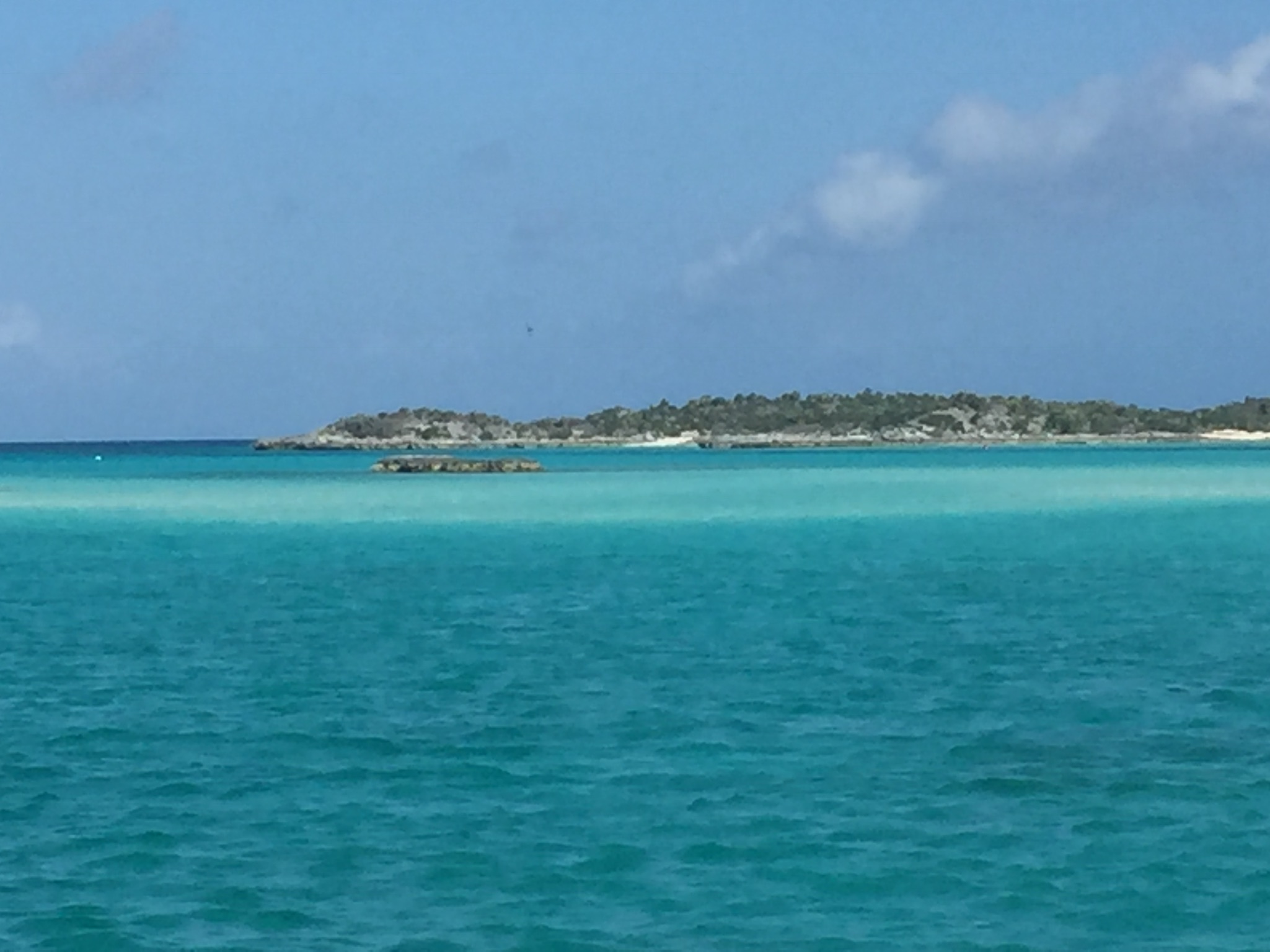
Warderick Wells is part of the Exuma Land and Sea Park….they have a loop shaped Mooring field with about 20 Mooring Balls. We spent about six days here waiting for a front to blow through.
Image courtesy of Garmin BlueChart
The small black bars with the white dot are chart symbols for Mooring Balls…..
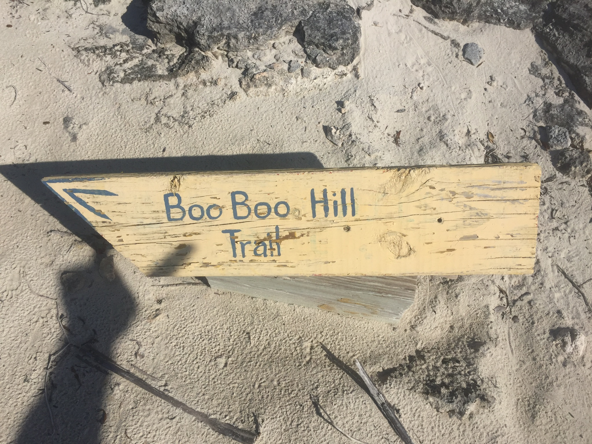
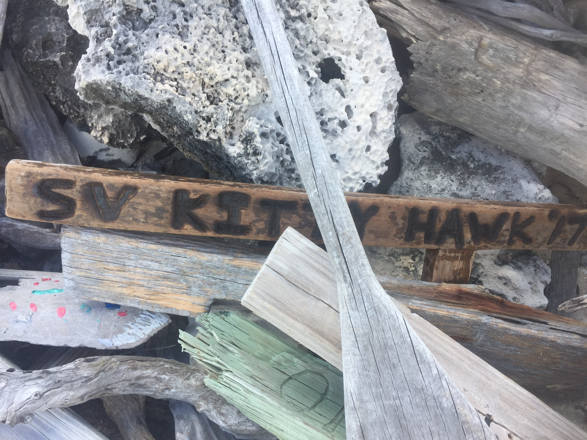
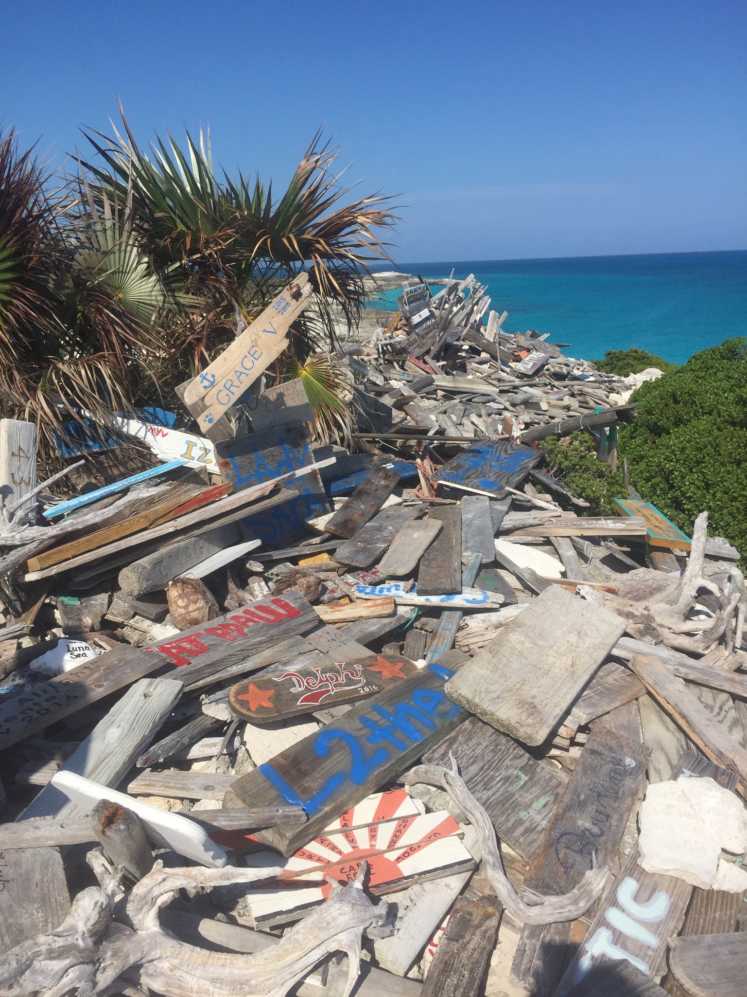
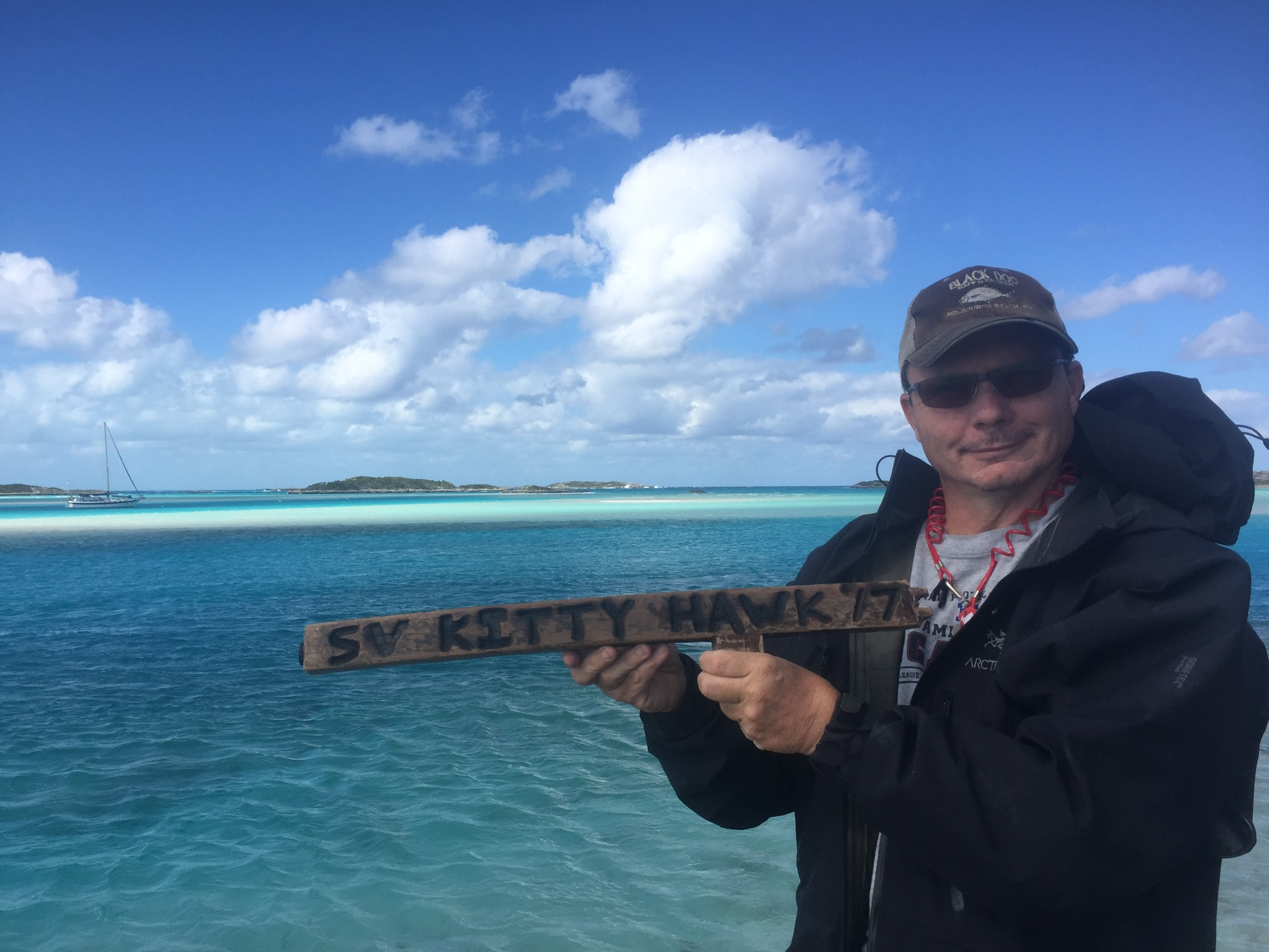
At the top of Boo Boo Hill is a pile of driftwood signs with boat names and dates. We found a piece of teak on our beach walk that I used to carve our boat name into….it took about six hours to carve and then I burned the letters to make them stand out….
Our sign placed on Boo Boo Hill….
The enormous pile of boat name signs on Boo Boo Hill….
As we placed the sign Kim pointed out that our boat sign sort of ended up (unintentionally) looking like a gun…..


