We get this question ….A LOT….
“How do you know where you are or how to get where you want to go?”

The question makes complete sense. After all, most people are, at a minimum, accustomed to having at least a road map, road signs and street name signs. Add to that a Tom-Tom, Garmin or other turn by turn GPS, either hanging on their dash or in their phone. On top of that, whether they know it or not, they have had a subliminal geography course going on their entire life. Some people may not be able to find New Jersey on a map, but they can navigate their local area pretty reliably.
What most people don’t realize is that they use a form of marine navigation in their every day life….it’s commonly called Dead Reckoning or D/R for short. D/R is essentially estimating your position based upon your known direction of travel, your speed, the elapsed time and use that to determine a point between where you started and where you are headed. You didn’t know you were a Navigator, did you? Just imagine if someone put you in a car on I-75 (that runs North and South between Detroit and Miami). Pick any spot…assume a speed of 70mph and an lapsed time of 5 hours….where are you ? Ta-da !!! A D/R “fix” or estimated position (EP).
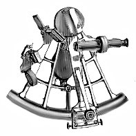
Many people, when they imagine marine navigation envision the use of a Sextant and some pretty complicated calculations based on the angles of the sun, moon or stars coupled with other fancy techniques. Frankly, the sun and stars aren’t always visible, so navigators need a method they can use reliably when they can’t see either, that’s where D/R comes in.
Take a look at the snapshot of the chart below. That’s an image of a “rhumbline” or direct course from an area South of Miami called Angel cut to Cat Cay (Cay is pronounced like “key”) in the Bahamas. That rhumbline is 48 miles long.
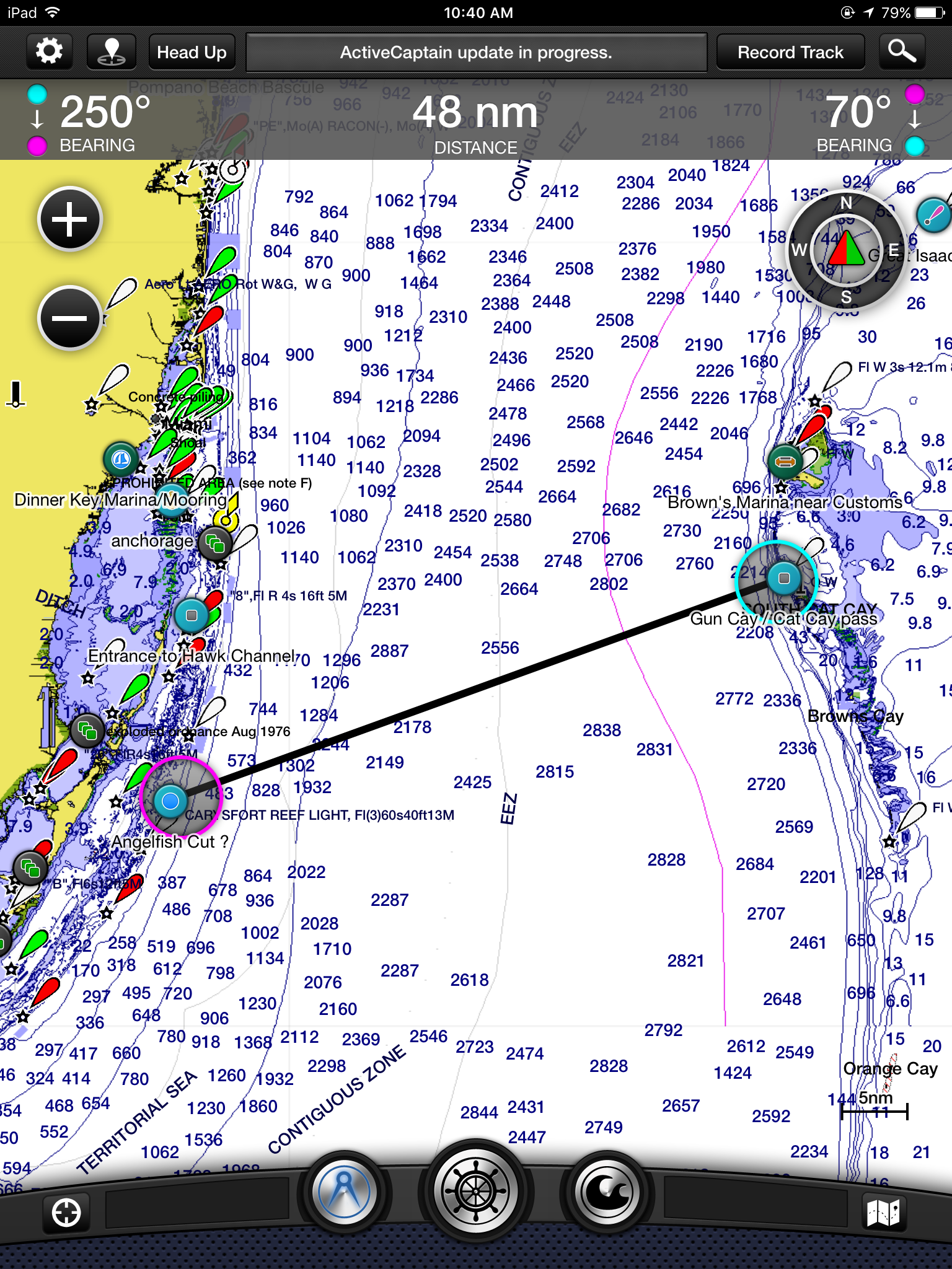
For the purpose of the example, let’s use our boat. Kitty Hawk averages about five knots per hour under power. If you average out the sailing speed, 5kts is also a safe number unless the wind really dies, at which point for this example we would fire up the diesel and still maintain 5kts. A knot is 1.152 miles per hour, much in the same way a nautical mile is equal to 1.1 statutory miles.
We will also assume, just to make things simpler and avoid calculating “tacking” (which is changing the course of the boat to take advantage of the direction of the wind) the boat, that the wind is coming out of the South at 10 knots. That means we could sail straight across our rhumbline course on a coinciding magnetic course, using our helm compass and autopilot to be sure we stay on that heading. A course is an intended route….a heading is the actual direction the boat ends up going based on current (like the Gulfstream), wind or other factors. In this scenario we would need to make a slight course adjustment to the south to stay on our rhumbline course due to the Gulf Stream that flows to the North in this area at about 1.5 to 3 knots. (That would be a dream crossing to the Bahamas by the way.) If we left Angel’s Cut at 7pm we could estimate our position on the rhumbline at any given time by multiplying the number of hours passed by our speed of 5kts and our ETA at Cat Cay would be ????
Drumroll please………….
If you said anything close to 9.5 hours later or around 4:30am….you’d be exactly right!!! Congrats !!! You’re a navigator !!!
Generally speaking, there are “road signs” out in the water as well. That way you have a visual confirmation of when you’ve arrived at your intended destination. While the U.S. has the best marked and best maintained system of waterway navigational aids, (called ATONs, as in Aid To Navigation, in the boating world) the Bahamas don’t do as bad a job as some countries. Most of these markers are colored (red or green) and numbered so you know when you are approaching the first or last in a line at an inlet, channel, or where you might be in a waterway. While Cat Cay doesn’t have any channel markers, you have to navigate this inlet by sight. In contrast, Bimini to the North, is marked by lighted red and green buoys numbered 1 for the green and 2 for the red. When numbered, Greens are odd and reds are even.
In this day and age, GPS and chart plotters have made navigation even simpler. Our chartplotter is capable of displaying our course, our speed though the water, speed over ground, heading and our position on a chart simultaneously. It’s always a good idea to have a non electronic backup method, and use it underway, in the event of a catastrophic failure though. That’s where D/R comes in to save the day.

Ring Outdoor Cam Plus, Battery (newest model), Home or business security, Wide-Angle 2K Video with Ring Vision, Low-Light Sight for full-color night vision, Mount-Anywhere Versatility, White
$59.99 (as of April 27, 2026 01:46 GMT +00:00 - More infoProduct prices and availability are accurate as of the date/time indicated and are subject to change. Any price and availability information displayed on [relevant Amazon Site(s), as applicable] at the time of purchase will apply to the purchase of this product.)
Visa Physical Gift Card $50 (plus $4.95 Purchase Fee)
$54.95 (as of April 27, 2026 01:46 GMT +00:00 - More infoProduct prices and availability are accurate as of the date/time indicated and are subject to change. Any price and availability information displayed on [relevant Amazon Site(s), as applicable] at the time of purchase will apply to the purchase of this product.)
Ring Solar Panel (2nd Generation), 4W for Outdoor Cam Plus, Outdoor Cam (Stick Up Cam), Stick Up Cam Pro, Spotlight Cam Plus, Spotlight Cam Pro - White
$47.99 (as of April 27, 2026 01:46 GMT +00:00 - More infoProduct prices and availability are accurate as of the date/time indicated and are subject to change. Any price and availability information displayed on [relevant Amazon Site(s), as applicable] at the time of purchase will apply to the purchase of this product.)
Ring Rechargeable Quick Release Battery Pack
$34.99 (as of April 27, 2026 01:46 GMT +00:00 - More infoProduct prices and availability are accurate as of the date/time indicated and are subject to change. Any price and availability information displayed on [relevant Amazon Site(s), as applicable] at the time of purchase will apply to the purchase of this product.)
Visa Physical Gift Card $200 (plus $6.95 Purchase Fee)
$206.95 (as of April 27, 2026 01:46 GMT +00:00 - More infoProduct prices and availability are accurate as of the date/time indicated and are subject to change. Any price and availability information displayed on [relevant Amazon Site(s), as applicable] at the time of purchase will apply to the purchase of this product.)Auto Amazon Links: No products found.
Good job explaining
Thanks!!!
Great read Captain!
Thanks Dave….